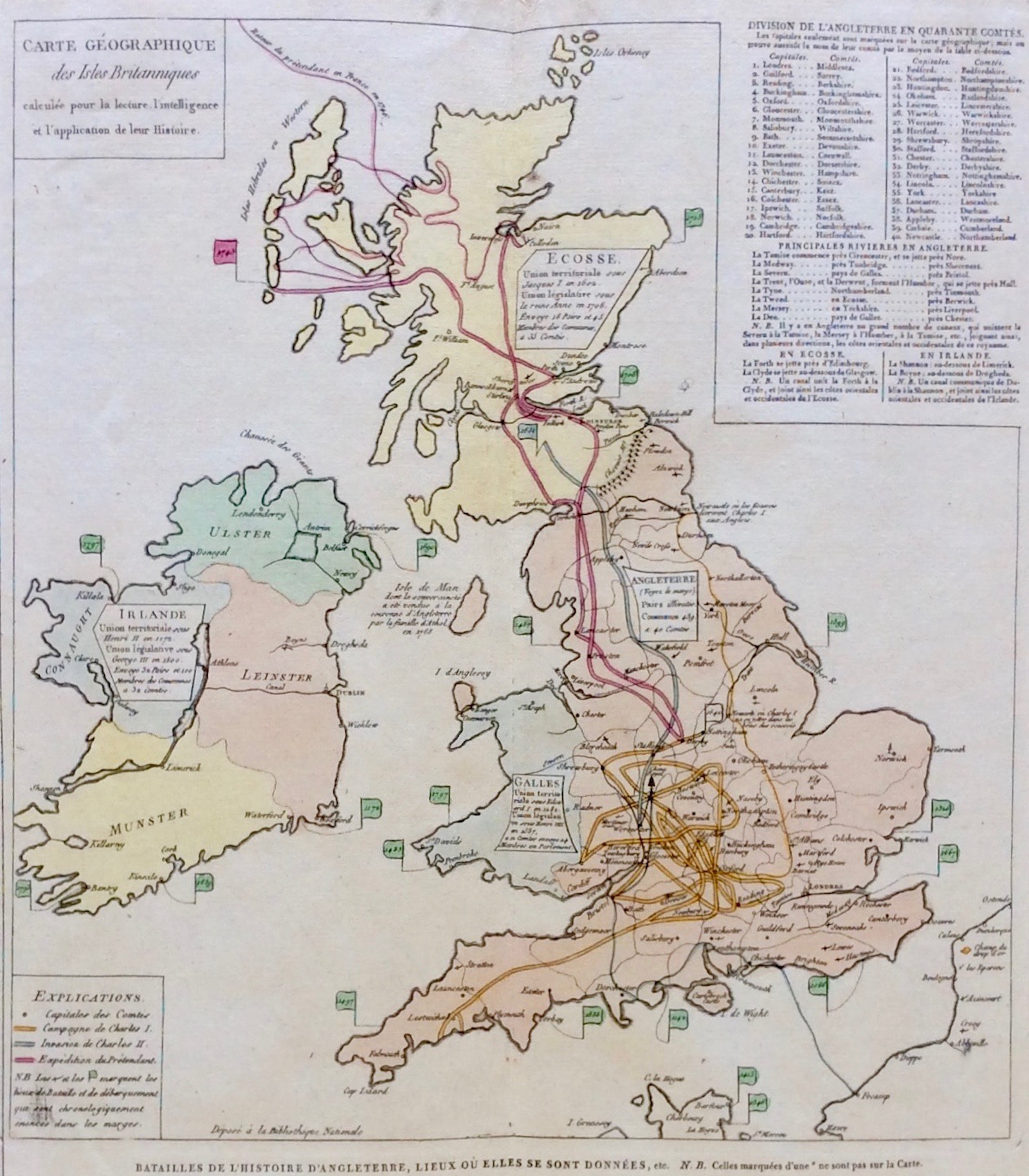
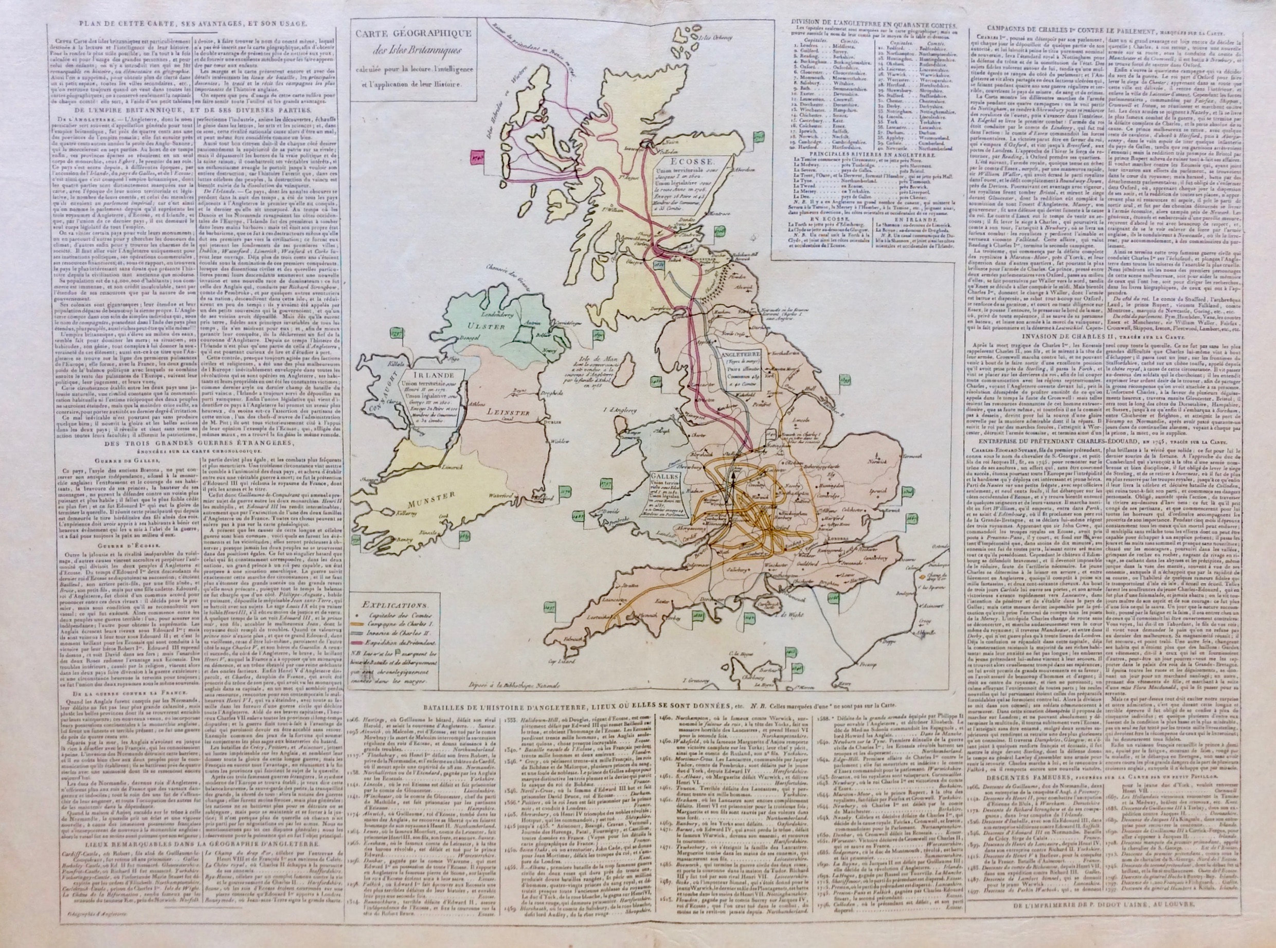
British Isles Published 1802
MAP of British Isles from Atlas historique c1802 De l'imprimerie de P. Didot L'Aine "Carte genealogique des Isles Britanniques"
Copper Engraved, later hand colour
Publisher/Artist: "Atlas historique, genealogique, chronologique et geographique", Emmanuel-Auguste-Dieudonne 1802
Good condition overall with some age tone, centre fold as issued. Engraved on heavy high quality hand made wove paper. Original hand coloured map, blank to verso
Approx unfolded sheet size: 19.5" x 28" (495mm x 710mm)
Notes: The Comte de Las Cases first published his historical, genealogical, chronological and geographical atlas in 1802, under the pseudonym A. Lesage. It proved to be an immensely popular publication, and was subsequently issued in numerous editions across several decades