Tonkin River Published 1750 SOLD
c1750 Bellin Map of Tonkin River (Red River or Sông Hồng) and Hanoi, Vietnam
Method: Copper plate engraved
Creator: Jaques Nicholas Bellin
Published: Jaques Nicholas Bellin for inclusion in Abbé Prévost's Histoire Générale des Voyages, volume IX in 1750
Approx engraved area: 8.5" x 6.25" (215mm x 165mm)
Condition: Good condition, some age tone, hand colour
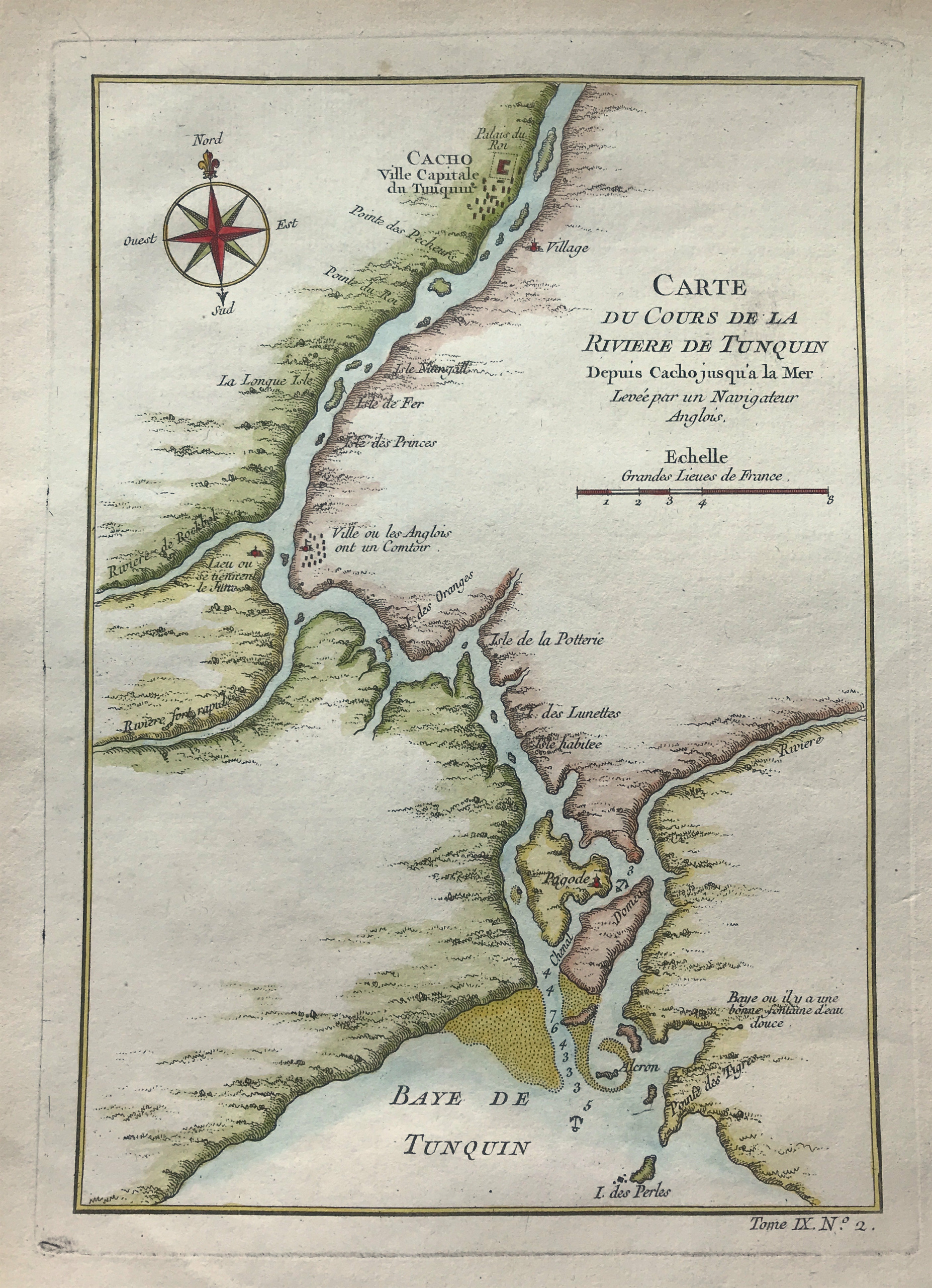
Notes: The map depicts the river's course from Cacho (modern Hanoi) to the Bay of Tonkin. The map is oriented slightly to the northeast, as depicted by a compass in the upper left corner. At Cacho, the lap makes special note of the Royal Palace and depicts a collection of buildings around it. Along the course of the river, the map notes several waypoints, most of which are islands, but the map depicts a city 'where the English have a bar.' A pagoda is also depicted on an island near the bay. As the river nears the bay, depth soundings are given, as well as two locations that would serve as a suitable anchorage, which are denoted by anchors.