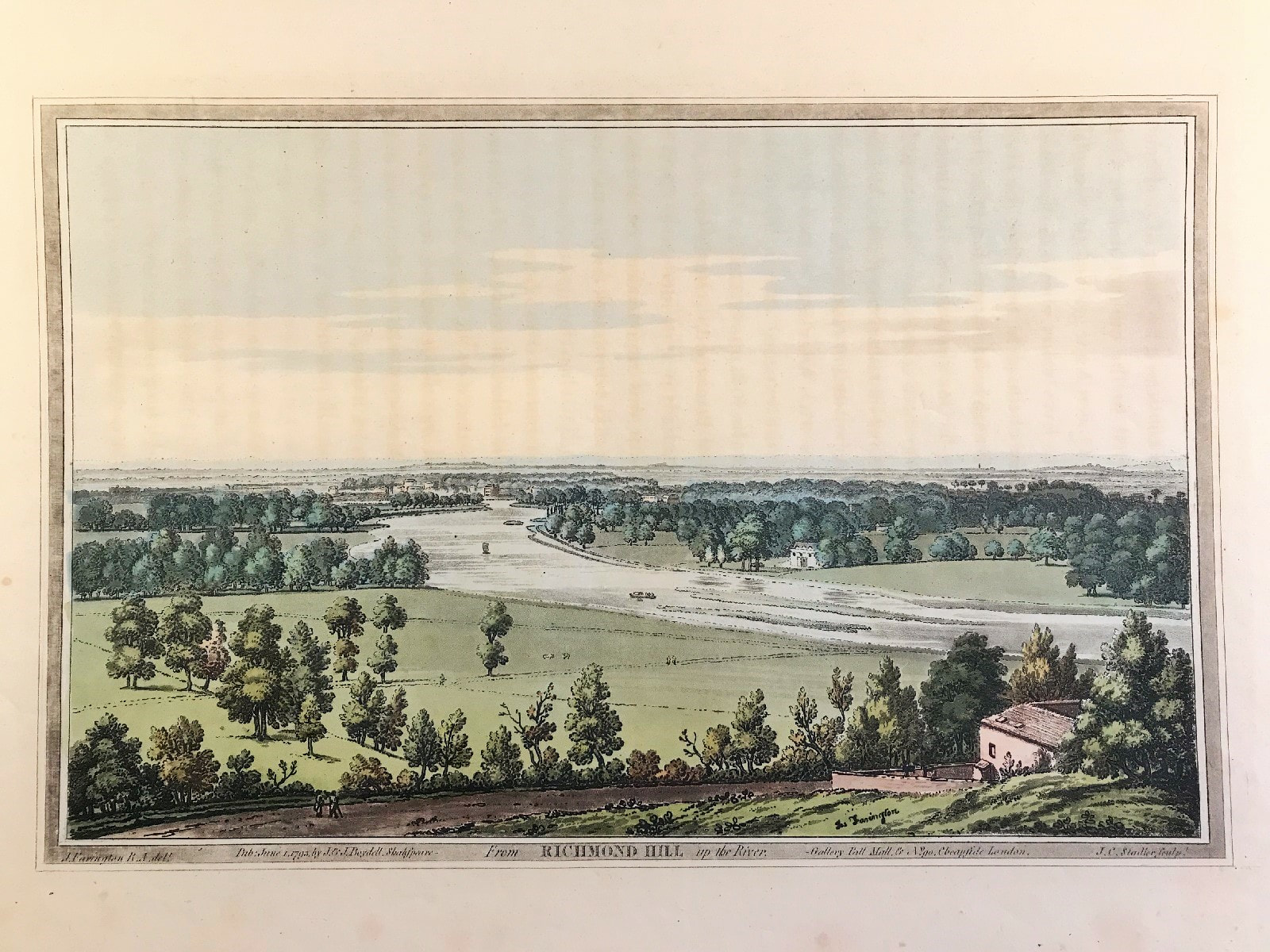
Richmond Hill Published 1793
Richmond Hill, Surrey c1793 by Farington, Stadler col. Volume II, Plate 50 from Joseph Farington's (1747-1821) 'History of the River Thames', 1794, A two-volume publication including 76 aquatints. A very fine large original antique hand coloured aquatint illustrating the view from Richmond Hill up the River Thames overlooking the water meadows and on the opposite bank Marble Hill House. Marble Hill was built in the 1720's for Henrietta Howard, mistress of King George II when he was Prince of Wales, as a retreat from court life. Both house and garden were designed with advice from the most fashionable gentlemen of early Georgian England
Original Aquatint with hand colour Creator: Drawn by Joseph Farington RA, engraved by Joseph Constantine Stadler. Published: J & J Boydell of London and dated June 1st 1793. Shakespeare Gallery, Pall Mall, & No. 90, Cheapside.
Generally very good condition, some age tone, with beautiful original hand colouring
Approx engraved plate area: 9" x 12" (230mm x 300mm) On lightweight wove paper, likely a later pull from plate.
Notes: As first published on folio sheet: 16? x 12? (420mm x 310mm). One of the grandest and most important books on the Thames. "although not the first coloured aquatint book, [it] was the first major one, and it was to set an example for the type of illustration that was to enjoy widespread popularity in England for some forty years" - Bruntjen (John Boydell 1719-1804).
A genuine antique print over 220 years old.