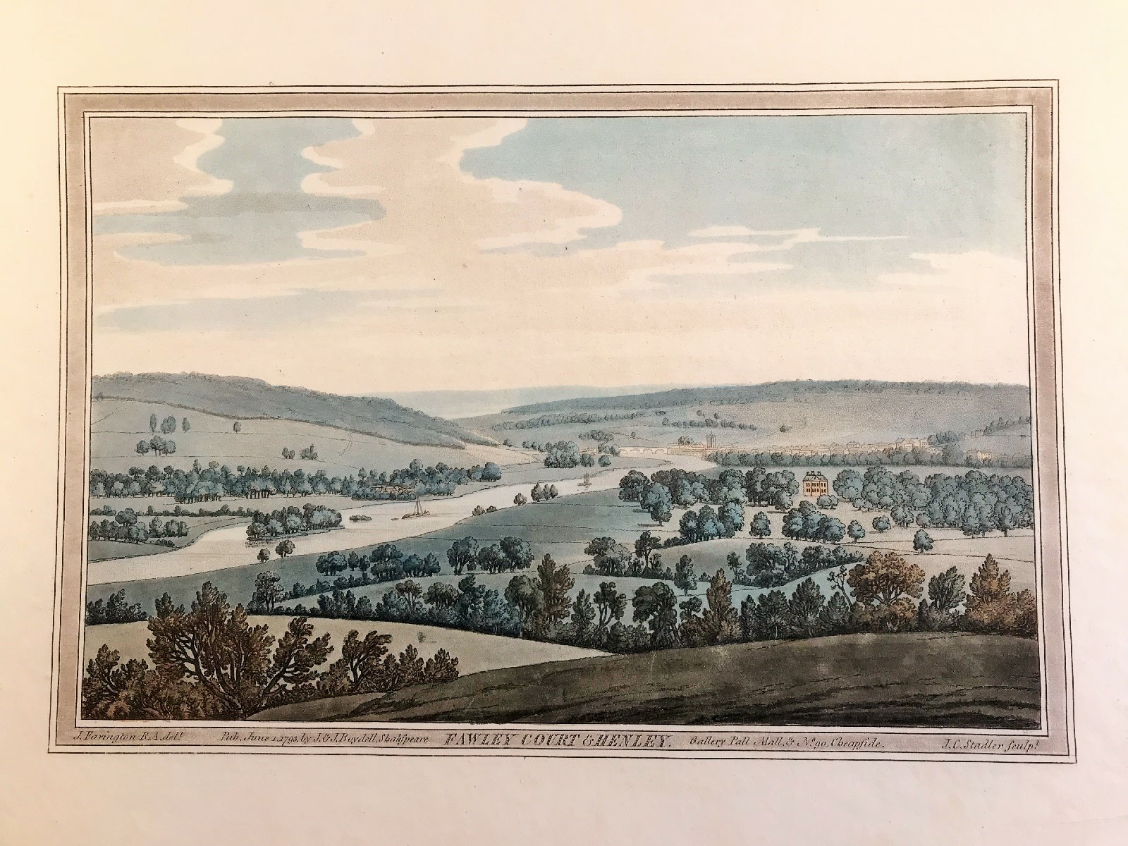
Fawley Ct Henley Published 1793 SOLD
Fawley Court Henley on Thames c1793 by Farington, Stadler col. Volume I, Plate 29 from Joseph Farington's (1747-1821) 'History of the River Thames', 1794, A two-volume publication including 76 aquatints. A very fine large original antique hand coloured aquatint illustrating the view up the River Thames towards Henley with Fawley Court on the west bank.In 1684 the house was completely rebuilt for Colonel William Freeman, a plantation and slave owner and merchant.Following Freeman's death the estate passed to John Cooke his nephew, a merchant, dilettante and amateur architect Between 1764 and 1766[7] the grounds were dramatically landscaped for Sambrooke Freeman by Capability Brown. Shortly thereafter the architect James Wyatt, not yet made famous by his Pantheon, London, worked on decorations in new rooms in the house (1770-71), where door cases and chimney pieces in Wyatt's early neoclassical style and the decoration of the Library reflect his presence. Fawley Court may have been Wyatt's first country house commission.
Method: Original Aquatint with hand colour
Creator: Drawn by Joseph Farington RA, engraved by Joseph Constantine Stadler
Published: J & J Boydell of London and dated June 1st 1793. Shakespeare Gallery, Pall Mall, & No. 90, Cheapside.
Condition: Generally very good condition, some age tone, with beautiful original hand colouring
Approx engraved plate area: 9" x 12" (230mm x 300mm)
Notes: As first published on folio sheet: 16" x 12" (420mm x 310mm). One of the grandest and most important books on the Thames. "although not the first coloured aquatint book, [it] was the first major one, and it was to set an example for the type of illustration that was to enjoy widespread popularity in England for some forty years" - Bruntjen (John Boydell 1719-1804).