RARE MAPS AND PRINTS
[email protected]
+44 7788 628706
  • About
  • Maps
    • British Isles
    • English Counties
    • Road Maps
    • River Thames
    • The Americas
    • Asia to Australia
    • Europe & Middle East
    • World & Hemispheres
    • Sea Charts
    • Military Battle Maps
  • Prints
    • British Topography >
      • Views England & Scotland
      • Views Wales
      • Views London
      • Views River Thames
    • Sporting
    • Amorial
    • Military & Naval
    • Portrait
    • Russian Art
    • Views Italy
  • Resources
    • Reference Books
  • Blog
  • The Colourist
  • Decorative Prints
  • >
  • British Topography
  • >
  • Views of England
  • >
  • Pangbourne Witchurch Published 1793 - SOLD!

Pangbourne Witchurch Published 1793 - SOLD!

SKU:
£0.00
Unavailable
per item

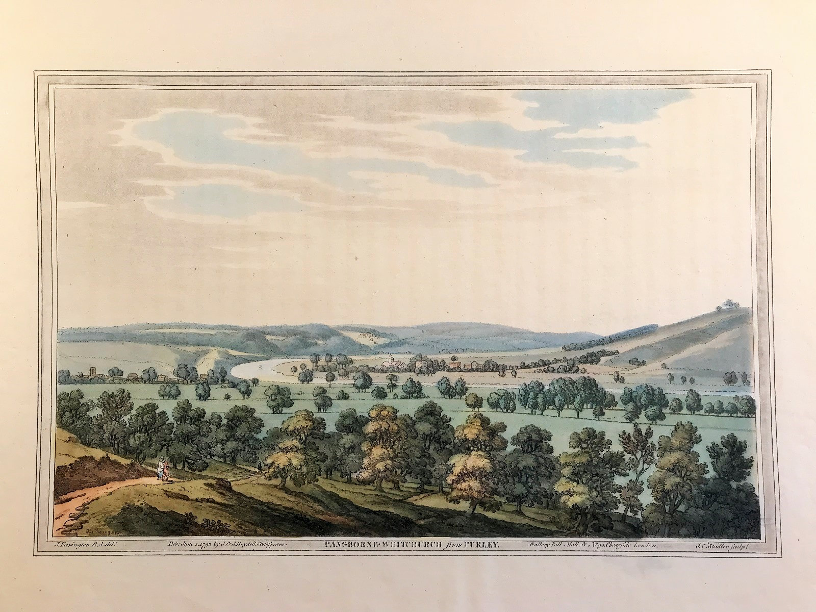
Pangbourne Witchurch from Purley on the River Thames c1793 by Farington, Stadler col. Volume I, Plate 25 from Joseph Farington's (1747?1821) 'History of the River Thames', 1794, A two-volume publication including 76 aquatints. A very fine large original antique hand coloured aquatint illustrating Pangebourne & Whitchurch. View with the Thames winding in a field in the middle distance, the Temple Island in the centre, a large house on each bank, the village of Harleyford on the right along the river, four figures in the right foreground standing along an elevated path, trees on the left.

Original Aquatint with hand colour. Drawn by Joseph Farington RA, engraved by Joseph Constantine Stadler. Published: J & J Boydell of London and dated June 1st 1793. Shakespeare Gallery, Pall Mall, No. 90, Cheapside.

Generally very good condition, some age tone, with beautiful original hand colouring

Approx engraved plate area: 9" x 12" (230mm x 300mm)

Notes: As first published on folio sheet: 16" x 12" (420mm x 310mm). One of the grandest and most important books on the Thames. "although not the first coloured aquatint book, [it] was the first major one, and it was to set an example for the type of illustration that was to enjoy widespread popularity in England for some forty years" - Bruntjen (John Boydell 1719-1804).

A genuine antique print over 220 years old.

  • Facebook
  • Twitter
  • Pinterest
  • Google+
Buy Now
Contact Info:     
Rare Maps and Prints Limited 
4, Ray House, Cressington Place,
​Bourne End, Bucks SL8 5SL UK 
                             
Kevin J Ryan :     

email: [email protected]         
​
    
          
Picture
Member of
​INTERNATIONAL MAP COLLECTORS SOCIETY 


    Maps & Prints Updates

Subscribe to List

Copyright © 2025 -  Rare Maps and Prints Limited  -  Raremapsandprints.co.uk   All Rights Reserved     Site Map     Terms & Conditions     Privacy Policy
  • About
  • Maps
    • British Isles
    • English Counties
    • Road Maps
    • River Thames
    • The Americas
    • Asia to Australia
    • Europe & Middle East
    • World & Hemispheres
    • Sea Charts
    • Military Battle Maps
  • Prints
    • British Topography >
      • Views England & Scotland
      • Views Wales
      • Views London
      • Views River Thames
    • Sporting
    • Amorial
    • Military & Naval
    • Portrait
    • Russian Art
    • Views Italy
  • Resources
    • Reference Books
  • Blog
  • The Colourist

    Join Our List

sign up
SHOP
Home
Shop
About
Updates
Contact
SOCIAL
Facebook
Twitter
Instagram
Proudly powered by Weebly