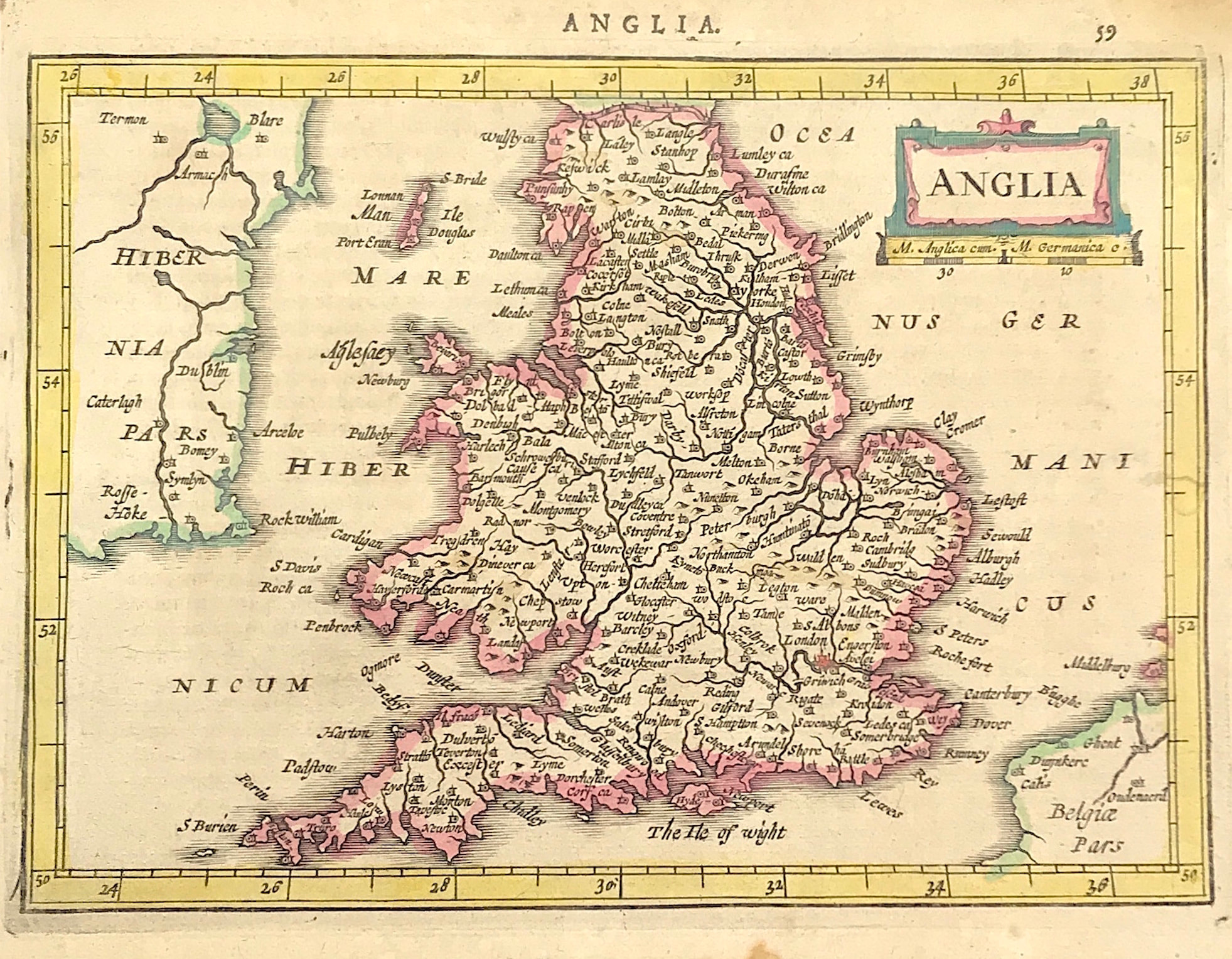

Anglia Published 1634
ORIGINAL MAP of England & Wales After Mercator c1634 From Atlas minor Gerardi Mercatoris...J. Hondius(From the Collection of the late Rodney Shirley)
Method: Copper Plate engraved
Creator: MERCATOR,G./ HONDIUS,J.. (Jansson).
Published: Jan Jansson c1651 (German issue) Amsterdam
Condition: Overall good condition with hand colour, some toning and staining to lower boarder, marks to upper left/right corners of sheet where previously mounted
Approx engraved area: Area: 5.5" x 8 (140mm x 200mm)
Notes: In 1628 a new set of pocket size maps was published by Jansson, from plates engraved by Peiter Van Den Keere and Abraham Goos. In contrast to the Mercator-Hondius series started in 1607, these maps follow Speed. They are slightly larger in size and show more detail. There is Latin text on the reverse and the title of the map in the language of the text appears outside the top boarder of the map.(Ref: R. W. Shirley Early Printed Maps of The British Isles 1477-1650 edition 1980)