ANGLIA Published 1601 SOLD
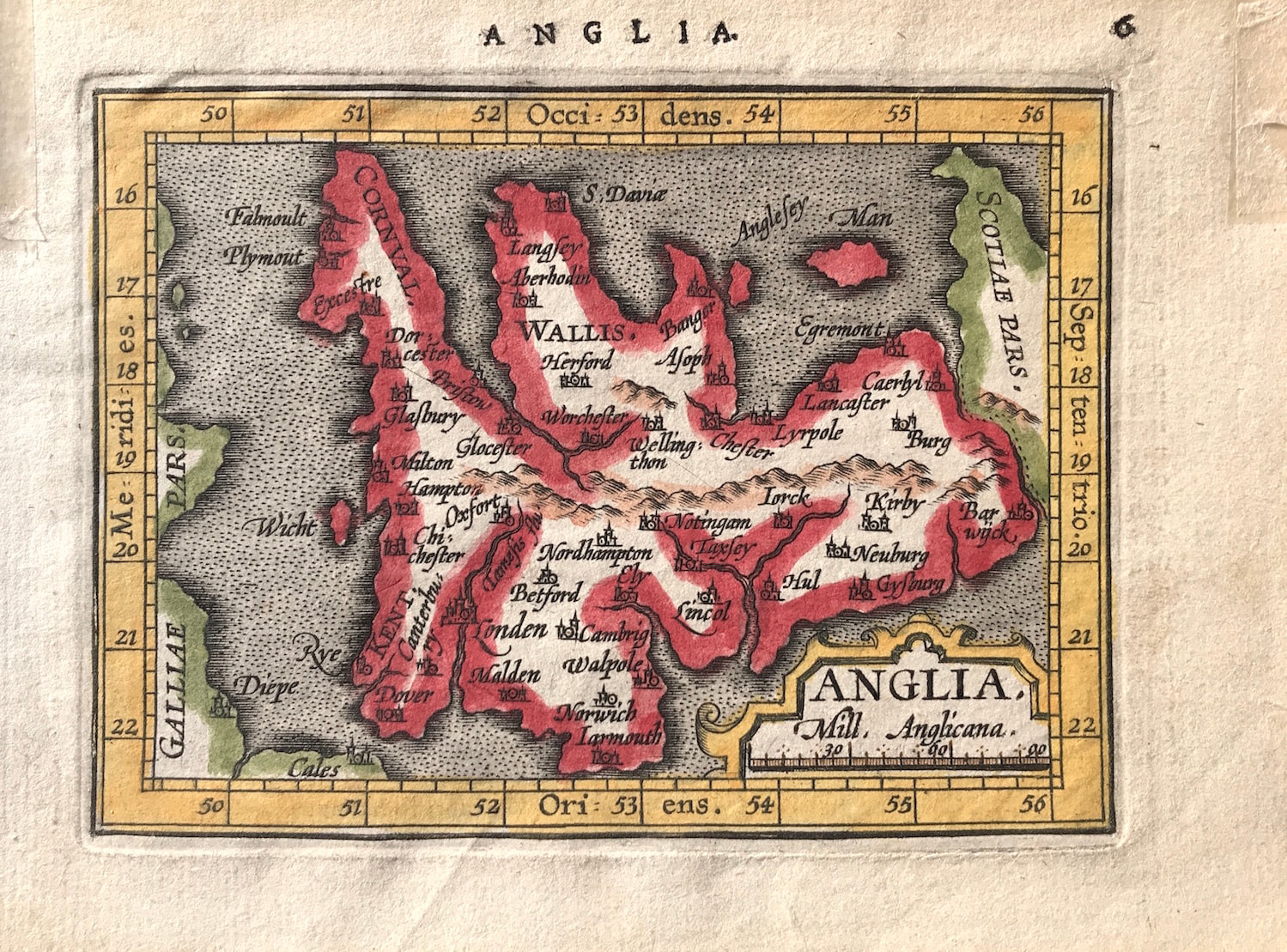
Map ANGLIA by A. Ortelius & Coignet c1601 Latin text / British Isles. Very Rare Antique Map - Oriented to the West - From the Collection of the late Rodney Shirley.
Method: Copper Plate engraved
Creator: Abraham Ortelius & Michael Coignet c1601
Published: Antwerp from: 'Epitome theatri orbis terrarum...nova recognita...a Michaele Coigneto...Ioannis Keerbergii, Anno MDCI'.
Condition: Overall good condition with hand colour, some toning and staining to lower boarder, marks to upper left/right corners of sheet where previously mounted
Approx engraved area: 3.25" x 4.5 (85mm x 115mm)
Notes: To meet international demand for Ortelius' miniature maps a new set of plates were engraved by the brothers Ambroase and Ferdinand Arsenius (Aertsen) who were assistants to Francis Hogenburg and thus with him co-engravers of the plates for Ortelius' main atlas. The map of England and Wales is a new plate which is generally similar to the second one used by Philip Galle. There is now a heavy boarder with markings of latitude and longitude, and the title is contained in a more decorative panel in the lower right corner. The Latin text on the reverse describing, Scotland. (Ref: R. W. Shirley Early Printed Maps of The British Isles 1477-1650 edition 1980 p83)