- Antique Maps
- >
- English Counties
- >
- Suffolk Published 1648
Suffolk Published 1648
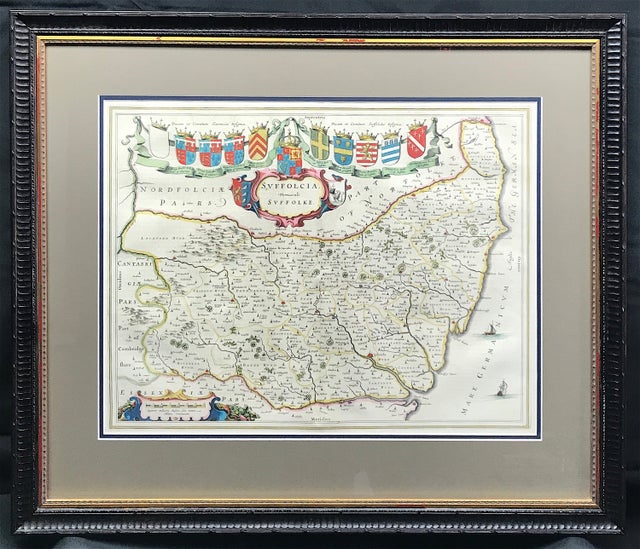
Map of SUFFOLK by Johannes Blaeu c1648 Edition with Franch Text to verso "Suffolcia Vernacule Suffolke" A fine example of this collectors map.
Copper plate engraved by Blaeu c1648 Published: Amsterdam Approx engraved area: 15.25" x 19.75" (385mm X 500mm) Excellent quality Bainbridge double mount with conservation quality mat boards providing the highest level of protection.
The external mount dimensions approx: Height 542mm x Width: 643mm (21.25" x 25.25)
Condition: Original fine engraved Copperplate, French text to verso, fine hand colour, fold as issued, good margins. Set in 'aged' Gold gilt Black overpainted frame, some gilt loss. External dimensions: 24" x 28.25" (610mm x 720mm). Conservation 2mm 'clear' acrylic plexiglass glass. Ready to hang on wall.
Notes: The Blaeu workshop, based in Amsterdam, produced the most magnificent atlas and maps of the period, the time in which the Netherlands was experiencing its 'Golden Age' in art, science and commerce. A true perfectionist, Blaeu used only the best engravers, printers and colourists and only the finest materials, including paper to produce his atlases. This example epitomises the craftsmanship and artistry being finely detailed with ornate cartouches, heraldic shields and calligraphy.

