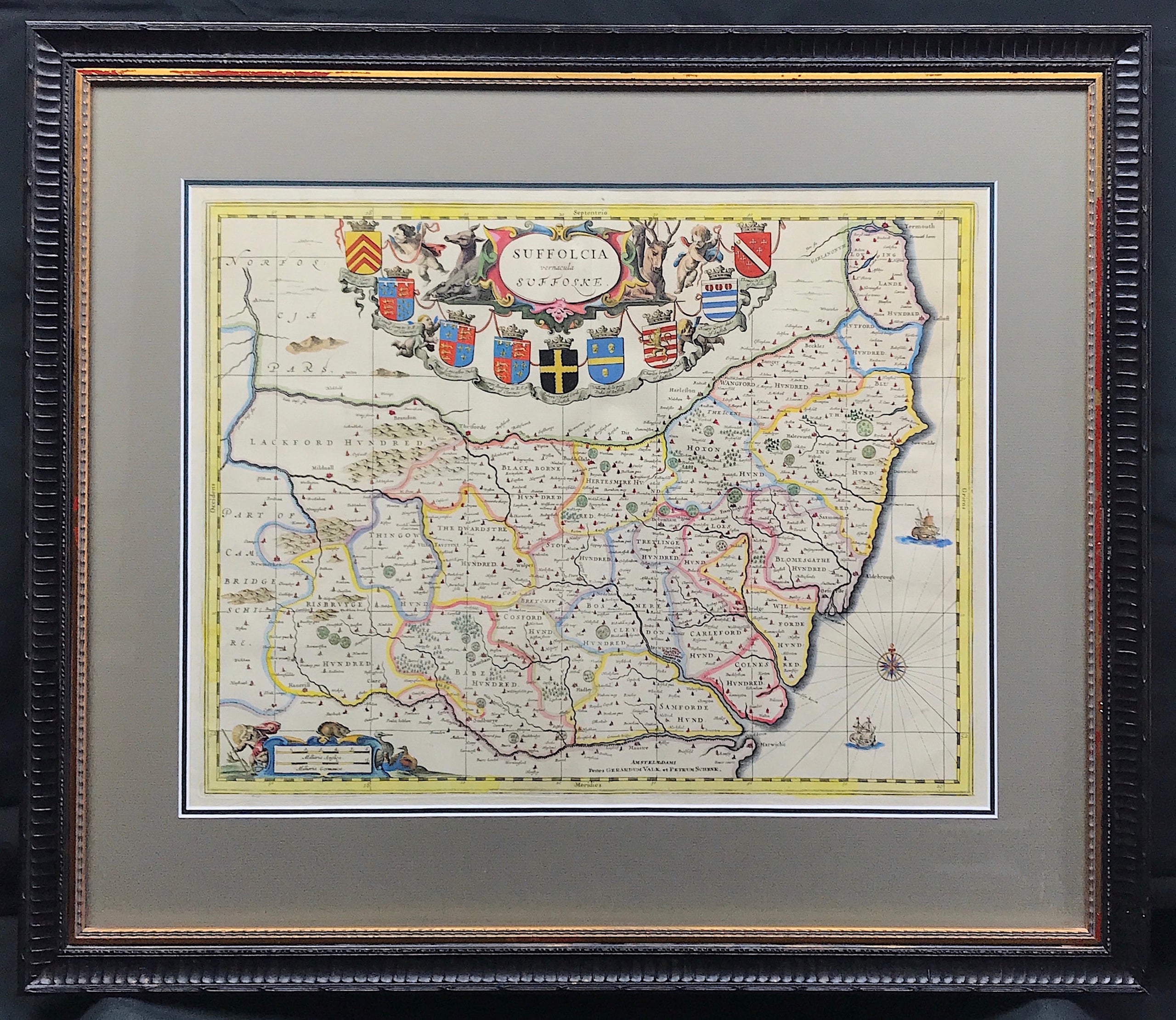
Suffolk Published 1694
Map of SUFFOLK by P. Schenk & G. Valk c1694 (Ex Jansson) "Suffolcia Vernacule Suffoske" A fine example of this collectors map. Copper plate engraved by P. Schenk & G. Valk c1694 Published: Amsterdam Approx engraved area: 15.25" x 19.75" (385mm X 500mm)
The external mount dimensions approx: Height 542mm x Width: 643mm (21.25" x 25.25) Excellent quality Bainbridge double mount with conservation quality mat boards providing the highest level of protection.
Condition: Original fine engraved Copperplate, blank to verso, fine hand colour, fold as issued, good margins.
Notes: The plates of Jansson's British maps were aquired by Peter Schenk and Gerard Valk in 1694. The new owners' imprint was substituted and a graticule of grid lines was added to mast maps. The delineation of major towns was also amended to show plan views. The maps were sold singly and in made-up atlases. By 1714 the plates seem to have been acquired by David Mortier who re-issued some of them in his Atlas Anglois. They appeared a final time in 1724 in an edition of the Atlas Anglois, now published by Joseph Smith.