RARE MAPS AND PRINTS
[email protected]
+44 7788 628706
  • About
  • Maps
    • British Isles
    • English Counties
    • Road Maps
    • River Thames
    • The Americas
    • Asia to Australia
    • Europe & Middle East
    • World & Hemispheres
    • Sea Charts
    • Military Battle Maps
  • Prints
    • British Topography >
      • Views England & Scotland
      • Views Wales
      • Views London
      • Views River Thames
    • Sporting
    • Amorial
    • Military & Naval
    • Portrait
    • Russian Art
    • Views Italy
  • Resources
    • Reference Books
  • Blog
  • The Colourist
  • Antique Maps
  • >
  • Sea Charts
  • >
  • Sunda Strait Published 1815 SOLD!

Sunda Strait Published 1815 SOLD!

SKU:
£0.00
Unavailable
per item

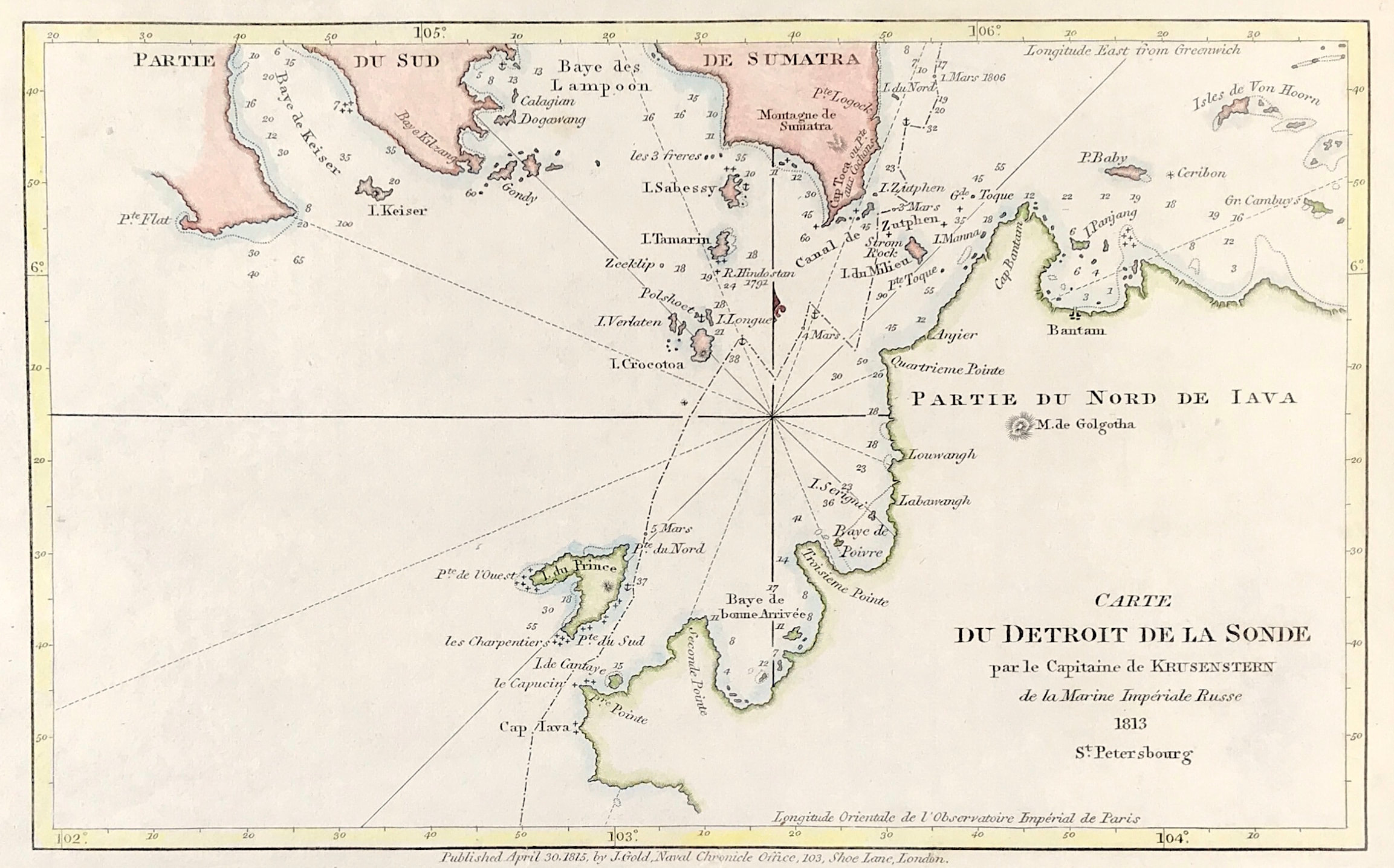
Carte Du Detroit De La Sonde par le Capitaine de KRUSENSTEIN de la Marine Imperiale Russe A nautical chart of the Sunda Strait ("Detroit de la Sonde"), a narrow waterway connecting the Java Sea to the Indian Ocean. Includes the Indonesian islands of Sumatra and Java. Charted by Captain Krusenstern of the Russian Imperial Navy

Copper plate engraved by Adam Johann von Krusenstern for April 30th 1815 by J. Gold, Navel Chronicle Office, 103, Shoe Lane London

Approx engraved area: 5.25" x 8.5" (135mm x 215mm)

Good condition, some age tone

Notes: Adam Johann von Krusenstern, also known in his Russian name as Ivan Fyodorovich Krusenstern, was captain and then admiral of the Russian Imperial Navy.

  • Facebook
  • Twitter
  • Pinterest
  • Google+
Buy Now
Contact Info:     
Rare Maps and Prints Limited 
4, Ray House, Cressington Place,
​Bourne End, Bucks SL8 5SL UK 
                             
Kevin J Ryan :     

email: [email protected]         
​
    
          
Picture
Member of
​INTERNATIONAL MAP COLLECTORS SOCIETY 


    Maps & Prints Updates

Subscribe to List

Copyright © 2025 -  Rare Maps and Prints Limited  -  Raremapsandprints.co.uk   All Rights Reserved     Site Map     Terms & Conditions     Privacy Policy
  • About
  • Maps
    • British Isles
    • English Counties
    • Road Maps
    • River Thames
    • The Americas
    • Asia to Australia
    • Europe & Middle East
    • World & Hemispheres
    • Sea Charts
    • Military Battle Maps
  • Prints
    • British Topography >
      • Views England & Scotland
      • Views Wales
      • Views London
      • Views River Thames
    • Sporting
    • Amorial
    • Military & Naval
    • Portrait
    • Russian Art
    • Views Italy
  • Resources
    • Reference Books
  • Blog
  • The Colourist

    Join Our List

sign up
SHOP
Home
Shop
About
Updates
Contact
SOCIAL
Facebook
Twitter
Instagram
Proudly powered by Weebly