British Isles Published 1636 - SOLD!
ORIGINAL MAP of Great Britain Anglia Scotia et Hibernia c1636 Mercator / Coppenburgh original British Isles
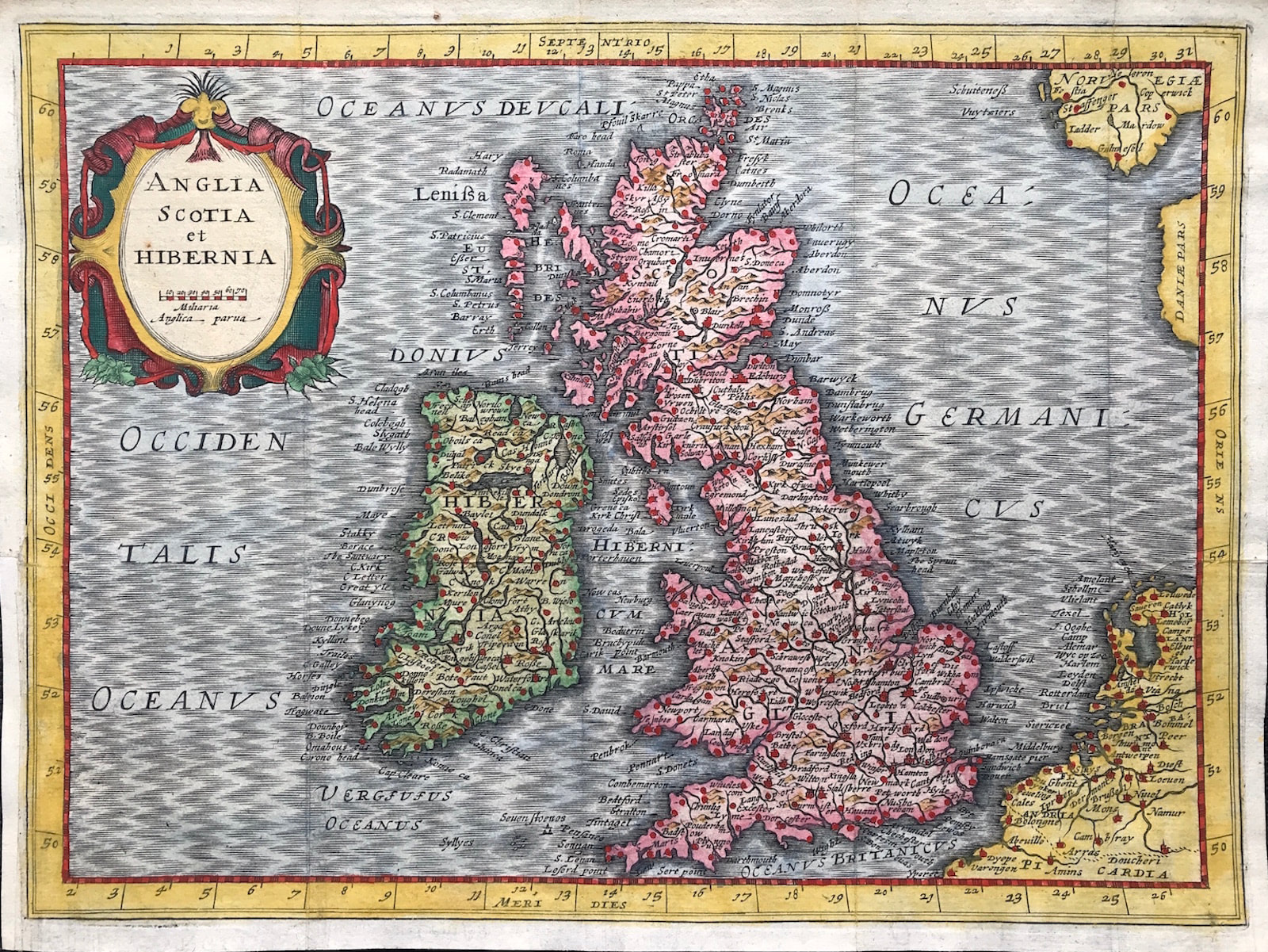
MERCATOR, G. HONDIUS, J.. (Cloppenburgh). from "Atlas Minor Gerardi Mercatoris...Ioannis Cloppenburgij, 1630" The fourth and final series of reduced versions of Mercator's atlas was published by the Amsterdam bookseller Johan Cloppenburgh in 1630.
Copper Plate engraved
Gerardi Mercatoris...G. HONDIUS &Johan Cloppenburgh in 1630
Original engraved copper plate map excellent condition with hand colour. Old softfolds and blank on verso
Approx engraved area: 5.5" X 8" (140mm x 200mm)
Notes:"Atlas Minor Gerardi Mercatoris...Ioannis Cloppenburgij, 1630" The fourth and final series of reduced versions of Mercator's atlas was published by the Amsterdam bookseller Johan Cloppenburgh in 1630. Maps engraved by Pieter Van Den Keere.The plates were reprinted by the Jansson heirs in 1673 with no text to verso as this example". First reworked edition of Mercator's Atlas Minor issued by the Janssonius heirs (Johannes Janssonius van Waesberge) in 1673, without text or printed index.Because the maps are all taken from the Cloppenburg plates of the 1636 edition, these maps are dated 1636, while the atlas is dated (Pub Date) as 1673. The maps include decorative cartouches, latitudinal and longitudinal lines, coats of arms, compass rose, and show political boundaries, cities, towns, topography, vegetation, waterways and landmarks. Excellent map of the British Isles and Ireland showing the major cities. Large strap work title cartouche. Blank to Verso (Ref: R W Shirley Early Printed Maps of The British Isles 1477-1650 Revised Edition p 123)