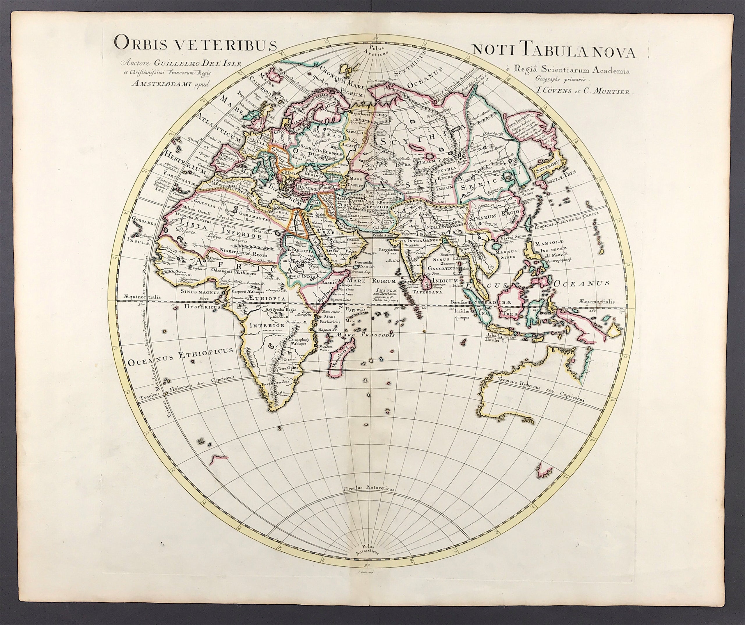
Eastern Hemisphere Published 1730 SOLD!
MAP of Eastern Hemisphere c1730 "Orbis veteribus noti tabula nova" by Guillaume Delisle (1675-1726) Leading French cartographer of the C18th who was re-known for the accuracy of his maps. Australia shown according the two voyages of Abel Tasman 1642-1644.
Copper Plate engraved by Guillaume Delisle Published Amsterdam, J Covens & C. Mortier
Good condition, fine detail, outline colour, some age tone, clear plate mark, wide boarders. Blank to verso with fold as published.
Approx engraved area: 19.5" X 19.5" (500mm x 490mm)
Notes: Delisle studied under Jean Cassini and from an early age showed his talent. De L'Isle is important as the first "scientific" cartographer who incorporated the most current information on exploration and topography into his maps. Where he was unable to verify information conclusively, he would note the fact on his maps.
A genuine antique map over 280 years old.