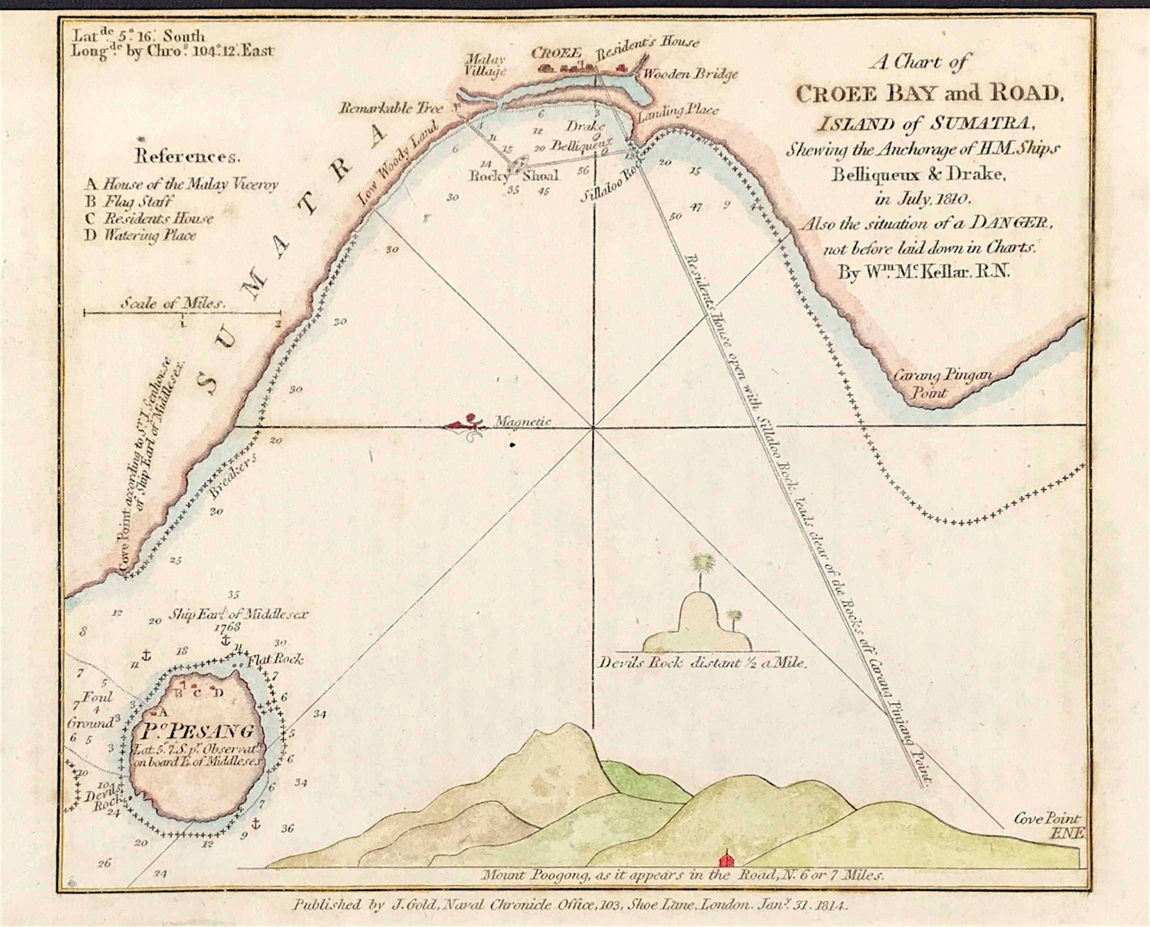
Island of Sumatra Published 1814
SKU:
£75.00
£75.00
per item
A Chart of CROEE BAY and ROAD Island of Sumatra 1814 (Pulau Pisang Island) Showing the Anchorage of H.M. Ships Belliqueux & Drake in July 1810. Also the situation of a DANGER not before laid down in Charts. By William McKeller R.N.
Copper plate engraved by William Mc Keller. R.N. and engraved by Robert Rowe. Jan 31st 1814 by J. Gold, Navel Chronicle Office, 103, Shoe Lane London
Approx engraved area: 5.5" x 6.25" (140mm x 160mm)
Good condition, some age tone
Notes: Top neat line close to edge of sheet - As published in Navel Chronicle 1814.