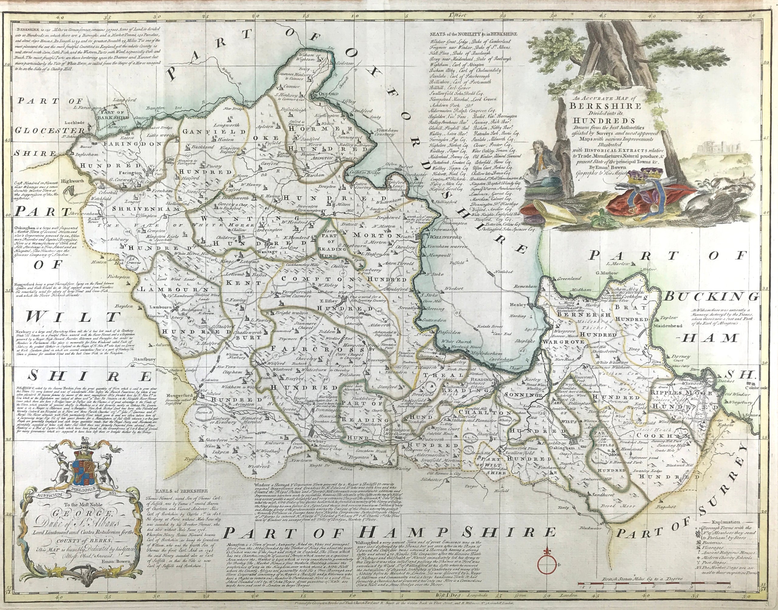
Berkshire Published 1785
ORIGINAL ANTIQUE MAP OF BERKSHIRE c1785 Edition An ACCURATE MAP of BERKSHIRE Divided into its HUNDREDS and Drawn from the best Authorities assisted by Surveys and most approved Maps with various improvements. Illustrated with Historic Extracts relative to Trade, Manufactures, Natural produce & present state of the principal towns &c Erected &c
By Emanl: Bowen Geographer to His Majesty.
An original antique map of Berkshire by Emanuel Bowen. Published in Bowen's Large English Atlas. The publishers’ imprint is: Printed for Carrington Bowles in St Paul's Church Yard, Robert Sayer at the Golden Buck in Fleet Street, and R. Wilkinson 58 Cornhill, London
This is an impressive and finely detailed map with all available spaces filled with notes and descriptions of the history and topography of the county.
Copper engraving by Emanuel Bowen and later published in The Large English Atlas from 1760. The work was the first large scale atlas of English counties since the works of Blaeu and Jansson a century earlier and was based on the latest surveys available. The maps were a long time in preparation, the engraving work mostly shared between Emanuel Bowen and Thomas Kitchin, beginning in 1749 with the county of Sussex and reaching completion of 45 plates in 1760. During this time the plates passed through the hands of several publishers and were issued individually and in part works without title. The Large English Atlas was issued by various publishers until c.1794 with few changes to the maps.
Excellent condition with fine outline and wash hand colour. Engraved on heavy weight hand laid paper. Blank to verso. Centre fold as issued.Approx Engraved Area: 21.25" x 27.5" (540mm X 700mm)
A genuine antique map over 270 years old.