- Antique Maps
- >
- English Counties
- >
- Dorsetshire Published 1838
Dorsetshire Published 1838
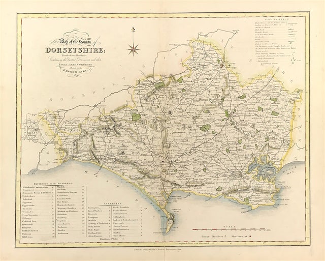
Map of DORSETSHIRE from A Complete County Atlas of England & Wales. Published by JAMES DUNCAN c1838 A finely engraved and detailed map showing the changes made by the Great Reform Act of 1832. Steel Engraved Originally constructed by William Ebden, engraved by Hoare & Reeves Originally constructed by William Ebden, engraved by Hoare & Reeves and first published in Atlas form by James Duncan in 1833 James Duncan, Paternoster Row
Good Condition, slight offsetting, later hand colour, fold as issued, blank to verso, some age tone.
Approx Engraved area: Large Sheet size: 15.5" X 19" (396mm x 483mm)
Notes: The Atlas provided Forty Four Superior Maps, Divided into Hundreds, With District Divisions and Other Local Arrangements effected by the Reform Bill. Ebden's impressive county maps are typical of the best produced for English atlases in the early 19th century. They are beautifully engraved and there relatively large size compared to most other county maps of the period ensures unusually clear depiction of a wide range of feature. Map highlights the counties individual hundreds and all major roads. There is a useful table of reference to the hundreds, an extensive explanation of the map symbols and a mileage scale.

