- Antique Maps
- >
- Road Maps
- >
- London to Lands End Published 1675 - Now Sold!
London to Lands End Published 1675 - Now Sold!
SKU:
£0.00
Unavailable
per item
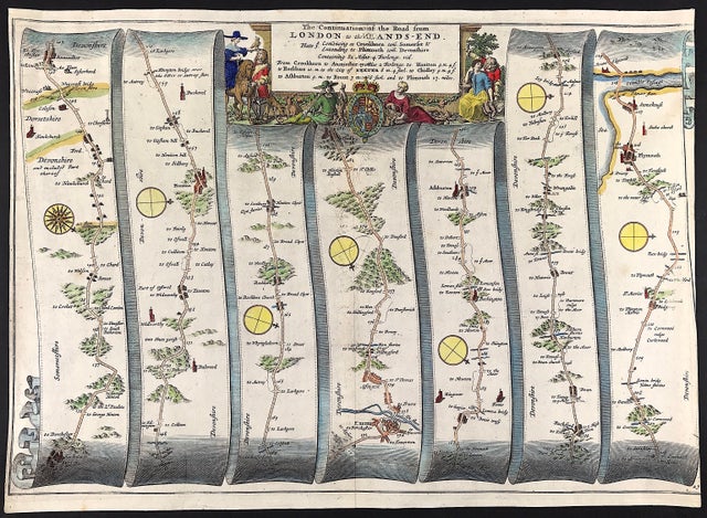
Road Map by John Ogilby c1675 London to Lands End Axminster Plymouth. "London to Lands End (continuation) Commencing Crookham com Somerset & extending to Plymouth con Devonshire"
Method: Copper plate engraved
Creator: John Ogilby
Published: William Camden "Britannia" c1675
Approx engraved area: 15.5" x 17" (395mm x 430mm)
Condition: Good, age tone and close cut to right edge with loss of vertical boarder line, fine detailed map with good old hand colour.
Notes: This map is Number 27 of 100 maps in the atlas and is entitled " The Road from London to the Lands End." Includes the road from Axminster to Honiton to Exeter to Plymouth.

