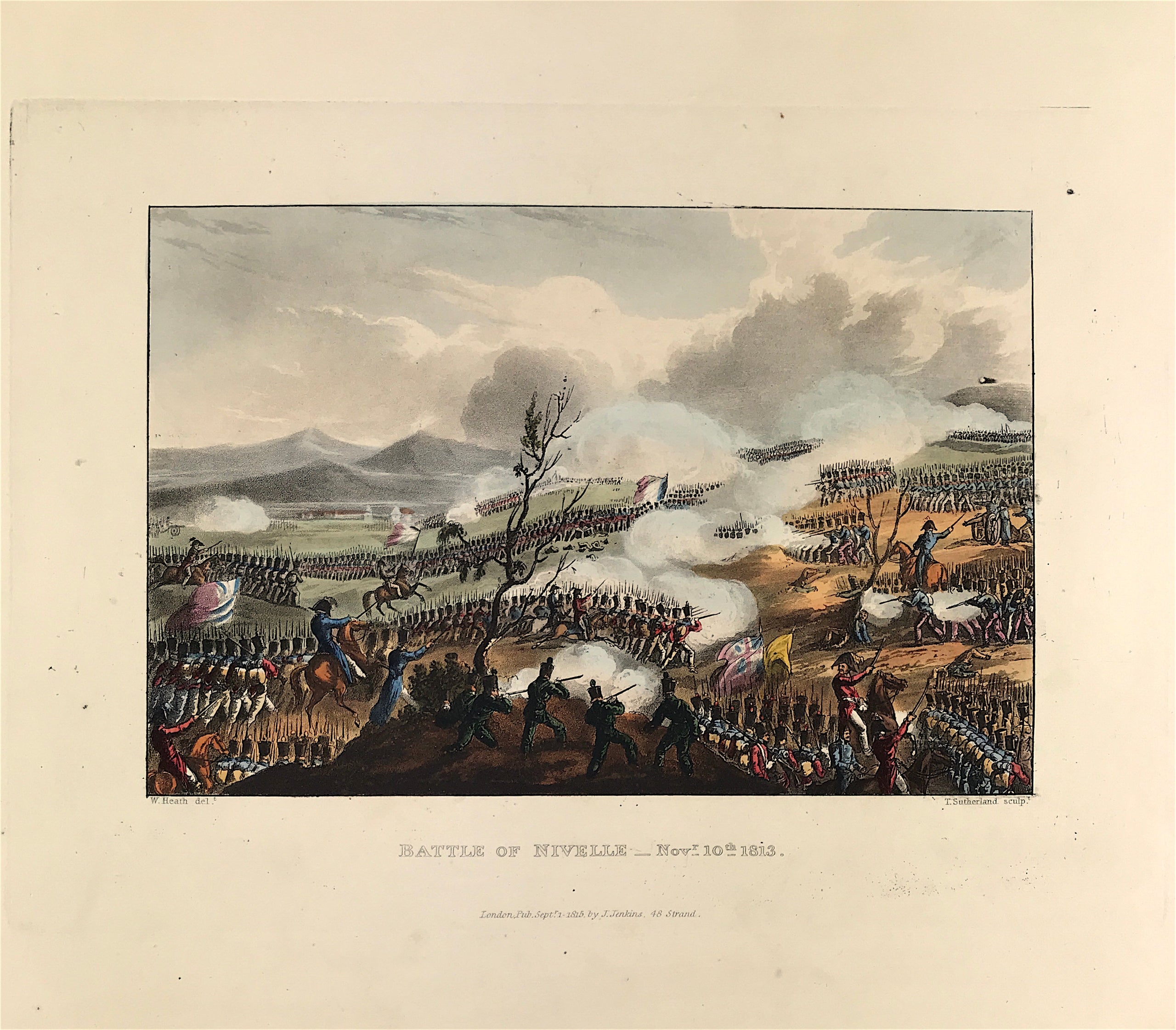
Battle of Nivelle c1813 - SOLD!
Peninsular War: Battle of Nivelle Nov 10th 1813. London Published Sept 1st 1815 by J. Jenkins, 48 Strand. An original aquatint print from "The Martial achievements of Great Britain and Her Allies from 1799 to 1815. London: Printed for James Jenkins, No 48, Strand, By L. Harrison & J. C. Leigh, 373 Strand. Included with the print is the original folio text pages account of the action as first published with the aquatint and watermarked J. Whatman 1812.
Original aquatint engraving on medium weight wove paper with fine hand colour. Drawing by William Heath (delt) with aquatint engraving by Thomas Sutherland (sculpt).
Good overall condition with exceptional original colour and wide margins. The plate has the date of publication and the name of the publisher beneath the engraved title. The approx engraved area of the plate is 8.5" x 7.75" (215mm x 195mm) including the engraved title text. Engraved plate mark area is approx 8.5 x 11.75 (215mm x 300mm). The large sheet size is approx 11.5" x 14" (290mm x 355mm).
The Battle fought on 10th November 1813, during the Peninsular War; Wellington’s army crossing the River Nivelle and moving from the Pyrenees Mountains into the plains of France. In the north-east on the Spanish-French border. General the Earl of Wellington against Marshal Soult. The British, Portuguese and Spanish forced the French back from the River Nivelle to the River Nive and beyond.
A genuine antique print over 200 years old.