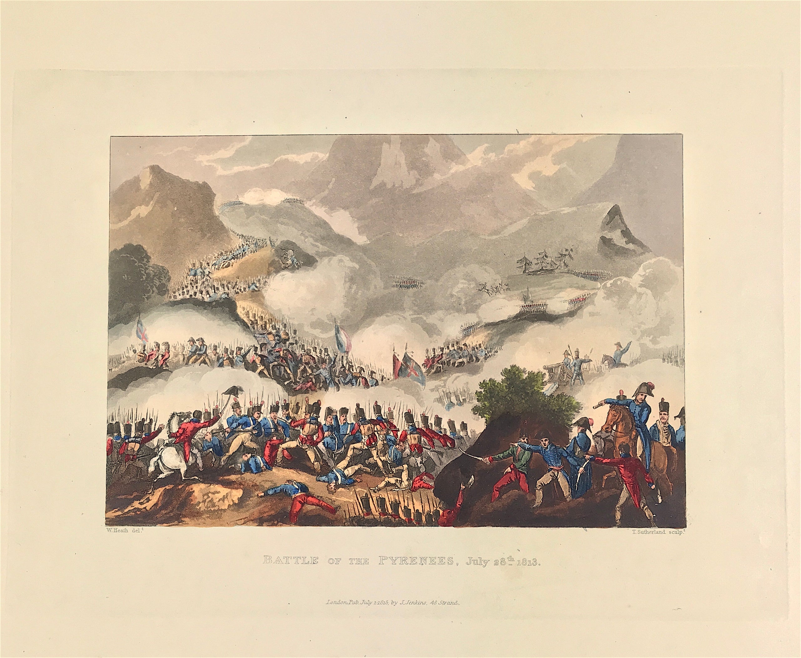
Battle of the Pyrenees c1813
Peninsular War: Battle of the Pyrenees July 28th 1813 London Published Jul 1st 1815 by J. Jenkins, 48 Strand. An original aquatint print from "The Martial achievements of Great Britain and Her Allies from 1799 to 1815. London: Printed for James Jenkins, No 48, Strand, By L. Harrison & J. C. Leigh, 373 Strand. Included with the print is the original folio text pages account of the action as first published with the aquatint and watermarked J. Whatman 1812.
Original aquatint engraving on medium weight wove paper with fine hand colour. Drawing by William Heath (delt) with aquatint engraving by T. Sutherland (sculpt).
Good overall condition with exceptional original colour and wide margins. The plate has the date of publication and the name of the publisher beneath the engraved title. The approx engraved area of the plate is 8.5" x 7.75" (215mm x 195mm) including the engraved title text. Engraved plate mark area is approx 8.5 x 11.75 (215mm x 300mm). The large sheet size is approx 11.5" x 14" (290mm x 355mm).
The Battle fought between 25th July and 2nd August 1813 in the western Pyrenees Mountains; Wellington decisively repelling Marshal Soult’s incursion across the border, intended to re-establish French occupation of Spain. British, Portuguese and Spanish against the French. General the Earl of Wellington against Marshal Soult. 50,000 British, Portuguese and Spanish against 70,000 French troops.
A genuine antique print over 200 years old.