- Antique Maps
- >
- Military Battle Maps
- >
- Military Plan Battle of Tourcoing and Tournay 1794
Military Plan Battle of Tourcoing and Tournay 1794
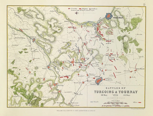
Antique Military Map The Battle of Turcoing and Tournay May 18th and 22nd 1794 From the Atlas to Alinson's History of Europe By Sir Archibald Alinson by Alexander Keith Johnson, F.R.S.E F.R.G.S. F.G.S. Published by William Blackwood & Sons, Edinburgh and London c1875. Original map produced with mechanical outline colour. Addition later fine wash hand colour embellishments make this a unique edition of the map.
The Battle of Tourcoing (18 May 1794) saw a Republican French army directed by General Joseph Souham defend against an attack by an Habsburg, British, and Hanoverian Coalition army under Austrian Prince Josias of Saxe-Coburg-Saalfeld and Prince Frederick, Duke of York and Albany.
The Battle of Tournay (1794) or Tournai was fought on 22 May 1794 as part of the Flanders Campaign in the Belgian province of Hainaut on the Schelde River (about 80 km southwest of Brussels) between French forces under General Pichegru and Coalition forces (Austrian, British, and Hanoverian troops) under Prince Josias of Coburg, in which the Coalition forces were victorious.
Condition: Overall excellent example, some age tone to plate. Engraved map area: 6" x 8" (155mm x 205mm) Approx sheet size including boarders:10 inches by 8 inches (25cm x 20cm).
A genuine antique map over 140 years old.

