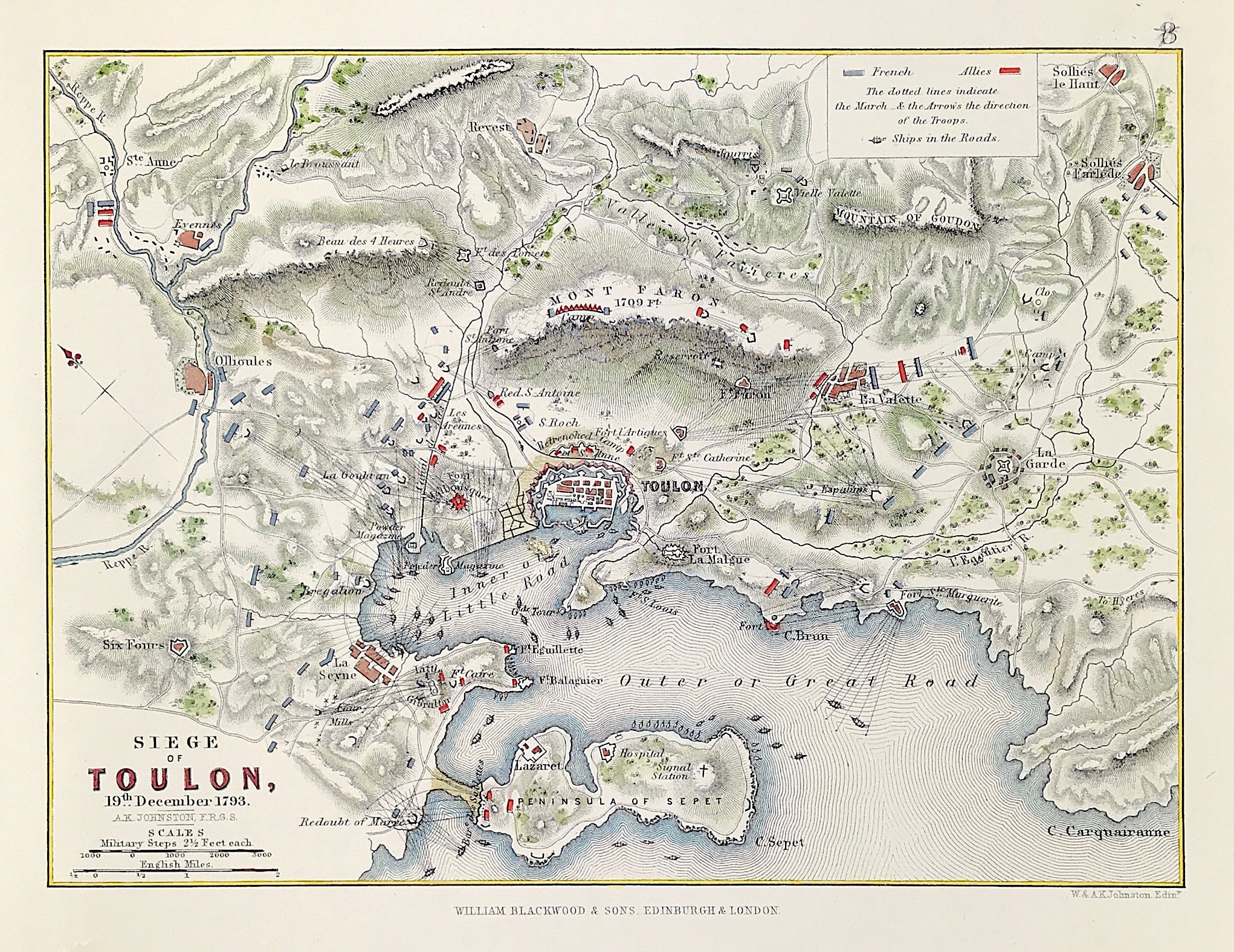
Military Plan The Siege of Toulon December 1793
Antique Military Map The Siege of Toulon 19th December 1793. From the Atlas to Alinson's History of Europe By Sir Archibald Alinson by Alexander Keith Johnson, F.R.S.E F.R.G.S. F.G.S. Published by William Blackwood & Sons, Edinburgh and London c1875. Original map produced with mechanical outline colour. Addition later fine wash hand colour embellishments make this a unique edition of the map.
The Siege of Toulon (29 August – 19 December 1793) was a military engagement that took place during the Federalist revolts of the French Revolutionary Wars. It was undertaken by Republican forces against Royalist rebels supported by Anglo-Spanish forces in the southern French city of Toulon. It was during this siege that young Napoleon Bonaparte first won fame and promotion when his plan, involving the capture of fortifications above the harbor, was credited with forcing the city to capitulate and the Anglo-Spanish fleet to withdraw. The British siege of 1793 marked the first involvement of the Royal Navy with the French Revolution.
Condition: Overall excellent example, some age tone to plate. Engraved map area: 6" x 8" (155mm x 205mm) Approx sheet size including boarders:10 inches by 8 inches (25cm x 20cm). Small boarder tear/repair to bottom boarder not affecting the engraved area.
A genuine antique map over 140 years old.