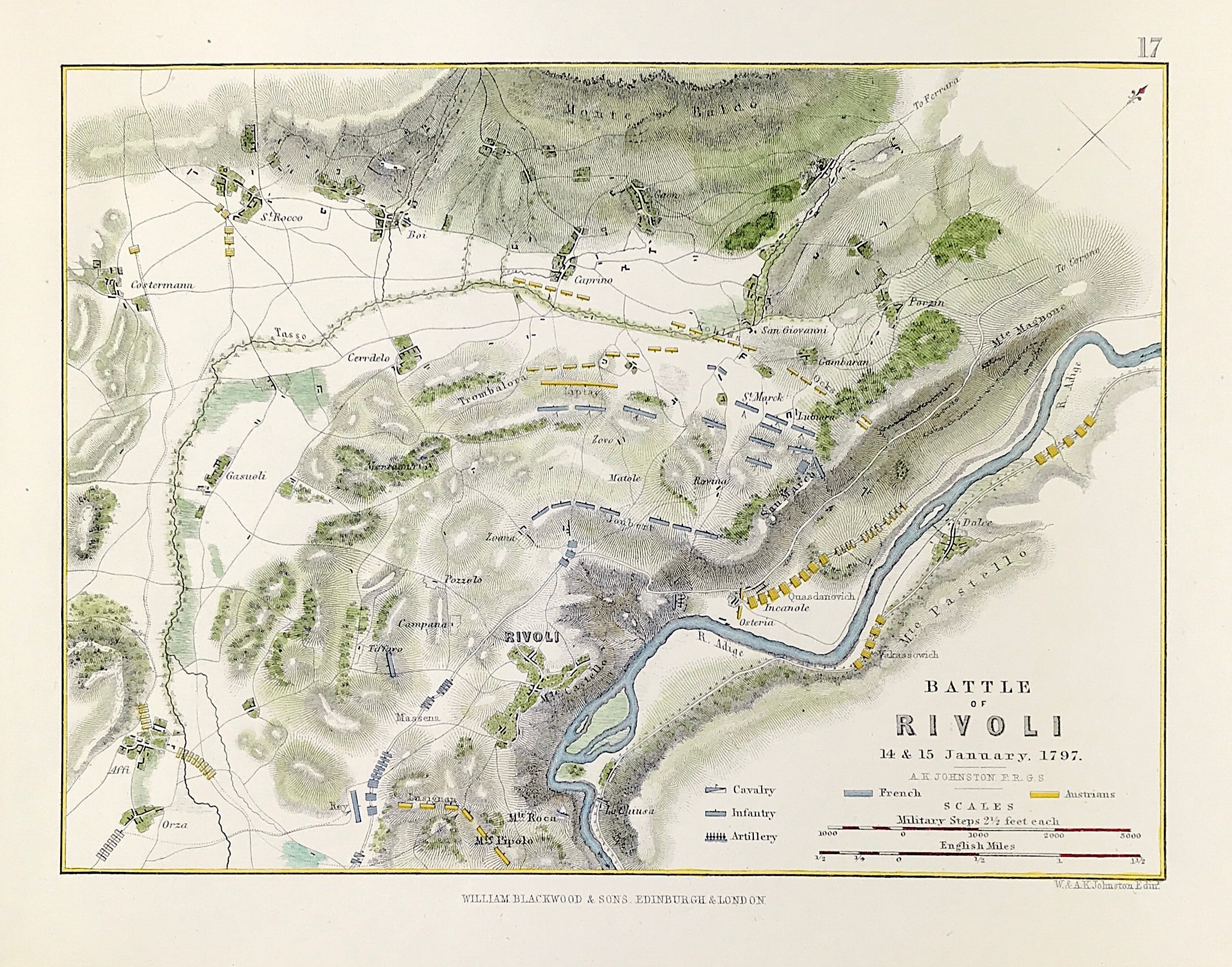
Military Plan Battle of Rivoli 1793
Antique Military Map Battle of Rivoli 14th & 15th January 1793. From the Atlas to Alinson's History of Europe By Sir Archibald Alinson by Alexander Keith Johnson, F.R.S.E F.R.G.S. F.G.S. Published by William Blackwood & Sons, Edinburgh and London c1875. Original map produced with mechanical outline colour. Addition later fine wash hand colour embellishments make this a unique edition of the map.
The Battle of Rivoli (14–15 January 1797) was a key victory in the French campaign in Italy against Austria. Napoleon Bonaparte's 23,000 Frenchmen defeated an attack of 28,000 Austrians under General of the Artillery Jozsef Alvinczi, ending Austria's fourth and final attempt to relieve the Siege of Mantua. Rivoli further demonstrated Napoleon's brilliance as a military commander and led to the French consolidation of northern Italy.
Condition: Overall excellent example, some age tone to plate. Engraved map area: 6" x 8" (155mm x 205mm) Approx sheet size including boarders:10 inches by 8 inches (25cm x 20cm).
A genuine antique map over 140 years old.