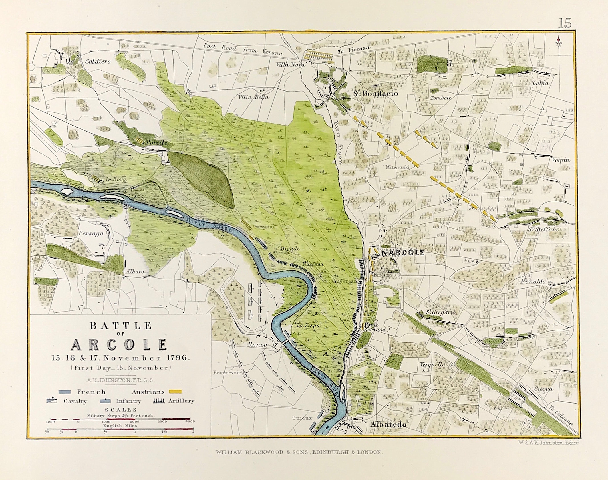
Military Plan Battle of Arcole 1796
Antique Military Map Battle of Arcole 15th, 16th, 17th November 1796. From the Atlas to Alinson's History of Europe By Sir Archibald Alinson by Alexander Keith Johnson, F.R.S.E F.R.G.S. F.G.S. Published by William Blackwood & Sons, Edinburgh and London c1875. Original map produced with mechanical outline colour. Addition later fine wash hand colour embellishments make this a unique edition of the map.
The Battle of Arcole or Battle of Arcola (15–17 November 1796) was a battle fought between French and Austrian forces 25 kilometres (16 mi) southeast of Verona during the War of the First Coalition, a part of the French Revolutionary Wars. The battle saw a bold maneuver by Napoleon Bonaparte's French Army of Italy to outflank the Austrian army led by József Alvinczi and cut off its line of retreat. The French victory proved to be a highly significant event during the third Austrian attempt to lift the Siege of Mantua.
Condition: Overall excellent example, some age tone to plate. Engraved map area: 6" x 8" (155mm x 205mm) Approx sheet size including boarders:10 inches by 8 inches (25cm x 20cm).
A genuine antique map over 140 years old.