Military Plan Battle of Friedland 1807
Antique Military Map Battle of Friedland 14th June 1807. From the Atlas to Alinson's History of Europe By Sir Archibald Alinson by Alexander Keith Johnson, F.R.S.E F.R.G.S. F.G.S. Published by William Blackwood & Sons, Edinburgh and London c1875. Original map produced with mechanical outline colour. Addition later fine wash hand colour embellishments make this a unique edition of the map.
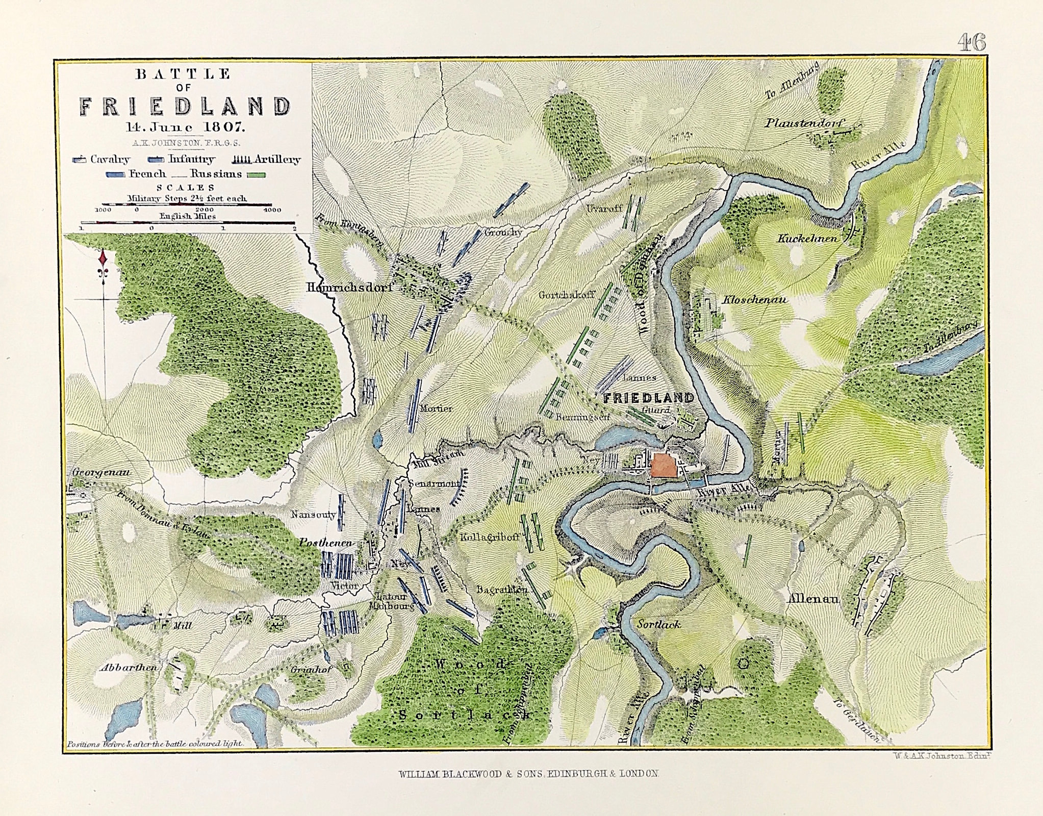
The Battle of Friedland (June 14, 1807) was a major engagement of the Napoleonic Wars between the armies of the French Empire commanded by Napoleon I and the armies of the Russian Empire led by Count von Bennigsen. Napoleon and the French obtained a decisive victory that routed much of the Russian army, which retreated chaotically over the Alle River by the end of the fighting. The battlefield is located in modern-day Kaliningrad Oblast, near the town of Pravdinsk, Russia.
Condition: Overall excellent example, some age tone to plate. Engraved map area: 6" x 8" (155mm x 205mm) Approx sheet size including boarders:10 inches by 8 inches (25cm x 20cm).
A genuine antique map over 140 years old.