RARE MAPS AND PRINTS
help@raremapsandprints.co.uk
+44 7788 628706
  • Start Here
  • About
  • Maps
    • British Isles
    • English Counties
    • Road Maps
    • River Thames
    • The Americas
    • Asia to Australia
    • Europe & Middle East
    • World & Hemispheres
    • Sea Charts
    • Military Battle Maps
  • Prints
    • British Topography >
      • Views River Thames
      • Views England
      • Views Wales
      • Views London
    • Satire & Caricature >
      • Vanity Fair Prints
      • Tour of Dr Syntax
      • William Hogarth
      • Max Beerbohm
    • Sporting
    • Amorial
    • Military & Naval
    • Portrait
    • Russian Art
    • Views Italy
  • Engravings
    • Copper
    • Steel
    • Etching
    • Wood Block
    • Lithograph
    • Lithotint
    • Aquatint
    • Photogravure
  • Resources
    • Reference Books
  • Blog
  • Contact
  • Antique Maps
  • >
  • Reverence Books
  • >
  • Bleau's Grand Atlas 17th Century - Sold!

Bleau's Grand Atlas 17th Century - Sold!

SKU:
£0.00
Unavailable
per item

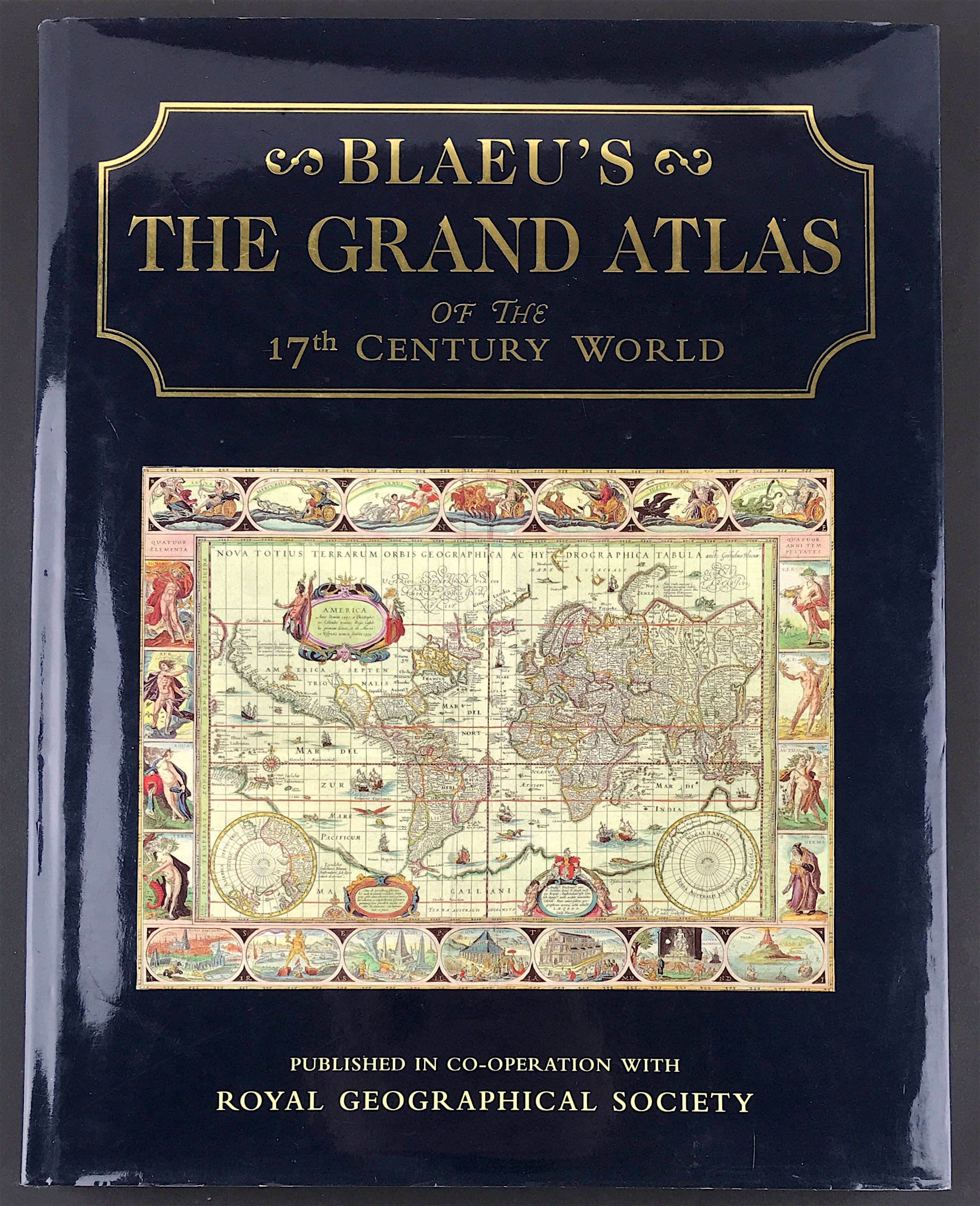
Blaeu's The Grand Atlas of the 17th Century World

INTRODUCTION BY JOHN GOSS, FOREWORD BY PETER CLARK, KEEPER(1989-92), ROYAL GEOGRAPHICAL SOCIETY. Publisher: Royal Geographical Society London 1997 Size: 14.5" x 11.25" (370mm x 285mm). Hardcover. Condition: Good. Dust Jacket Condition: Good. With 100 colour maps.

This edition of Blaeu's 17th-century atlas includes the finest maps selected from the original nine volumes. These contained almost 600 maps, covering the entire world as it was known at that time. John Goss has supplied extended captions for the benefit of a modern readership.

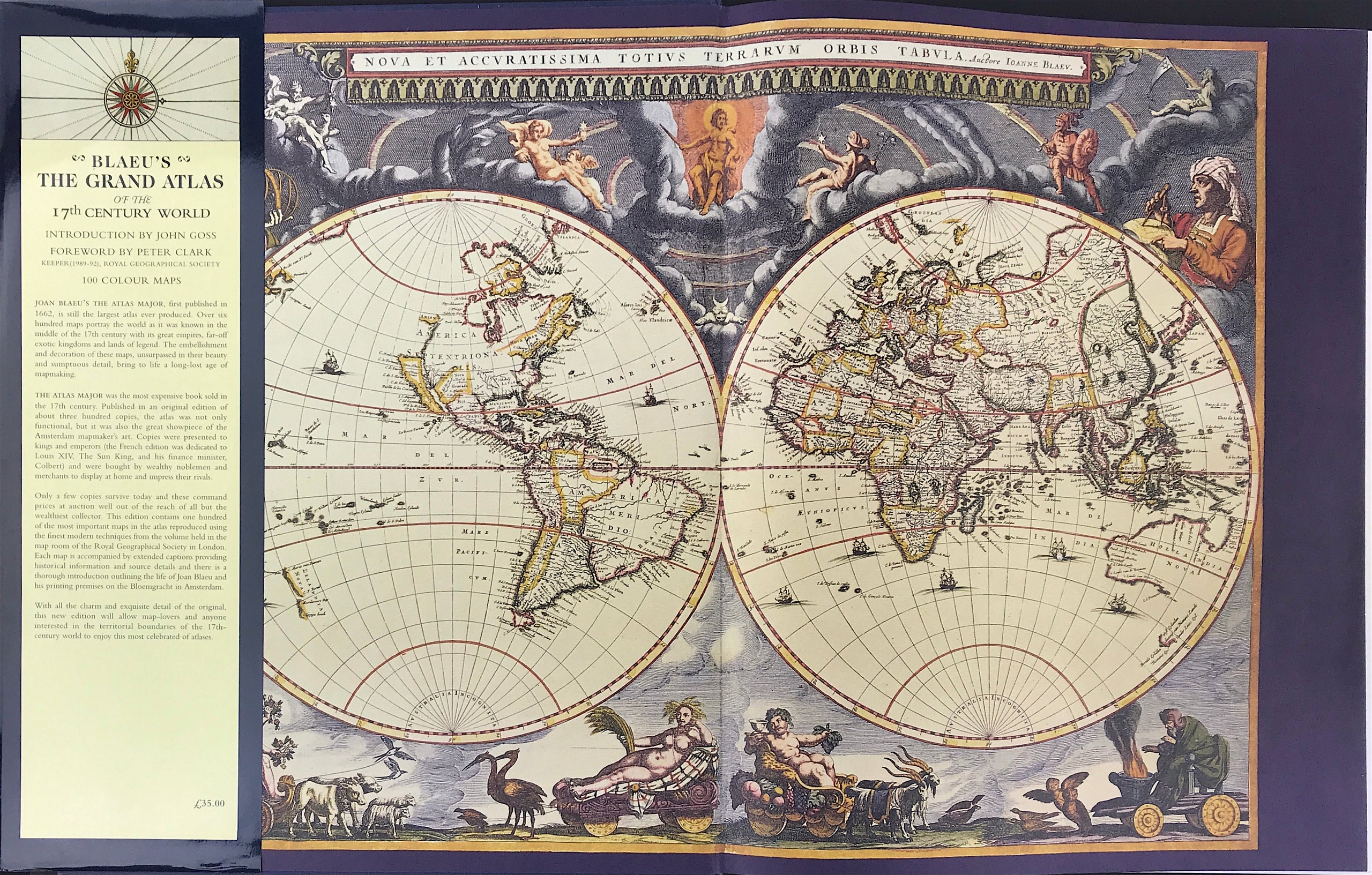
JOAN BLAEU'S THE ATLAS MAJOR, first published in 1662, is still the largest atlas ever produced. Over six hundred maps portray the world as it was known in the middle of the 17th century with its great empires, far-off exotic kingdoms and lands of legend. The embellishment and decoration of these maps, unsurpassed in their beauty and sumptuous detail, bring to life a long-lost age of mapmaking.

THE ATLAS MAJOR was the most expensive book sold in the 17th century. Published in an original edition of about three hundred copies, the atlas was not only functional, but it was also the great showpiece of the Amsterdam mapmaker's art. Copies were presented to kings and emperors (the French edition was dedicated to Louis XIV, The Sun King, and his finance minister, Colbert) and were bought by wealthy noblemen and merchants to display at home and impress their rivals.

Only a few copies survive today and these command prices at auction well out of the reach of all but the wealthiest collector. This edition contains one hundred of the most important maps in the atlas reproduced using the finest modern techniques from the volume held in the map room of the Royal Geographical Society in London. Each map is accompanied by extended captions providing historical information and source details and there is a thorough introduction outlining the life of Joan Blaeu and his printing premises on the Bloemgracht in Amsterdam.

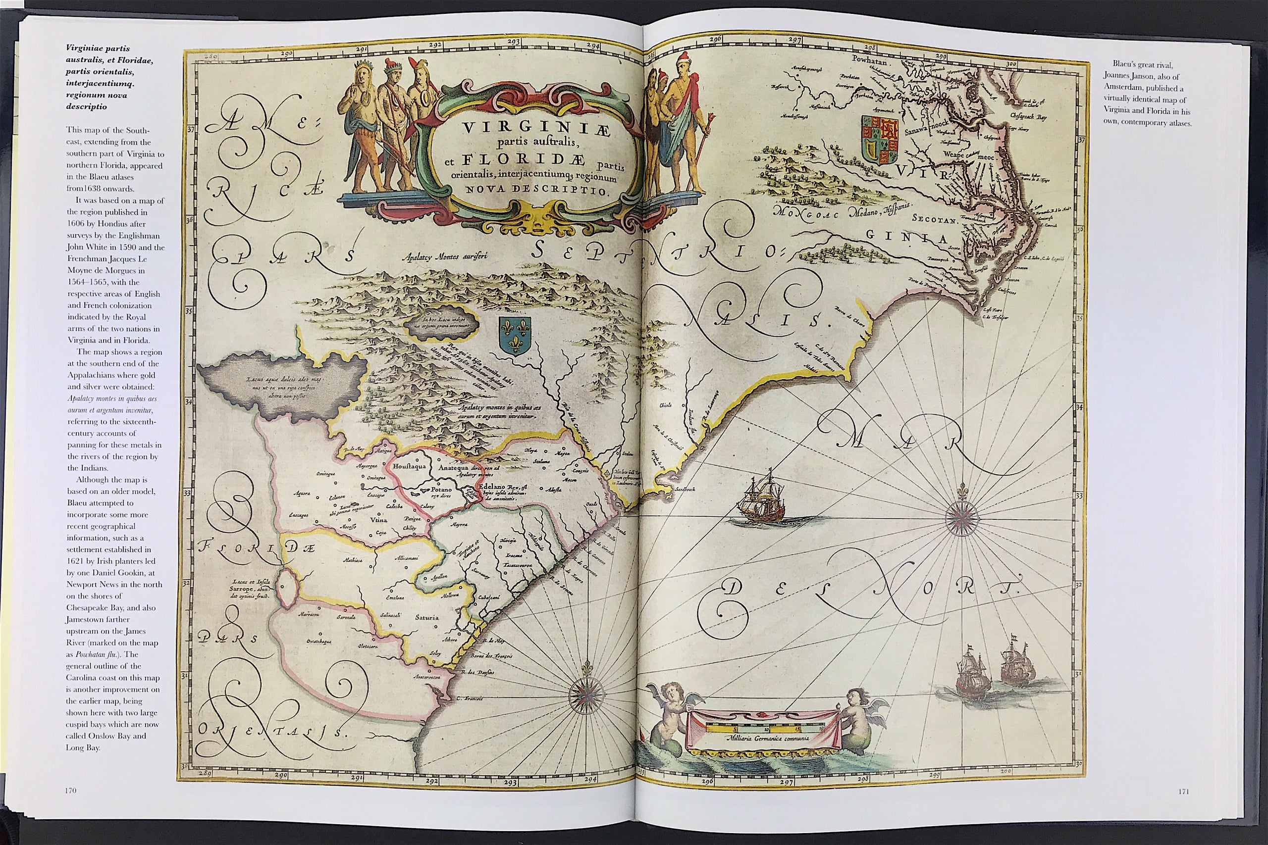
With all the charm and exquisite detail of the original, this new edition will allow map-lovers and anyone interested in the territorial boundaries of the 17th-century world to enjoy this most celebrated of atlases.


  • Facebook
  • Twitter
  • Pinterest
  • Google+
Buy Now
Contact Info:     
Rare Maps and Prints Limited 
4, Ray House, Cressington Place,
​Bourne End, Bucks SL8 5SL UK 
                             
Kevin J Ryan :     

email: kevin@raremapsandprints.co.uk         
​
Customer Service     
email: help@raremapsandprints.co.uk           
Picture
Member of
​INTERNATIONAL MAP COLLECTORS SOCIETY 


    Maps & Prints Updates

Subscribe to List

Copyright © 2021  -  Rare Maps and Prints Limited  -  Raremapsandprints.co.uk   All Rights Reserved     Site Map     Terms & Conditions     Privacy Policy
  • Start Here
  • About
  • Maps
    • British Isles
    • English Counties
    • Road Maps
    • River Thames
    • The Americas
    • Asia to Australia
    • Europe & Middle East
    • World & Hemispheres
    • Sea Charts
    • Military Battle Maps
  • Prints
    • British Topography >
      • Views River Thames
      • Views England
      • Views Wales
      • Views London
    • Satire & Caricature >
      • Vanity Fair Prints
      • Tour of Dr Syntax
      • William Hogarth
      • Max Beerbohm
    • Sporting
    • Amorial
    • Military & Naval
    • Portrait
    • Russian Art
    • Views Italy
  • Engravings
    • Copper
    • Steel
    • Etching
    • Wood Block
    • Lithograph
    • Lithotint
    • Aquatint
    • Photogravure
  • Resources
    • Reference Books
  • Blog
  • Contact

    Join Our List

sign up
SHOP
Home
Shop
About
Updates
Contact
SOCIAL
Facebook
Twitter
Instagram
Proudly powered by Weebly