India Published 1799 - SOLD!
SKU:
£0.00
per item
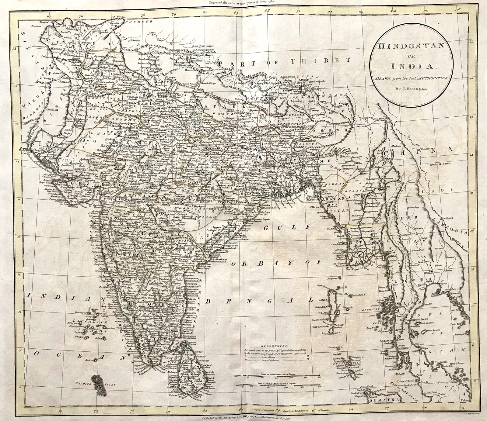
Map of HINDOSTAN, INDIA by J Russell c1799 "drawn from the best authorities"
Method: Copper plate engraved
Creator: John Charles Russell
Published: Published as the Act Directs by C. Dilley & G G & J. Robinson, April 7th 1799 for Guthrie's "New System of Geography" Approx engraved area: 18" x 17.5" (460mm x 440mm)
Condition: Good condition, copper plate engraving, some age tone, original outline colour, fold as published Notes: