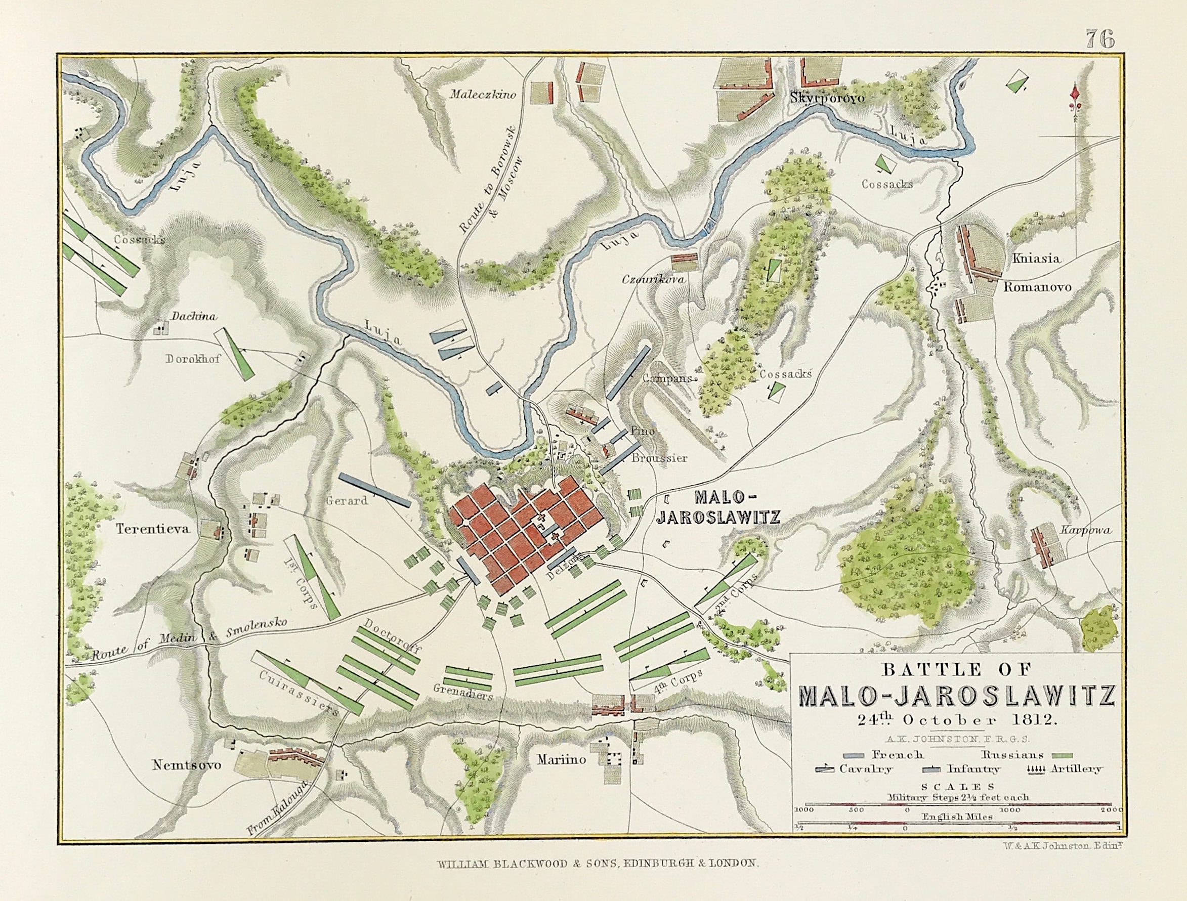
Military Battle Plan - Malo 1812
Antique Military Map The Battle of Malo - Jaroslawitz (Maloyaroslavets) 24th October t 1812 from the Atlas to Alison's History of Europe By Sir Archibald Alison by Alexander Keith Johnson, F.R.S.E F.R.G.S. F.G.S.
Published by William Blackwood & Sons, Edinburgh and London c1875. Original map produced with mechanical outline colour. Addition later fine wash hand colour embellishments make this a unique edition of the map.
Condition: Overall excellent example, some age tone to plate. Engraved map area: 6" x 8" (155mm x 205mm) Approx sheet size including boarders:10 inches by 8 inches (25cm x 20cm).
The Battle of Maloyaroslavets took place on 24 October 1812 as part of the French invasion of Russia. It was Kutuzov's decisive battle to force Napoleon to retreat northwest over Mozhaisk to Smolensk on the devastated route of his advance with a higher probability of starvation.
After a victory in the Battle of Maloyaroslavets Napoleon decided just two days later to retreat over Mozhaisk on Smolensk for reasons unknown.
A genuine antique map over 140 years old.