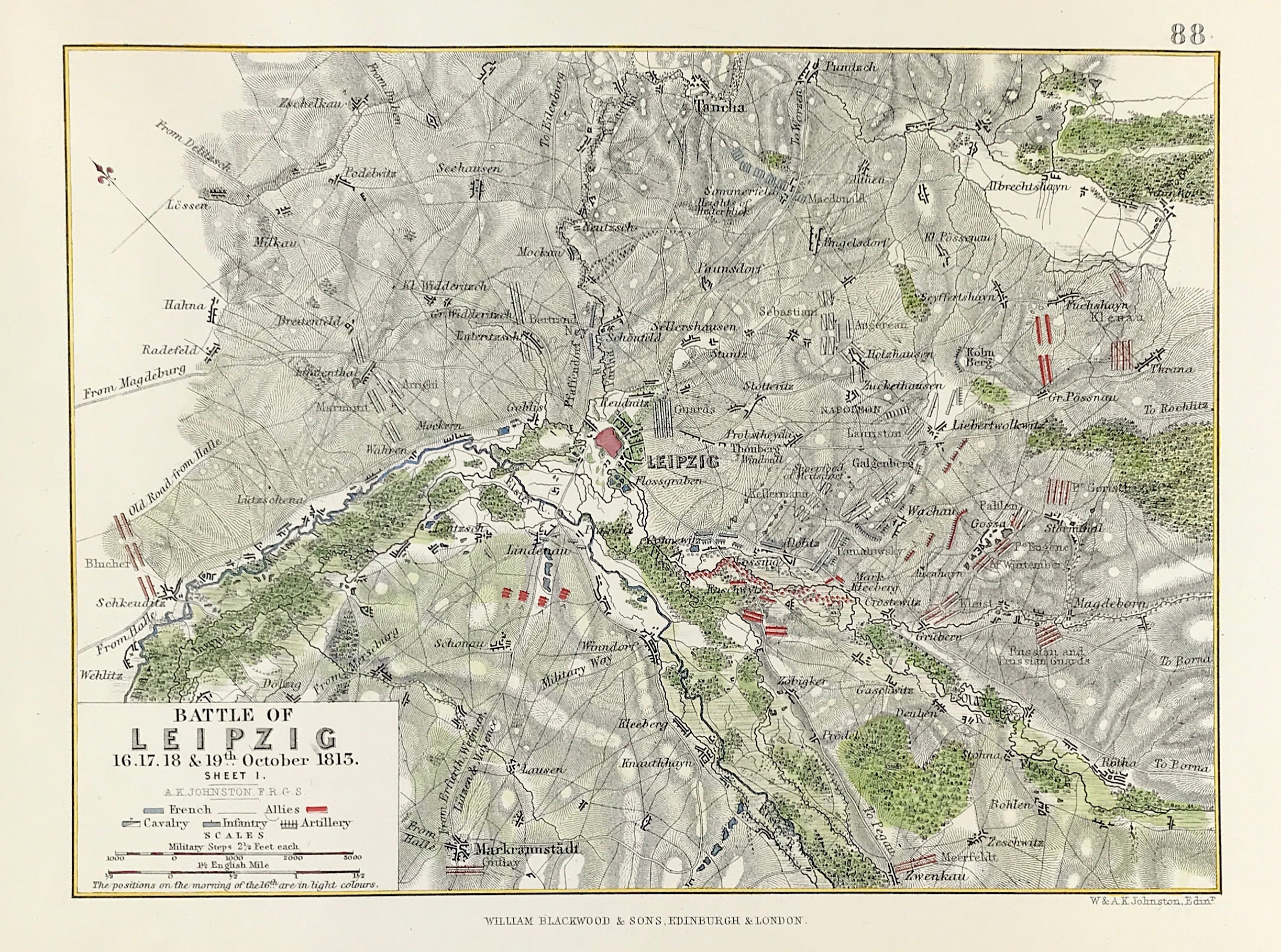
Military Plan Leipzig 1, 1813
Antique Military Map The Battle of Leipzig 16th, 17th, 18th & 19th October 1813, Sheet 1, from the Atlas to Alison's History of Europe By Sir Archibald Alison by Alexander Keith Johnson, F.R.S.E F.R.G.S. F.G.S.
Published by William Blackwood & Sons, Edinburgh and London c1875. Original map produced with mechanical outline colour. Addition later fine wash hand colour embellishments make this a unique edition of the map.
Condition: Overall excellent example, some age tone to plate. Engraved map area: 6" x 8" (155mm x 205mm) Approx sheet size including boarders:10 inches by 8 inches (25cm x 20cm).
The Coalition armies of Austria, Prussia, Sweden, and Russia, led by Tsar Alexander I and Karl von Schwarzenberg, decisively defeated the Grande Armée of French Emperor Napoleon I. Napoleon's army also contained Polish and Italian troops, as well as Germans from the Confederation of the Rhine (mainly Saxony and Württemberg). The battle was the culmination of the German Campaign of 1813 and involved 500,000 soldiers, 2,200 artillery pieces, the expenditure of 200,000 rounds of artillery ammunition, and 127,000 casualties, making it the largest battle in Europe prior to World War I.
A genuine antique map over 140 years old.