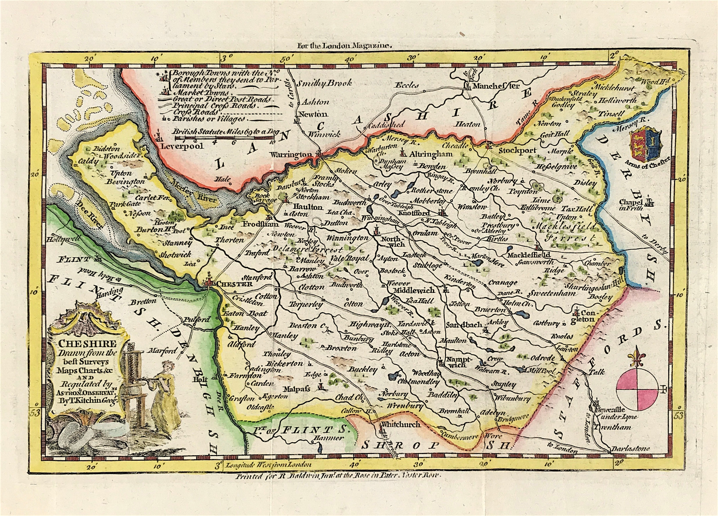
Cheshire Published 1750 SOLD!
ORIGINAL ANTIQUE MAP OF CHESHIRE By Thomas Kitchin c1750. Drawn from the best Surveys, Maps, Charts and Regulated by Astronomical Observations By T. Kitchin Geographer from The London Magazine 1750. The London Magazine is England’s oldest literary periodical, with a history stretching back to 1732. A complete set of English county maps by Thomas Kitchin were published in the London Magazine between 1747 and 1754.
Thomas Kitchin (1718–1784 was an English engraver and cartographer, who became hydrographer to the king. He was also a writer, who wrote about the history of the West Indies. He produced 170 maps for London Magazine (1747–83). Kitchin was the head hydrographer for the King of England. Kitchin frequently stole the works of other cartographers, which is one reason why he "created" so much work as a cartographer.
Excellent clean condition with Later Hand Colour. Clear plate mark. Blank to verso. Centre fold as issued. Approx Engraved Plate Area: 6" x 9" (153mm X 228mm)
A Genuine antique map over 270 years old from Rare Maps and Prints