RARE MAPS AND PRINTS
[email protected]
+44 7788 628706
  • About
  • Maps
    • British Isles
    • English Counties
    • Road Maps
    • River Thames
    • The Americas
    • Asia to Australia
    • Europe & Middle East
    • World & Hemispheres
    • Sea Charts
    • Military Battle Maps
  • Prints
    • British Topography >
      • Views England & Scotland
      • Views Wales
      • Views London
      • Views River Thames
    • Sporting
    • Amorial
    • Military & Naval
    • Portrait
    • Russian Art
    • Views Italy
  • Resources
    • Reference Books
  • Blog
  • The Colourist
  • Antique Maps
  • >
  • English Counties
  • >
  • Nottinghamshire Published 1610 - SOLD!

Nottinghamshire Published 1610 - SOLD!

SKU:
£0.00
Unavailable
per item

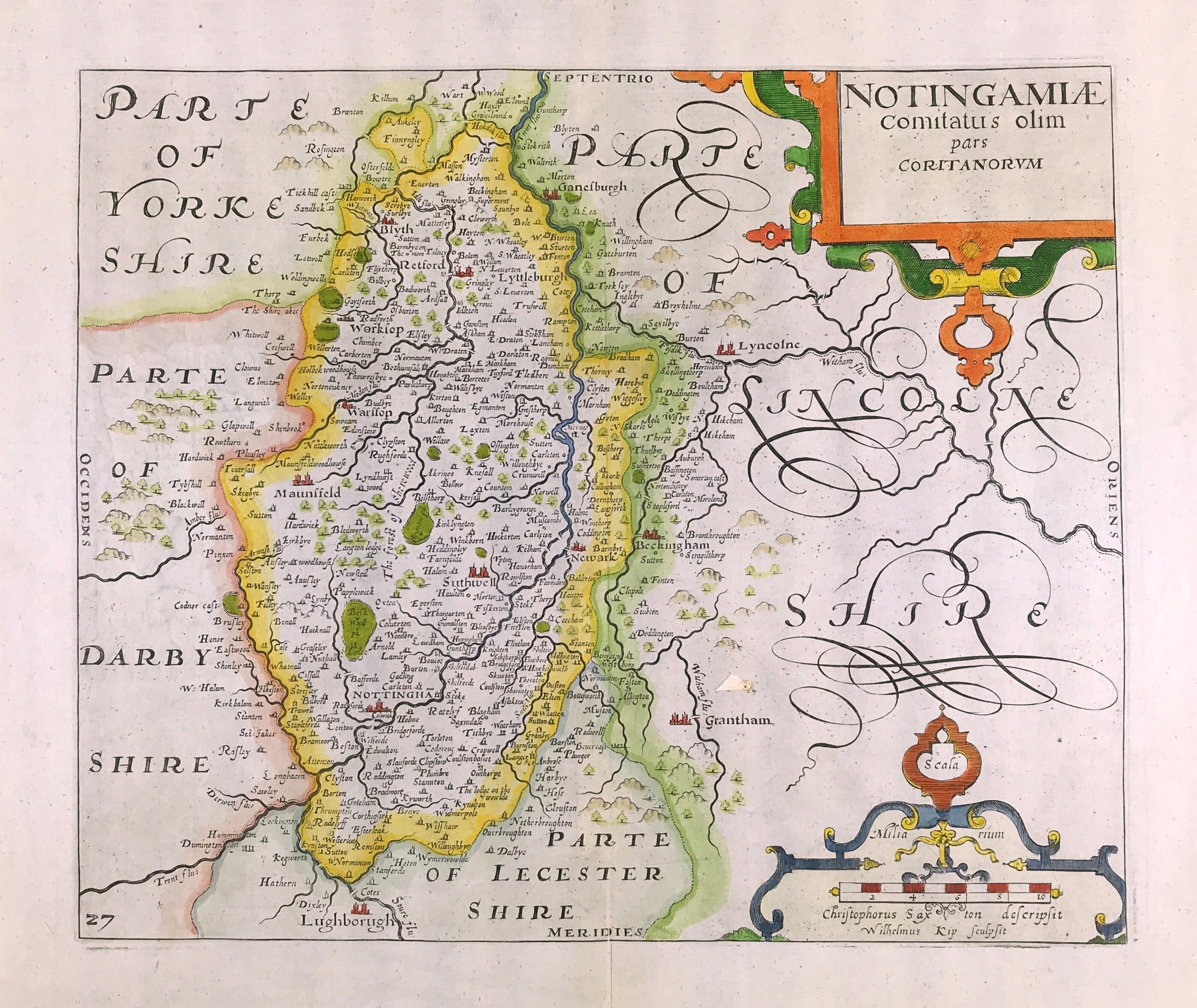
County Map Nottinghamshire c1610 by C Saxton & W. Kip. In 1579, in the first atlas of counties of England and Wales, Christopher Saxton's maps frequently showed counties together as geographical regions rather than as independent entities. However, when maps were commissioned for the 1607 edition of William Camden's historical guide to the country, "Britannia", the engravers, William Hole and William Kip, though copying Saxton's detail, in the main, depicted each county in a separate engraving. Camden's "Britannia" with maps by Kip and Hole appeared in three editions of 1607, 1610, as here, and 1637.

Copper plate engraved. C Saxton & William Hole and William Kip. c1610

Overall good condition, plate mark, later hand colour, blank to verso and fold as issued on Watermarked laid paper. Approx engraved area: 10.75" x 12.5" (270mm x 320mm)

A genuine antique map over 400 years old.

  • Facebook
  • Twitter
  • Pinterest
  • Google+
Buy Now
Contact Info:     
Rare Maps and Prints Limited 
4, Ray House, Cressington Place,
​Bourne End, Bucks SL8 5SL UK 
                             
Kevin J Ryan :     

email: [email protected]         
​
    
          
Picture
Member of
​INTERNATIONAL MAP COLLECTORS SOCIETY 


    Maps & Prints Updates

Subscribe to List

Copyright © 2025 -  Rare Maps and Prints Limited  -  Raremapsandprints.co.uk   All Rights Reserved     Site Map     Terms & Conditions     Privacy Policy
  • About
  • Maps
    • British Isles
    • English Counties
    • Road Maps
    • River Thames
    • The Americas
    • Asia to Australia
    • Europe & Middle East
    • World & Hemispheres
    • Sea Charts
    • Military Battle Maps
  • Prints
    • British Topography >
      • Views England & Scotland
      • Views Wales
      • Views London
      • Views River Thames
    • Sporting
    • Amorial
    • Military & Naval
    • Portrait
    • Russian Art
    • Views Italy
  • Resources
    • Reference Books
  • Blog
  • The Colourist

    Join Our List

sign up
SHOP
Home
Shop
About
Updates
Contact
SOCIAL
Facebook
Twitter
Instagram
Proudly powered by Weebly