- Antique Maps
- >
- Asia to Australia
- >
- Southern India Sri Lanka c1780
Southern India Sri Lanka c1780
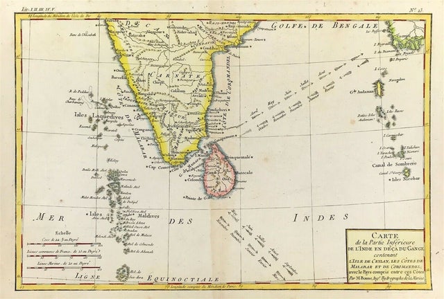
ANTIQUE MAP OF SOUTHERN INDIA & Sri Lanka c1780 Carte De la Partie Inferieure de L'Inde en Deca du Gange Contenant L'Isle de Ceylan, Les Cotes de Malabar et de Coromandel, avec le Pays compris entre ces Cotes. Original engraved map as published by Jean-Leonard Pellet, Geneva, c.1780
Attractive 1780 map of southern India by the French cartographer Rigobert Bonne. Covers from the Deccan plateau south as far as the Maldives and as far east as the Andaman and Nicobar Islands. Includes Ceylon or Sri Lanka. Shows the direction of the important Indian Ocean trade winds and their corresponding seasons. The regularity of the trade winds in the Indian Ocean generated active nautical trade routes well into antiquity. Published as plate no. L 3 in Bonne's 1780 Atlas de Toutes les Parties Connues du Globe Terrestre.
Good condition, copper plate engraving, some overall age tone centre fold as issued with later fine hand colour. Engraved area approx 10" x 14.5" (250mm x 375mm)
A genuine antique map over 240 years old

