Road Map Northumberland c1720
SKU:
£35.00
£35.00
per item
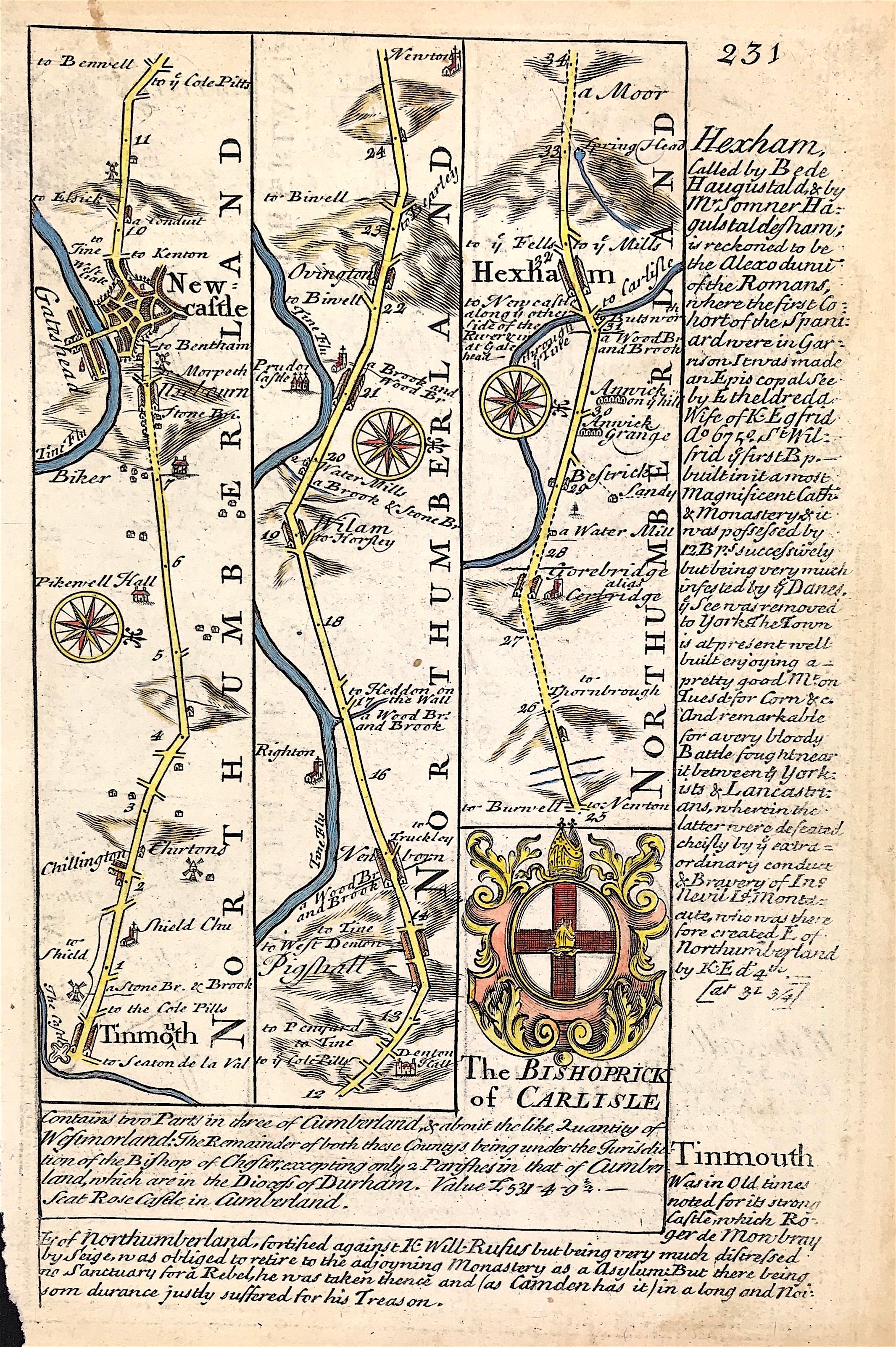
A MAP OF TINMOUTH NEWCASTLE HEXHAM (Northumberland) Road Map c1720 - Plate 231
An original county map from Owen and Bowen road atlas, "Britannia Depicta or Ogilby Improv'd; Being a Correct Coppy of Mr. Ogilby's Actual Survey of all ye Direct & Principal Cross Roads in England and Wales…" by John Owen, with maps by Emmanuel Bowen.
Printed & sold by Thomas Bowles, print & map seller in St Pauls Churchyard.
Good condition, copper plate engraving, some age tone, later hand colour small loss to bottom left boarder not affecting engraving.
Additional road map to verso - Plate 232 uncoloured
Sheet approx: 7.75" x 5.25" (195mm x 130mm)
A genuine antique map over 270 years old.