- Antique Maps
- >
- The Americas
- >
- Map States of America c1802 - SOLD!
Map States of America c1802 - SOLD!
SKU:
£0.00
Unavailable
per item
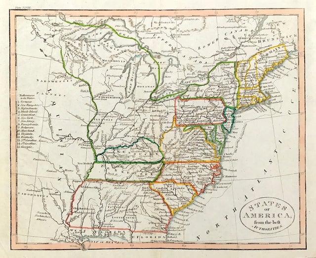
Map States of America, drawn from the Best Authorities . . . . . By John Charles Russell c1802. Fine map of United States of America by John Charles Russell.
Detailed and fascinating map detailing states and Indian lands east of the Mississippi River from northern Florida to Canada. The map pre-dates Ohio and Mississippi Territory. Louisiana is shown, but the map would seem to predate Louisiana Territory.
Map with center fold as published, original outline hand colour
Good condition, copper plate engraving, some age tone
Engraved Area approx " x 7.5" (230mm x 190mm)
A Genuine Antique Map over 200 years old from Rare Maps and Prints

