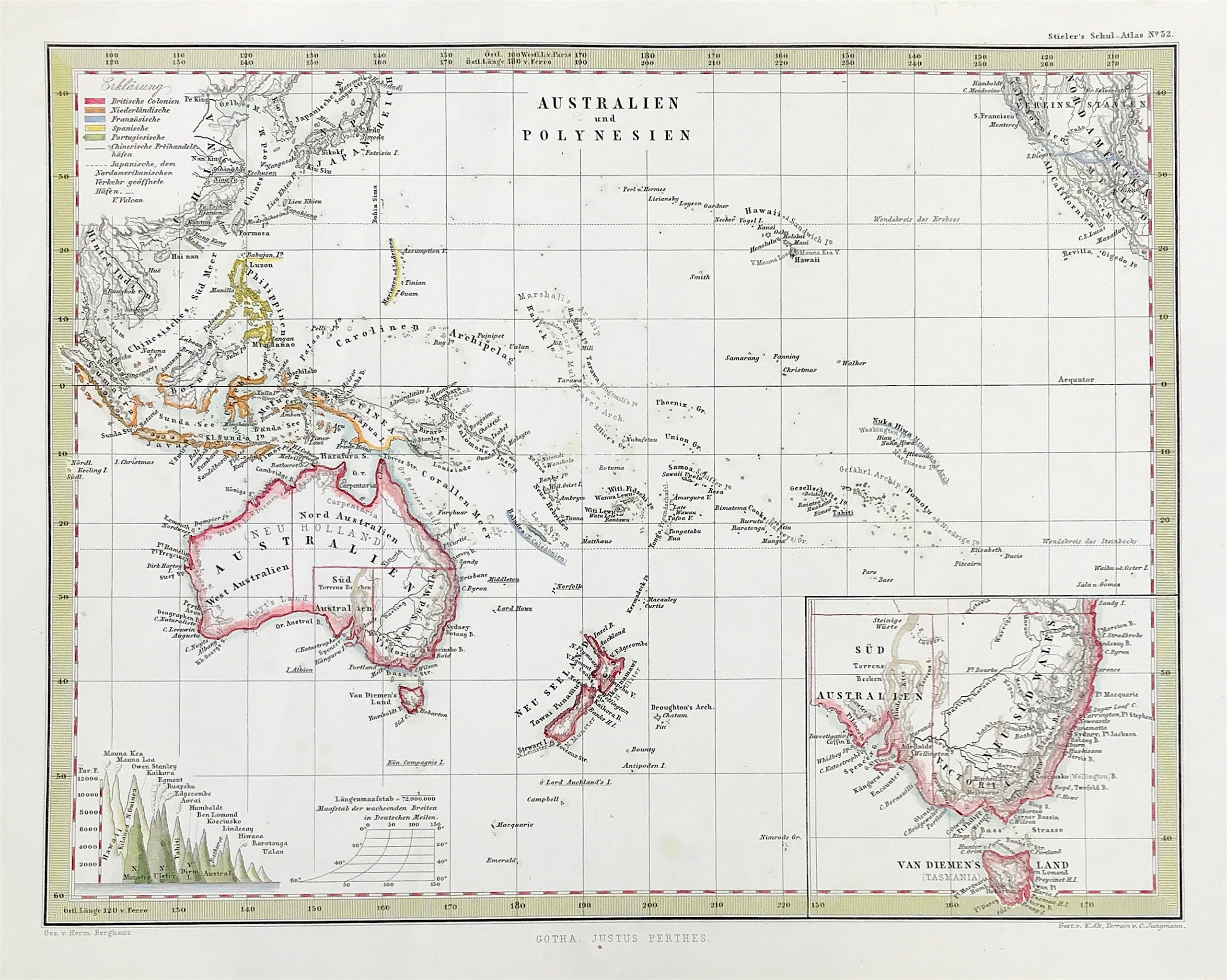
Australia and Polynesia c1862
SKU:
£70.00
£70.00
per item
c1862 Map of Australia (New Holland) and Polynesia. With an inset map of Southern Australia including Tasmania (Van Diemen's Land).Engraved by H. Berghaus
This fascinating 1862 map by Justus Perthes and Stieler depicts Polynesia and Australia. There is an inset of southeastern Australia and Tasmania. On the bottom left there is a relative elevation chart. Issued in the 1862 edition of Stieler’s Schul-Atlas.
Good Clean Condition, fine engraved detail Copperplate engraved with later hand wash and outline colour. Approx 8" x 10.5" (200mm x 260mm)Couple of old vertical soft creases to left of image.
MORE GENUINE ANTIQUE MAPS FROM RARE MAPS AND PRINTS