
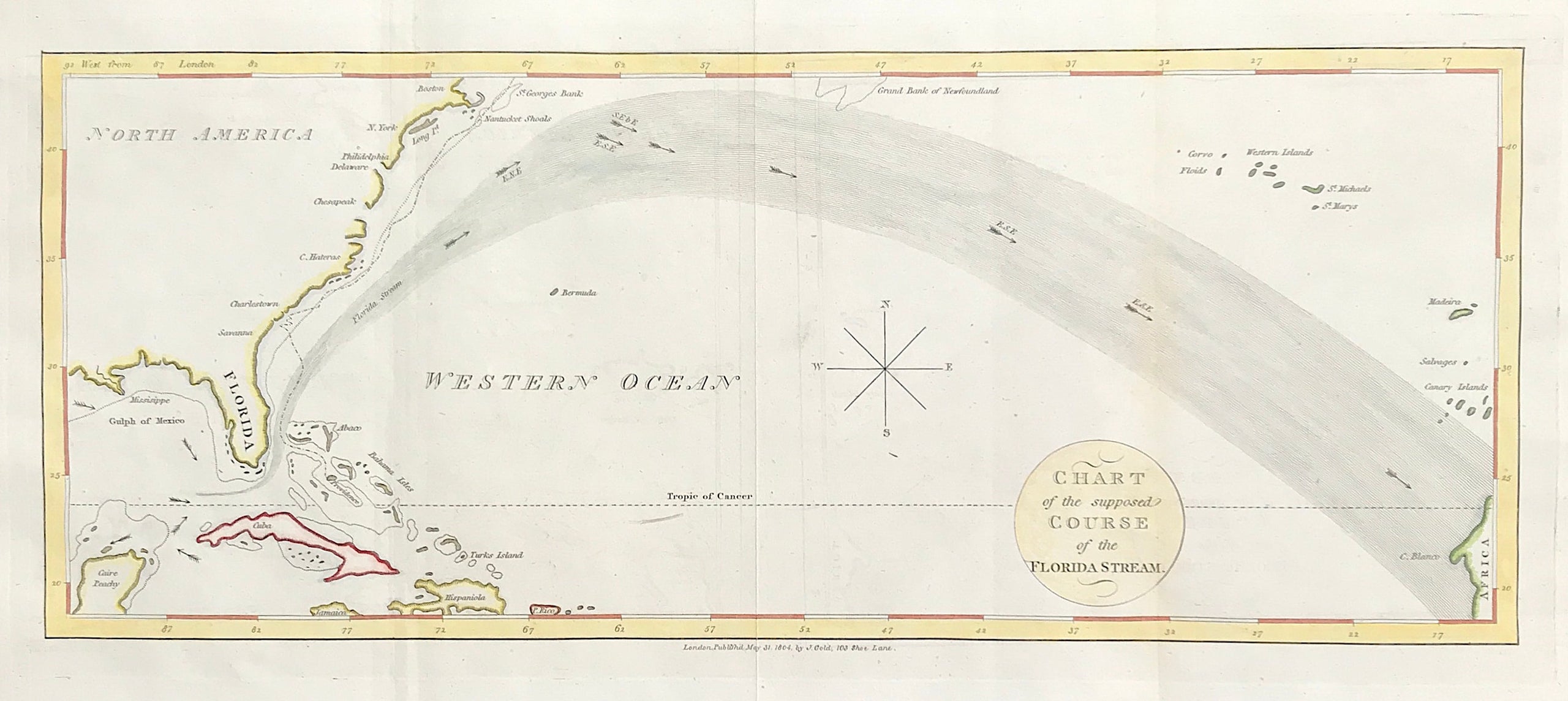
The Florida Stream c1804
Scarce Chart of the supposed Course of the Florida Stream c1804 Published: May 31st 1804 by J. Gold, Navel Chronicle Office, 103, Shoe Lane London.
Good condition engraved on medium weight wove paper with later hand colour
Three vertical folds as published, blank to verso, some light staining to top edge of sheet.
Approx size to plate mark 7" x 19.25" (180mm x 490mm)
Scarce map of a portion of the North Atlantic, showing an early conception of the Gulf Stream, from Florida to Capo Blanco. Extends from the Caribbean, up the east coast, below the Grand Banks, the Western Islands and the Canary Islands, with arrows illustrating the directional flow of the water. From the Naval Chronicle.
The Naval Chronicle was a monthly magazine published in London between 1799 and 1818. Each issue featured a treasure trove of reports of naval battles; news of promotions, retirements and deaths; naval biographies; and more general news of significance to the naval establishment. First published by John Bunney and Joyce Gold, Gold later took over as sole publisher, with an imprint placing him at 103 Shoe Lane, Fleet Street.
ANOTHER GENUINE ANTIQUE MAP OVER 216 YEARS OLD FROM RARE MAPS AND PRINTS