RARE MAPS AND PRINTS
[email protected]
+44 7788 628706
  • About
  • Maps
    • British Isles
    • English Counties
    • Road Maps
    • River Thames
    • The Americas
    • Asia to Australia
    • Europe & Middle East
    • World & Hemispheres
    • Sea Charts
    • Military Battle Maps
  • Prints
    • British Topography >
      • Views England & Scotland
      • Views Wales
      • Views London
      • Views River Thames
    • Sporting
    • Amorial
    • Military & Naval
    • Portrait
    • Russian Art
    • Views Italy
  • Resources
    • Reference Books
  • Blog
  • The Colourist
  • Antique Maps
  • >
  • World & Hemispheres
  • >
  • Parallels of Latitude Published 1684 - SOLD!

Parallels of Latitude Published 1684 - SOLD!

SKU:
£0.00
Unavailable
per item

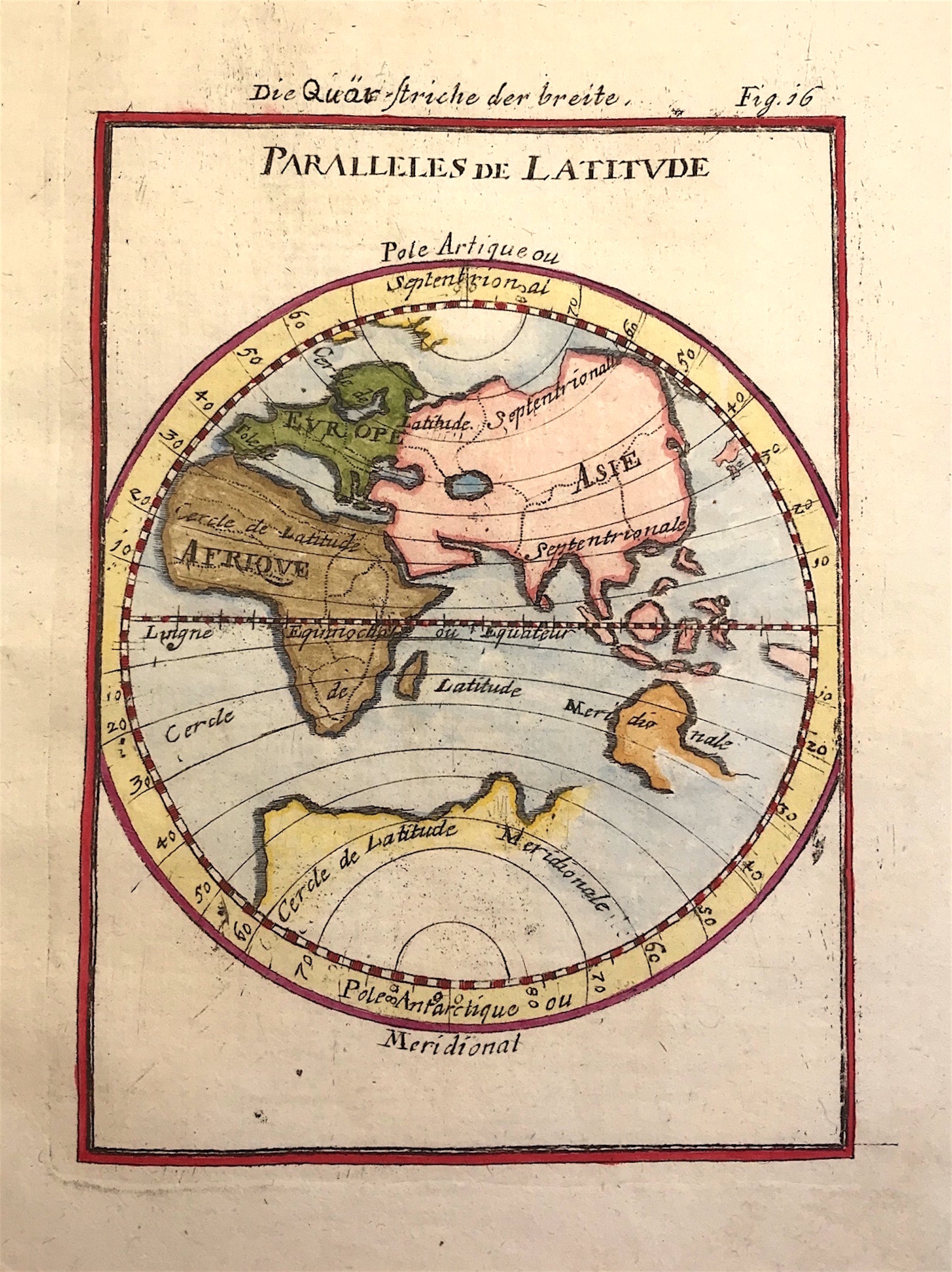
Parallels de Latitude or Parallels of Latitudeby Allain Manesson Mallet c1684

'Description de Univers' Decorative engraved Armillary Sphere

Copper plate engraved by Allain Manesson Mallet. First published 1683

Excellent condition, fine engraving on hand laid paper with later hand colour.

Approx engraved area: 4" x 5 5/8" (102mm x 143mm)

Notes: It shows Europe, Africa, Asia, part of Australia and the Arctic and Antarctica . This from Volume 1 of the French text edition published by Johann David Zunner 1684. The plates engraved for Zunner are close copies of the originals and still have French titles and names. A few are signed by there engravers: J.P. Aubrey, Johann J. Vogel and W.C. Daucher.

  • Facebook
  • Twitter
  • Pinterest
  • Google+
Buy Now
Contact Info:     
Rare Maps and Prints Limited 
4, Ray House, Cressington Place,
​Bourne End, Bucks SL8 5SL UK 
                             
Kevin J Ryan :     

email: [email protected]         
​
    
          
Picture
Member of
​INTERNATIONAL MAP COLLECTORS SOCIETY 


    Maps & Prints Updates

Subscribe to List

Copyright © 2025 -  Rare Maps and Prints Limited  -  Raremapsandprints.co.uk   All Rights Reserved     Site Map     Terms & Conditions     Privacy Policy
  • About
  • Maps
    • British Isles
    • English Counties
    • Road Maps
    • River Thames
    • The Americas
    • Asia to Australia
    • Europe & Middle East
    • World & Hemispheres
    • Sea Charts
    • Military Battle Maps
  • Prints
    • British Topography >
      • Views England & Scotland
      • Views Wales
      • Views London
      • Views River Thames
    • Sporting
    • Amorial
    • Military & Naval
    • Portrait
    • Russian Art
    • Views Italy
  • Resources
    • Reference Books
  • Blog
  • The Colourist

    Join Our List

sign up
SHOP
Home
Shop
About
Updates
Contact
SOCIAL
Facebook
Twitter
Instagram
Proudly powered by Weebly