London Plan Published 1775 - SOLD!
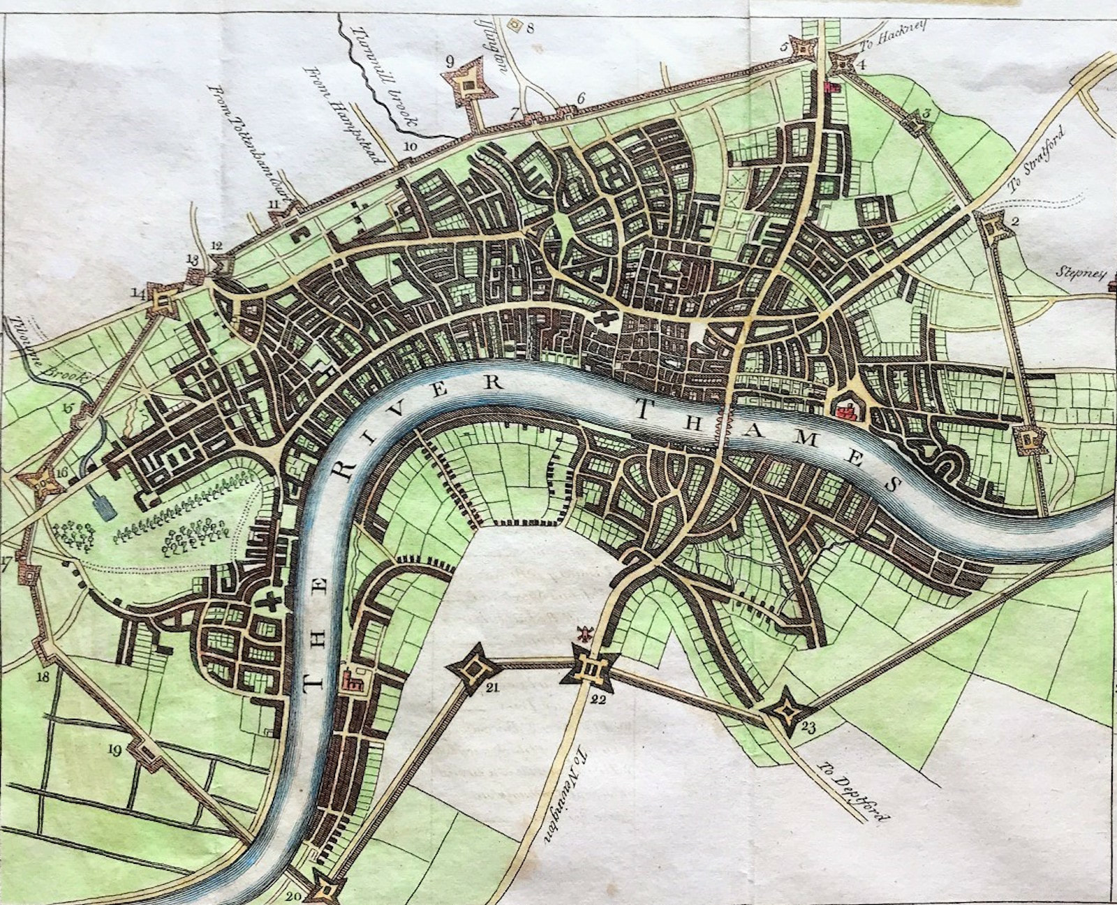
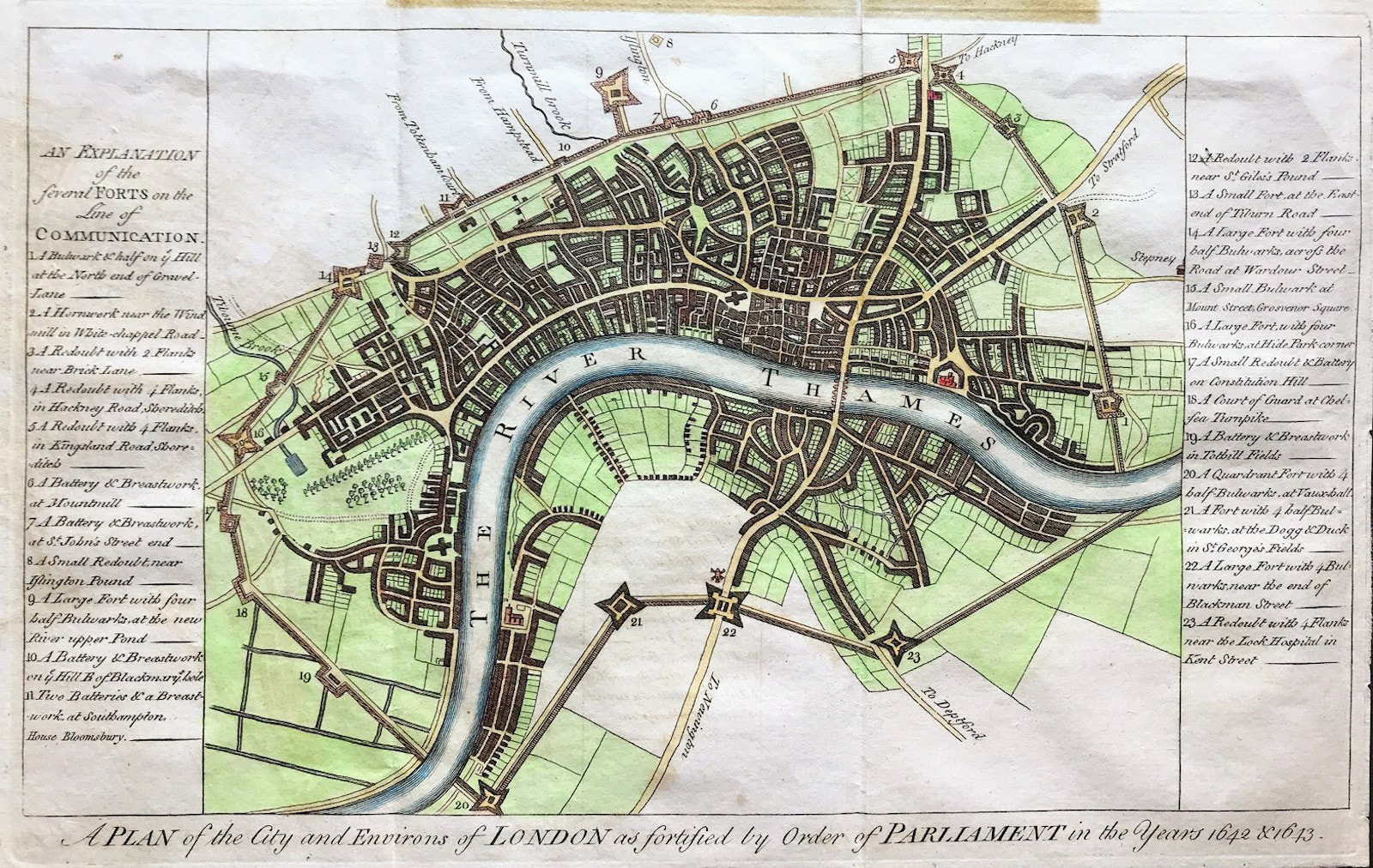
ORIGINAL Map of London The City And Environs Of London, As Fortified .. 1642 & 1643
Engraved for "A New and Universal History, Description, and Survey Of The Cities Of London and Westminster, The Borough of Southwark, And Their Adjacent Parts. Including not only all the Parishes within the Bills of Mortality but the Towns, Villages, Palaces, Seats, and Country, to the extent of Twenty Miles round, Comprising A Circle Of Near One Hundred And Fifty Miles" By Walter Harrison, Esq. 1775.
Copper Plate Engraved, Published by Walter Harrison, London. Published for Harrison's History of London. 1775
Good condition copper plate engraved with later hand colour and overall age tone. Clear plate mark, folds as issued, blank to verso. Some staining to top of sheet where previously mounted, not affecting engraved area
Approx engraved area: 8" x 12.5" (200mm x 310mm)
Notes: The map shows and a numbered key describes the fortifications put in place (and perhaps made of wood) to defend London from the Royalist forces in the Civil War. With no such attack forthcoming, they were demolished in 1647. Recent excavations in the grounds of Buckingham Place, through which the walls appear to go, failed to reveal any trace. Adams, London Illustrated, 61(21)
A genuine antique map over 240 years old.