- Published on
Military History in the United Kingdom emerged during the eighteenth century with studies of the Napoleonic wars, especially the Peninsular and Waterloo campaigns. This interest in armed conflict remains today, with stories of campaigns and battles and the continuing assessment of leaders, tactics and their strategy. Nowadays its defined as a humanities discipline and also remains popular with antique print collectors with a passion for military history, records of armed conflict and rare prints depicting battle scenes.
These small scale maps and plans produced for Alison's History of Europe, Atlas published in 1875 remain popular with original print collectors. The atlas was intended to illustrate the most important period of modern history and consists of Plans, Sieges and Battles pointing out every circumstance of locality, affecting the operations detailed, and maps of extensive portions of country, exhibiting at one view the whole range of a campaign, with relative positions and political boundaries of Empire and States. Below is just one example of these popular little maps.
These small scale maps and plans produced for Alison's History of Europe, Atlas published in 1875 remain popular with original print collectors. The atlas was intended to illustrate the most important period of modern history and consists of Plans, Sieges and Battles pointing out every circumstance of locality, affecting the operations detailed, and maps of extensive portions of country, exhibiting at one view the whole range of a campaign, with relative positions and political boundaries of Empire and States. Below is just one example of these popular little maps.
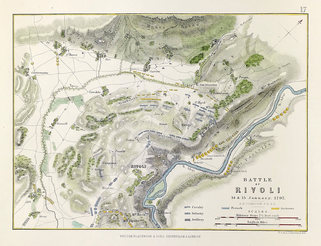
Above: Battle of Rivoli 14th & 15th January 1793. From the Atlas to Alison's History of Europe By Sir Archibald Alison by Alexander Keith Johnson, F.R.S.E F.R.G.S. F.G.S. Published by William Blackwood & Sons, Edinburgh and London c1875. Original map produced with mechanical outline colour. Addition later fine wash hand colour embellishments make this a unique edition of the map.
The Battle of Rivoli (14–15 January 1797) was a key victory in the French campaign in Italy against Austria. Napoleon Bonaparte's 23,000 Frenchmen defeated an attack of 28,000 Austrians under General of the Artillery Jozsef Alvinczi, ending Austria's fourth and final attempt to relieve the Siege of Mantua. Rivoli further demonstrated Napoleon's brilliance as a military commander and led to the French consolidation of northern Italy.
A selection of these Plans, Sieges and Battle Maps are available HERE
0 Comments