- Published on
When it comes to collecting rare maps its often the embellishment on old maps that catches the eye and draws us in. My first maps as a collector were from the Blaeu family. I'm sure it was my fascination with the ornamentation that initially drew me in and before long I was hooked. I love to read and research so it quickly became evident to me that what was going on here was not just about art or decoration but visual messaging.
Besides the map and geographical area being of interest these embellishments add to the story. Their used to enhance and convey messages on a number of levels. Mythology, allegory, emblems, power, the importance of local trade, naval battles, indigenous peoples, flora and fauna, sea monsters, sailing ships, customs, explorers, figures of importance, continents, gods and godesses, the heavens and planets to name just a few devices, all used to help convey the message.
Besides the map and geographical area being of interest these embellishments add to the story. Their used to enhance and convey messages on a number of levels. Mythology, allegory, emblems, power, the importance of local trade, naval battles, indigenous peoples, flora and fauna, sea monsters, sailing ships, customs, explorers, figures of importance, continents, gods and godesses, the heavens and planets to name just a few devices, all used to help convey the message.
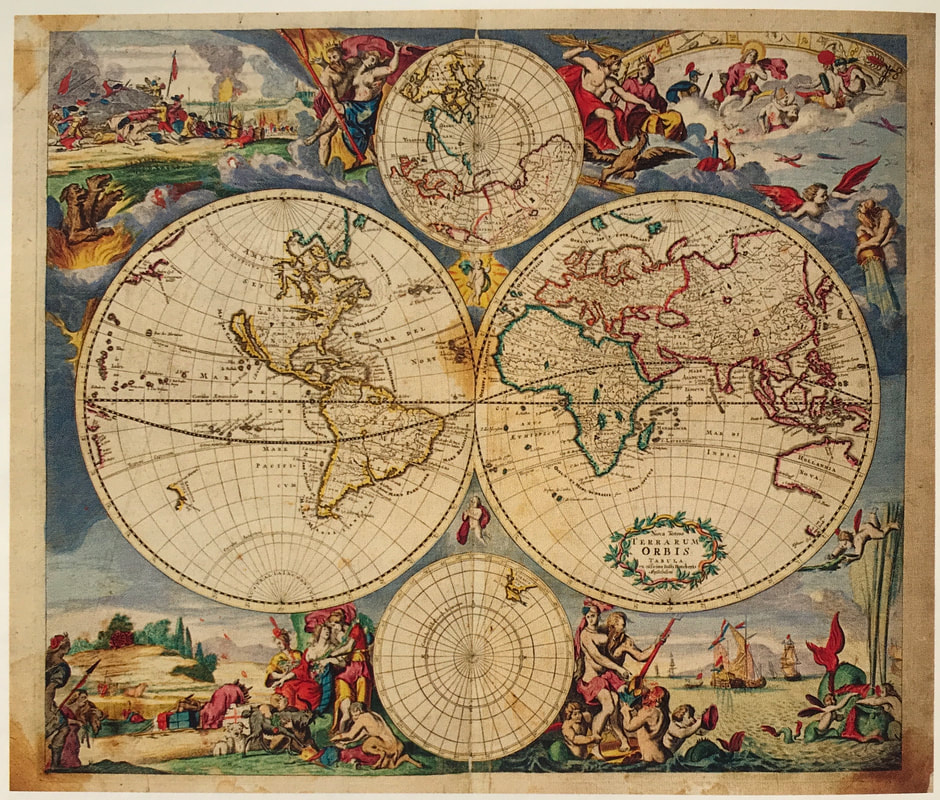
Above: Nova Totius Terrarum Orbis Tabula... Justus Danckerts (1635-1701) Atlas. Amsterdam: J. Dackerts. c. 1688. The Danckerts family were prominent print and map sellers active in Amsterdam for nearly a century.
This map is embellished by four large lively allegorical scenes, representing the four elements. Top left fire is shown by war and destruction, top right air by the heavens, bottom left earth by harvesting and husbandry and bottom right water by ships and a spouting whale. There are groups of figures between the hemispheres and on either side of the smaller polar maps.
HOW TO IDENTIFY:
The embellishments say it all! Delightful maps like the one above by Danckerts and those of the Blaeu family I mentioned earlier are from whats known as the Golden Age of cartography c1550 - c1675. These are rich in cartographic ornamentation and remain popular with collectors. So if you're on the fence about what to collect maybe the embellishments on old maps will catch your eye making maps from the Golden Age the ones for you!
Happy Hunting!
Image Credit: Sotheby's Wardington Library 2005.
0 Comments

