- Published on
About 100AD a man known as Marinus of Tyre began drawing maps for the use of seaman based on a cylindrical projection forming a grid of parrelelograms centred on Rhodes, the marine focal point of the known world. It is only through the writings of one of the greatest geographers of all time that we know what we do of Marinus, for Ptolemy consciously built upon the formers work. Ptolemy wrote a great deal, his best known work being Geographia, in which he discusses cartography and lists the latitude and longtitude co-ordinates of 8,000 places, culled from ancient maps or estimated from a study of traveller's tales.
Sea Charts then have been around some time, travel back to around 1800 and charting was showing a true picture of the world. Captain Cook had disproved the existence of a great southern continent and placed New Zealand on the map. The knowledge gained by the Dutch in the East-Indies in the seventeenth century was now gradually becoming available. Admiralty surveying and charting probably reached its peak in the early 1850's and the charts of the period may be admired for their accuracy and their fine engraving.
Sea Charts then have been around some time, travel back to around 1800 and charting was showing a true picture of the world. Captain Cook had disproved the existence of a great southern continent and placed New Zealand on the map. The knowledge gained by the Dutch in the East-Indies in the seventeenth century was now gradually becoming available. Admiralty surveying and charting probably reached its peak in the early 1850's and the charts of the period may be admired for their accuracy and their fine engraving.
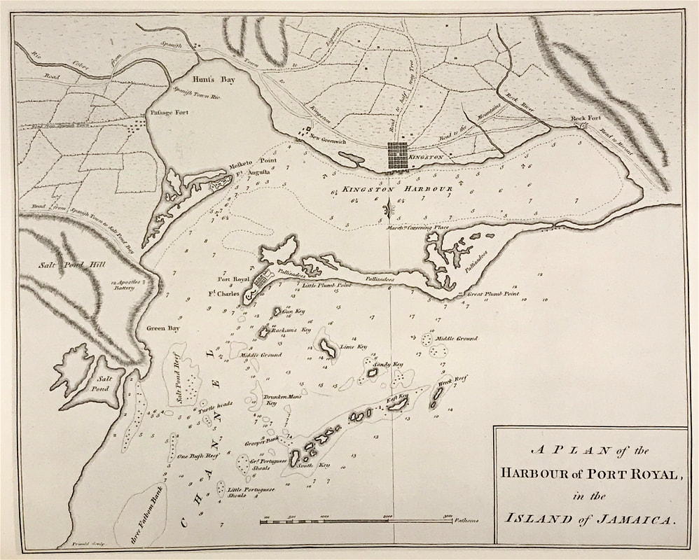
Above: The Harbour of Port Royal, Jamaica. Captain Joseph Speer c1766. From Speer's The West-India Pilot London. Little is known about Capt Speer, but his West India Pilot epitomises the great interest in the Caribbean throughout the eighteenth century, mainly as a result of the rapid growth in the sugar trade.
Sea Charts are a fascinating subject and another area of interest for the antique map or chart collector. These charts can describe seas, rivers and coasts in many parts of the world. Some show man-made features such as harbours and shore defences. They often include the best and most easily accessible maps of small oceanic islands. There are charts available of just about every part of the world constructed on large and small scales, in sheet and atlas form.
Happy Hunting!
Credit: Extract from 'The Sea Chart" Introduction by Rear-Admiral G. S. Ritchie CB DSC. c1973
0 Comments

