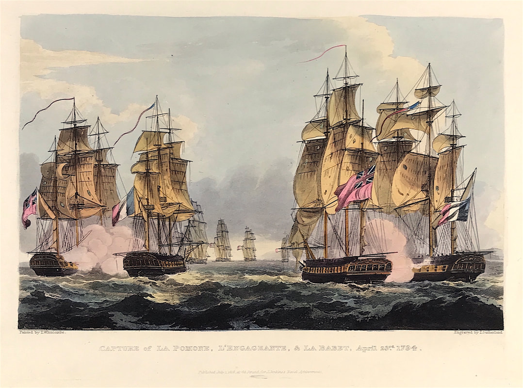
Collecting Maritime Prints - Capture of La Pomone L'Engageante and La Babet April 23rd 179411/28/2020 As promised another of the exceptional aquatint prints from James Jenkins The Naval Achievements of Great Britain, From the Year 1793 to 1817. These prints are exceptional in themselves with excellent hand colour. To give you more of an insight into the event as recorded I've shared a brief excerpt from the original written account published within Naval Achievements here below the print. Engageante was captured, along with Pomone and Babet, off the Île de Batz during the Action of 23 April 1794. Her captor was HMS Concorde.... In the evening after the action Engageante's masts fell overboard, and Concorde's masts were kept upright only with great difficulty. The naval campaigns, operations and battles of the Napoleonic Wars were events during the period between 1802 and 1814 that were undertaken by European powers in support of their land-based strategies. Above: The Capture of La Pomone L' Engageante and La Babet April 23rd 1794 from The Martial achievements of Great Britain and Her Allies from 1799 to 1815 by J. Jenkins.
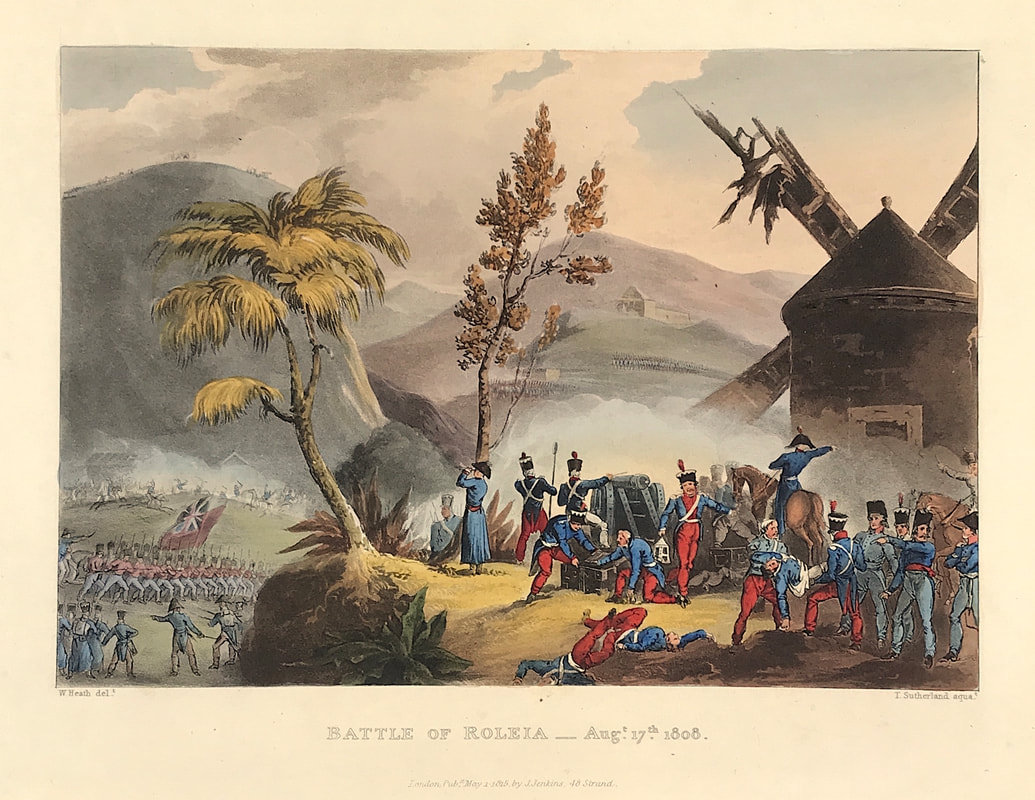
Excerpt from the written account as published: CAPTURE OF LA POMONE, L'ENGAGEANTE, AND LA BABET, APRIL 23, 1794. Sir John BORLASE WARREN having been dispatched by Admiral Macbride on a cruise off the coast of France, steered for the Seven Islands on the coast of Brittany; and on the 230 April discovered a French squadron, consisting of four sail, standing out of Concale Bay. Orders were immediately given to pre pare for action, and the British squadron bore down to attack. The annexed plate represents the Flora and Arethusa engaging La Pomone and La Babet to leeward, at the time La Babet struck her colours. The Melam pus, the Nymph, and the Concord are in the distance, pursuing the flying enemy. The following is a copy of the letter sent by Commodore Warren to Admiral Macbride, detailing the particulars of the above action. FLORA, at Sea, April 25, 1794. Sir: In pursuance of your orders, I proceeded with the ships named in the margin, to cruise off the coast of France; and on the 23d instant, from variable winds, being to the westward of Guernsey, Rock Dove bearing E. by S. four or five leagues, the Seven Islands S. S. W. four or five leagues, Guernsey N. E. { E. seven or eight leagues, I discovered, at four in the morning, four sail standing out to sea upon the larboard tack, the wind S. S. W.; and as the morning began to break, I saw, from their manæuvres and firing of guns, that they were some of the enemy's ships of war: they soon afterwards appeared in a line of battle on the larboard tack, and as our ships, from having chased, were not collected, I made the signal to form in succession. We crossed each other on contrary tacks, and the enemy began an action at a considerable distance: the sternmost ship having passed over, they again tacked; but the wind changing two points in our favour . . . How to Identify the Prints: The original prints from "The Naval Achievements of Great Britain. From the Year 1793 to 1817" are aquatint engravings on a medium weight wove paper. All the plates identify at bottom left Painted by T. Whitcombe and bottom right T. Sutherland (sculpt) who produced the aquatint engravings. Some plates were engraved by Jeakes and Bailey after Whitcombe. Each plate is accompanied by text pages describing the action, often with lists of ships captured or sunk, and excerpts from contemporary bulletins, dispatches, letters, and speeches. The first edition appeared in 1817. Early issues have watermarks of J. Whatman with the undated watermark IIS&S on some plates. The vignette title page was uncoloured in the first issue. The approx engraved image area of the plates are 7" x 10.25" (175mm x 260mm). Engraved plate mark area is approx 8.5 x 11.75 (215mm x 300mm). The folio sheet size is approx 11.5" x 14" (290mm x 355mm). You can see more prints from Jenkins The Naval Achievements of Great Britain, From the Year 1793 to 1817 HERE. If you're interested in a specific print and you cannot see it on my website please feel free to message me. As promised another of the exceptional aquatint prints from Jenkins The Martial achievements of Great Britain and Her Allies from 1799 to 1815. Below the print is a short excerpt from the original written account as published with the print. In the Battle of Roliça an Anglo-Portuguese army under Sir Arthur Wellesley defeated an outnumbered Imperial French division under General of Division Henri François Delaborde, near the village of Roliça in Portugal. The French retired in good order. Formerly spelled Roleia in English, it was the first battle fought by the British army during the Peninsular War. Above: Battle of Roleia Aug 17th 1808 from Jenkins The Martial achievements of Great Britain and Her Allies from 1799 to 1815.
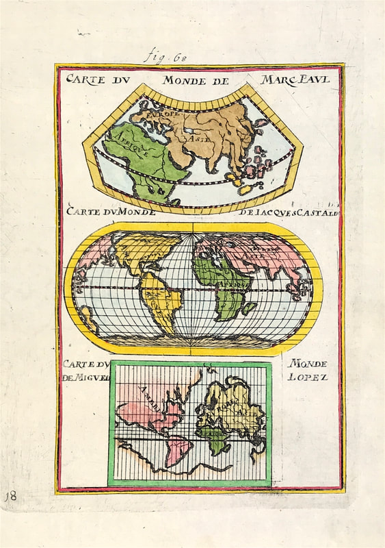
Excerpt from the written account as published: THE BATTLE OF ROLEIA. The fore-ground in the annexed plate is occupied by a part of the enemy's force, consisting of the staff of the French General Laborde, who are reconnecting; while many of the troops are employed in carrying their wounded country men to the windmill which occupies so prominent a place in this part of the scene, and which the enemy made a depository for his sick and wounded. Extract from the Dispatch of Lieutenant-General Sir Arthur Wellesley, dated August 17, 1808. The columns being formed, the troops moved from Obidos about seven o'clock in the morning. Brigadier-General Fane's riflemen were immediately detached on to the hills on the left of the valley, to keep up the communication between the centre and left columns, and to protect the march of the former along the valley, the enemy's posts being successively driven in. Major-General Hill's brigade, formed in three columns of battalions, moved on the right of the valley, supported by the cavalry, in order to attack the enemy's left; and Brigadier-Generals Nightingale and Crauford moved with the artillery along the high road, until at length the former formed in the plain immediately in the enemy's front, supported by the light infantry companies and the 45th regiment of Brigadier-General Crauford's brigade; while the two other regiments of this brigade (50th and 91st) and half of the nine-pounder brigade, were kept as a reserve in the rear. Major-General Hill and Brigadier-General Nightingale advanced upon the enemy's position; and at the same moment Brigadier-General Fane's riflemen were in the lills on his right, the Portuguese infantry in a village upon his left, and Major-General Ferguson's column was descending from the heights into the plain. . . . How to Identify the Prints: The original prints from The Martial achievements of Great Britain and Her Allies from 1799 to 1815 are aquatint engravings on a medium weight wove paper. Plates also exist that were printed on India Paper. They should clearly identify bottom left W. Heath (delt) who did the drawings and bottom right T. Sutherland (sculpt) who produced most of the aquatint engravings with some by D. Havell, M. Dubourg and J. Hill. Each plate has the date of publication and the name of the publisher beneath the engraved title. The approx engraved area of the plates are 8.5" x 7.75" (215mm x 195mm) including the engraved title text. Engraved plate mark area is approx 8.5 x 11.75 (215mm x 300mm). The large sheet size is approx 11.5" x 14" (290mm x 355mm). You can see more prints from Jenkins The Martial achievements of Great Britain and Her Allies from 1799 to 1815 HERE. If you're interested in a specific print and you cannot see it on my website please feel free to message me. If you're new to map collecting then the subject of what kinds of maps to collect is a consideration. In the last few posts we've been focused on a selection of what 'kinds' are available to collectors. Hopefully this has at least given you some direction, or has made you aware of the possibilities. Perhaps for the more technically minded or those simply seeking something different from the run of the mill maps, map projections are a niche within the antique map market that may interest you. As paper maps are flat and the earth is roughly spherical shaped the flat map obviously cannot represent the earths surface exactly. This is where the so called 'projection' comes in. Representations of the earths curved surface or forms of celestial spheres drawn on a flat surface are called projections. Above: World Maps by Allain Manesson Mallet c1684 Showing Map Projections of earlier maps 'Carte du Monde de Marc Paul; Carte du Monde de Jacques Castaldo; Carte du Monde de Miguel Lopez' by Marco Polo, Giacomo Gastaldi and Miguel Lopez.
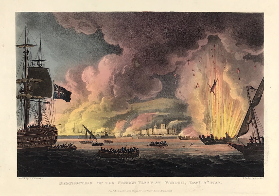
There are many ways projections can be constructed. Depending on the purpose of the map the projection will cause distortion of at least one aspect of the real world - shape, area, distance or direction. Ptolemy described several ways to translate the spherical earth onto a flat plane which you can research online for an in depth explanation if you choose. Happy Hunting! Collecting Antique Maritime Prints - Destruction of the French Fleet at Toulon Dec 18th 179311/19/2020 Todays post of another superb aquatint print from James Jenkins The Naval Achievements of Great Britain shows the Destruction of the French Fleet at Toulon. In 1793 French Republican forces suppressed a royalist rebellion in the city of Toulon (the royalists were assisted by British, Spanish, Neapolitan and Pedmontese troops). As the city fell, however, the British used firships to destroy the French Republican fleet, as shown here. To give you even more of an insight into the event recorded I've shared a brief excerpt from the original written account published below the print. Above: Destruction of the French Fleet at Toulon Dec 18th 1793 from The Naval achievements of Great Britain and Her Allies from 1793 to 1817 by J. Jenkins.
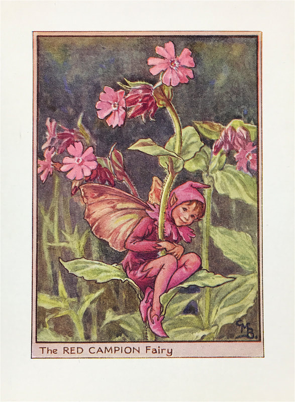
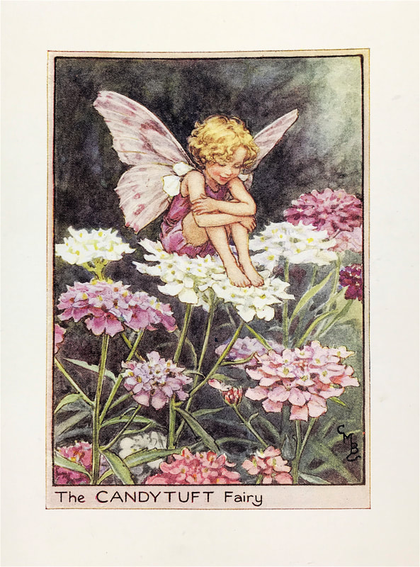
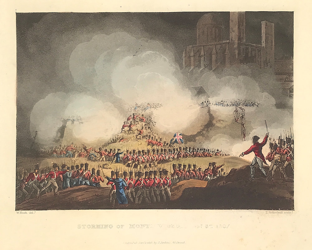
Excerpt from the written account as published: DESTRUCTION OF THE FRENCH FLEET AT TOULON: DECEMBER 18, 1793. The inhabitants of Toulon and Marseilles, under a disposition to be freed from the yoke of the Convention, entered into a negociation with Lord Hood, the British admiral then commanding in the Mediterranean, whereby the former town and its shipping were placed in the hands of the English in trust for Louis XVII. A large military force being sent by the revolutionary government against Toulon, Lord Hood found himself obliged to evacuate the place ; but in so doing he gave the first wound to the republican navy: ten ships of the line, besides frigates and smaller vessels, were destroyed, with an immense quantity of stores of every description; and three sail of the line, with some frigates, were added to the British fleet. Sir Sydney Smith arrived at the office of the principal Secretary of State on the 15th January, 1794, with a dispatch, of wbich the following is a copy: Victory, Hieres Bay, December 20, 1793. SIR, It is my duty to acquaint you, that I have been obliged to evacuate Toulon, and to retire from the harbour to this anchorage. It became unavoidably necessary that the retreat should not be deferred beyond the night of the 18th, as the enemy commanded the town and ships by their shot and shells: I therefore, agreeably to the governor's plan, directed the boats of the fleet to assemble by eleven o'clock, near fort La Malgue, and am happy to say the whole of the troops were brought off, to the number of near 8000, without the loss of a man; and in the execution of this service, I have infinite pleasure in acknowledging my very great obligations to Captain Elphinstone for his unremitting exertion, who saw the last man off; and it is a very comfortable satisfaction to me, that several thousands of the meritorious inhabitants of Toulon were sheltered in his Majesty's ships. I propose sending the Vice-Admirals Hotham and Crosby, with some other ships, to Leghorn or Porto Ferrara, to complete their wine and provisions, which run very short, having many mouths to feed; and to remain with the rest to block up the ports of Toulon and Marseilles. . . . How to Identify the Prints: The original prints from "The Naval Achievements of Great Britain. From the Year 1793 to 1817" are aquatint engravings on a medium weight wove paper. All the plates identify at bottom left Painted by T. Whitcombe and bottom right T. Sutherland (sculpt) who produced the aquatint engravings. Some plates were engraved by Jeakes and Bailey after Whitcombe. Each plate is accompanied by text pages describing the action, often with lists of ships captured or sunk, and excerpts from contemporary bulletins, dispatches, letters, and speeches. The first edition appeared in 1817. Early issues have watermarks of Whatman with the undated watermark IIS&S on some plates. The vignette title page was uncoloured in the first issue. The approx engraved image area of the plates are 7" x 10.25" (175mm x 260mm). Engraved plate mark area is approx 8.5 x 11.75 (215mm x 300mm). The folio sheet size is approx 11.5" x 14" (290mm x 355mm). You can see more prints from Jenkins The Naval Achievements of Great Britain, From the Year 1793 to 1817 HERE. If you're interested in a specific print and you cannot see it on my website please feel free to message me. For all the images that come my way as a map and print dealer its so often the little things that capture the attention and these delightful prints always get the thumbs up. They are simply captivating with both adults and children. At this time of year I always tend to post more of these images in my online shops as often people like to pick them up as small gifts for loved ones. Just yesterday I had a lady in Italy purchase a dozen or so from me online. You're not going to need to re-mortgage the house to buy these little gems and the market is full of later reproductions if thats all you want. The originals however seem to have something about them, almost a sense of 'time gone by' as the original coloured lithographs tend to warm with age. First published in 1923 by Cicely Mary Barker the drawings were not only botanically accurate but also the fairy images were based on real children from Cicely's sister's nursery school. Originally accompanied by a poem or verse dedicated to the individual Flower Fairy the charming characters and detailed artwork have also been translated into fiction for young readers as well as the New York Times bestselling Fairyopolis series. Cicely Mary Barker worked principally in watercolour with pen-and-ink, but she was equally competent in black-and-white, in oils, and in pastels. She carried a sketchbook with her for capturing interesting children. She once indicated, "I have always tried to paint instinctively in a way that comes naturally to me, without any real thought or attention to artistic theories" Well I'm still enchanted by the fairies and as my sister often says to me "You're as old as your shoe size" lets face it growing up is so overrated! Stay young and stay enchanted! You can see more flower fairies over in my etsy shop HERE. Another of the exceptional aquatint prints from Jenkins The Martial achievements of Great Britain and Her Allies from 1799 to 1815. Below the print is a short excerpt from the original written account as published with the print. The Battle of Montevideo was a battle between the British and Spanish Empires during the Napoleonic Wars, in which British forces captured the city of Montevideo. It formed part of the British invasions of the River Plate. Locally, it is remembered as the Siege of Montevideo (Spanish: Sitio de Montevideo). Above: STORMING OF MONTEVIDEO, FEBRUARY 3, 1807 from Jenkins The Martial achievements of Great Britain and Her Allies from 1799 to 1815.
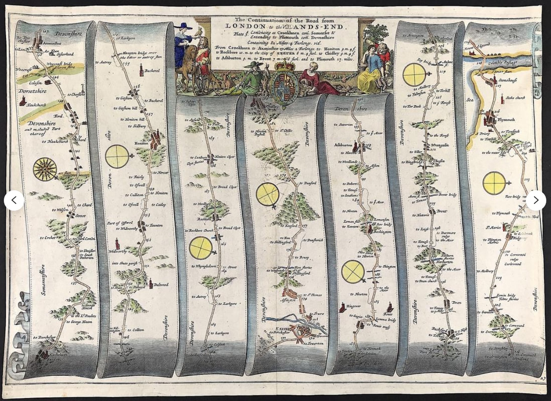
Excerpt from the written account as published: STORMING OF MONTEVIDEO, FEBRUARY 3, 1807: On the 13th January, the British troops under Sir S. Auchmuty left Maldonada, and landed on the 18th to the westward of the Careta rocks, about nine miles from the town; on the 19th they moved towards Monte Video. The right column, under Brigadier-General Lumley, was early engaged ; about 4000 of the enemy's horse occupied two heights to his front and right. As they advanced, a heavy fire of round and grape opened upon them; but a spirited charge from the light battalion under Lieutenant-Colonel Brownrigg dispersed the corps opposed to him, with the loss of a gun. The enemy on the flank did not wait a similar movement, but retreated, and permitted the British, without further opposition, to take up a position about two miles from the town. The next morning, the enemy came out of the town and attacked with their whole force, about 6000 men and many guns; but after a charge under Major Campbell, and being at the same time suddenly and unexpectedly attacked in flank by the rifle corps and light battalions, ordered to that particular point by Sir Samuel, they gave way on all sides, and were pursued with great slaughter. . . How to Identify the Prints: The original prints from The Martial achievements of Great Britain and Her Allies from 1799 to 1815 are aquatint engravings on a medium weight wove paper. Plates also exist that were printed on India Paper. They should clearly identify bottom left W. Heath (delt) who did the drawings and bottom right T. Sutherland (sculpt) who produced most of the aquatint engravings with some by D. Havell, M. Dubourg and J. Hill. Each plate has the date of publication and the name of the publisher beneath the engraved title. The approx engraved area of the plates are 8.5" x 7.75" (215mm x 195mm) including the engraved title text. Engraved plate mark area is approx 8.5 x 11.75 (215mm x 300mm). The large sheet size is approx 11.5" x 14" (290mm x 355mm). You can see more prints from Jenkins The Martial achievements of Great Britain and Her Allies from 1799 to 1815 and Jenkins The Naval Achievements of Great Britain, From the Year 1793 to 1817 HERE. If you're interested in a specific print and you cannot see it on my website please feel free to message me. What Kind of antique maps are available to collectors? In my previous post on the subject I highlighted river maps. Another subject that's collected by map enthusiasts is antique road maps. Way before google was around the Romans produced a pretty accurate map of the fifty thousand or more miles of roads in the Empire in around the third century. Jump forward in time to the late seventeenth century and sheet maps showing post roads and 'cross-roads' in England and Wales appeared but were limited in detail. One of the most popular for collectors nowadays first appeared in 1675 with John Ogilby inventing the 'strip map'. Above: Large Antique Road Map by John Ogilby c1675 'The Continuation of the Road from London to Lands End commencing at Crookham to Axminster to Honiton to Rockbere to the City of Exeter to Chidley to Ashburton to Brent to Plymouth' An original Road Map by John Ogilby being Part 3 (Plate 27) of the Road to Lands End. This part starting at Crookshorn via Axminster, Honiton, Exeter, Ashburton, Buckford through to Plymouth.
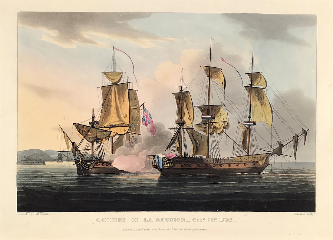
Ogilby's Britannia - A Geographical and Historical Description of the Principle Roads thereof, consisted of 100 maps of the principle roads of England and Wales, engraved in strip form. These maps provided details of the roads themselves and descriptive notes of the country on either side. Each strip had a compass rose to indicate changes in direction. Ogilby measured over 25,000 miles of roads all surveyed on foot with a 'perambulator' or measuring wheel. So maybe road maps might be something of interest if you're new to collecting. There maps are a nice size for displaying framed on a wall the approx sheet size: being about 14" X 20" and they can often be found in local auctions or like everything for sale online. Happy Hunting! You can see more examples of road maps HERE. As promised another of the exceptional aquatint prints from James Jenkins The Naval Achievements of Great Britain, From the Year 1793 to 1817. These prints are exceptional in themselves with excellent hand colour. To give you even more of an insight into the event recorded I've shared a brief excerpt from the original written account published below the print. The naval campaigns, operations and battles of the Napoleonic Wars were events during the period between 1802 and 1814 that were undertaken by European powers in support of their land-based strategies. Above: The Capture of La Reunion Oct 21st 1793 from The Martial achievements of Great Britain and Her Allies from 1799 to 1815 by J. Jenkins.
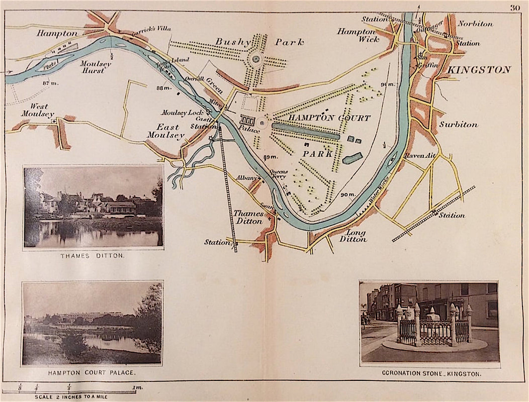
Excerpt from the written account as published: At the commencement of hostilities in 1793, Captain Saumarez hoisted his pendant on board the Crescent frigate, of 36 guns and 260 men. After having been employed on various services, he sailed from Spithead, on a cruise, on the 20th October, 1793. Having received information that there were two frigates stationed at Cherbourg, he proceeded off that port, and on the following morning, being close to Cape Barfleur lighthouse, discovered a frigate, in company with a large cutter; the Crescent was on the larboard tack, with the wind offshore, and immediately edged down to the enemy, and in a short time brought her to close action. Both ships were soon much disabled: the Crescent had her fore top sail-yard and her fore top-mast shot away, but coming suddenly round on the opposite tack, with the helm hard a-starboard, she was enabled to bring her lar board guns to bear; when Captain S. immediately seized the opportunity of raking his opponent, which soon became totally unmanageable, and was forced to strike her colours, in sight of multitudes by whom the adjacent coast was covered. Another of the enemy's frigates attempted to come out of Cherbourg, for the purpose of supporting her, but La Réunion was captured before she could receive any succour. The cutter made all sail into port, not daring to come into action. How to Identify the Prints: The original prints from "The Naval Achievements of Great Britain. From the Year 1793 to 1817" are aquatint engravings on a medium weight wove paper. All the plates identify at bottom left Painted by T. Whitcombe and bottom right T. Sutherland (sculpt) who produced the aquatint engravings. Some plates were engraved by Jeakes and Bailey after Whitcombe. Each plate is accompanied by text pages describing the action, often with lists of ships captured or sunk, and excerpts from contemporary bulletins, dispatches, letters, and speeches. The first edition appeared in 1817. Early issues have watermarks of Whatman with the undated watermark IIS&S on some plates. The vignette title page was uncoloured in the first issue. The approx engraved image area of the plates are 7" x 10.25" (175mm x 260mm). Engraved plate mark area is approx 8.5 x 11.75 (215mm x 300mm). The folio sheet size is approx 11.5" x 14" (290mm x 355mm). You can see more prints from Jenkins The Naval Achievements of Great Britain, From the Year 1793 to 1817 HERE. If you're interested in a specific print and you cannot see it on my website please feel free to message me. If you're new to collecting antique maps its unlikely that canal or river maps are going to be the first thing that springs to mind. As I mentioned in a previous post just about every subject, size, shape, form and kind of antique map is out there if you look. This includes some exceptional and rare river maps. I've been fortunate to live near the river Thames near London on and off for most of my life. Maybe you have a connection in your own past with a town or river that brings back fond memories perhaps from when you were growing up. Do you now live near a famous river? Do you know if any good antique maps of that river exist? Its worth doing some research, a river map may be just what you want to add to your new collection. Above: Original River Thames 'Map 30' by Henry W. Taunt c1885 Photographer to the Oxford Architectural and Historical Society from 'A New Map of The River Thames from Thames Head to London' on a scale of two inches to a mile. With original tipped in albumen prints that were added to the map before publication. A unique and exceptional smaller map of the river Thames. Lithograph print with early albumen prints and additional later hand colour.
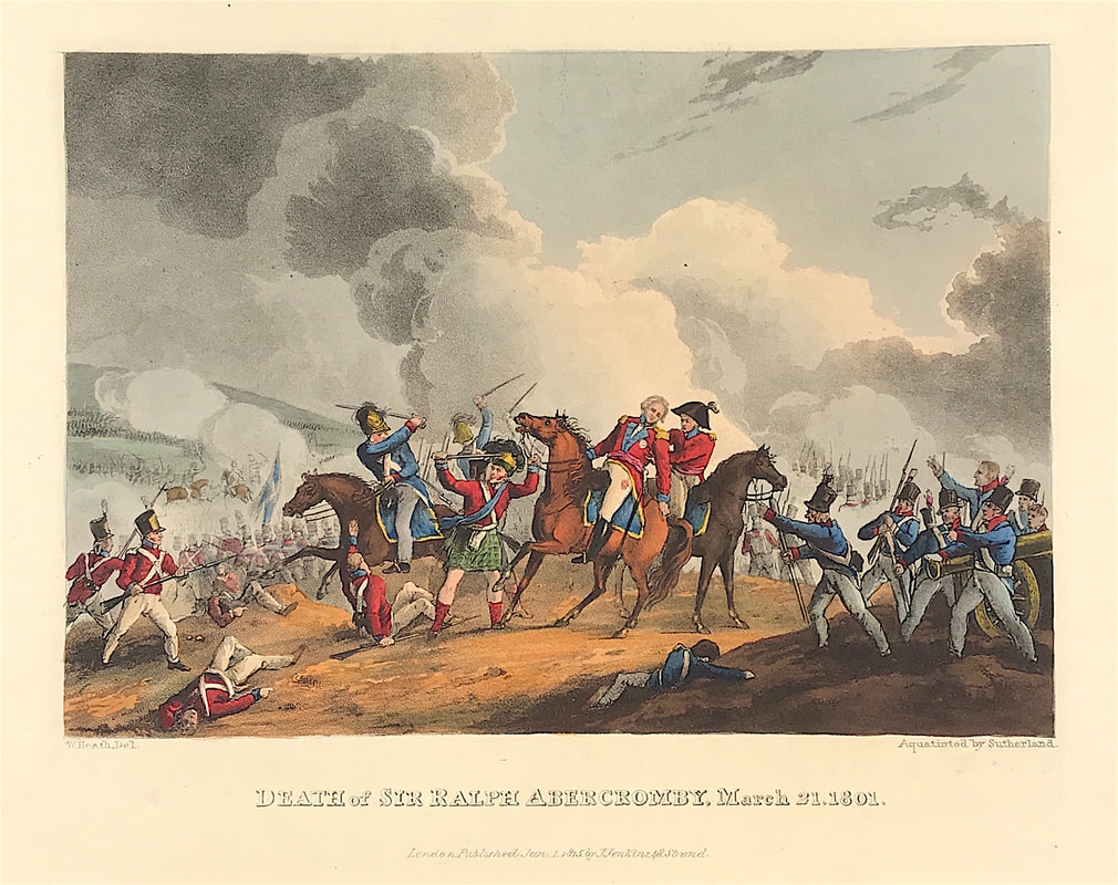
Maybe your family has roots in a certain area from way back, a town, a county or state, a region, country or part of the world you simply have an interest in historically. All sorts of people collect all sorts of maps for all sorts of reasons, even maps of rivers. Every map collector is different and the reason they collect what they collect is often linked to their own story or journey along the river of life. Happy Hunting! You can see more maps of the River Thames by Henry Taunt HERE. As promised another of the exceptional aquatint prints from Jenkins The Martial achievements of Great Britain and Her Allies from 1799 to 1815. Below the print is a short excerpt from the original written account as published with the print. In 1800, after the failure of a descent on Cádiz, Spain, Abercrombie was ordered to Egypt to expel or destroy the army left there by Bonaparte. Landing at Abū Qīr Bay on March 8, 1801, he advanced toward Alexandria. A French attack before daybreak on March 21 was beaten back with heavy loss, but Abercrombie was mortally wounded. He died on board the flagship Foudroyant and was buried at Malta. Above: Death of Sir Ralph Abercrombie March 21st 1801 from Jenkins The Martial achievements of Great Britain and Her Allies from 1799 to 1815.
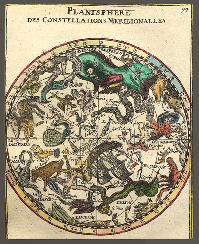
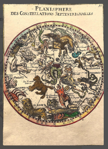
Excerpt from the written account as published: THE DEATH OF GENERAL ABERCROMBIE: It was on the plains of Alexandria, on the 21st of March, 1801, that the brave Abercrombie, the pride of Scotchmen, and the beloved of the army, received his death-blow. When, on the first alarm, Sir Ralph hastened towards the cannonading, he must have rode straight among the enemy, already broke into the rear of our front: as it was not yet day, and unable to distinguish friend from foe, he undoubtedly had the misfortune to get embarrassed among the latter; but was extricated by the valour of his own troops. To the first soldier who came up to him, he said, “Soldier, if you know me, don't name me.” He was rescued, and at this moment a French dragoon, conceiving the prize which he had lost, rode up to the general amidst his own guard, and made a stroke at him, but not being quite near enough, just cut through the coat, waistcoat, and shirt, and, with the point of his sabre, only grazed the skin. At the same moment, the dragoon's horse wheeling about, brought him to the charge again, and he made a second attempt by a lunge, but the sabre passed between the general's side and his right arm, which he immediately closed. The dragoon being at this instant shot dead, the sabre remained in the general's possession. About this time it was perceived, that the general had been wounded in the thigh, and he was en treated to have it examined; but he considered it as a trifle, and would not disappear for a moment. The conflict was very long after this and very obstinate, and Sir Ralph Abercrombie had been two hours wounded, but would not withdraw from the field: knowing the value of his presence, or judging, with equal certainty, of the bad effects of his absence from the army at this critical conjuncture, he persevered, nor till the battle was won did he yield to the violence of his pain . . . How to Identify the Prints: The original prints from The Martial achievements of Great Britain and Her Allies from 1799 to 1815 are aquatint engravings on a medium weight wove paper. Plates also exist that were printed on India Paper. They should clearly identify bottom left W. Heath (delt) who did the drawings and bottom right T. Sutherland (sculpt) who produced most of the aquatint engravings with some by D. Havell, M. Dubourg and J. Hill. Each plate has the date of publication and the name of the publisher beneath the engraved title. The approx engraved area of the plates are 8.5" x 7.75" (215mm x 195mm) including the engraved title text. Engraved plate mark area is approx 8.5 x 11.75 (215mm x 300mm). The large sheet size is approx 11.5" x 14" (290mm x 355mm). You can see more prints from Jenkins The Martial achievements of Great Britain and Her Allies from 1799 to 1815 and Jenkins The Naval Achievements of Great Britain, From the Year 1793 to 1817 HERE. If you're interested in a specific print and you cannot see it on my website please feel free to message me. As I mentioned previously understanding why a map was made, the lack of technologies at the time, how a map fits in with the perceived geography, beliefs, social and cultural realities of a bygone era all has a bearing on how you view such a map today. All these things can influence what maps we are personally attracted to. In the last post we took a quick look at the ever popular hemisphere projections, always a winner. These maps effectively convert half of the spherical world to a circle. But hemispheres are just one kind of map. Another favourite is Celestial Maps. Mapping of the sky and its celestial bodies within star charts goes all the way back to Ptolemy who is credited with creating the first star catalogue around the year 150. But the Golden Age of celestial cartography is roughly 1600 to 1800. All benefiting from the technological advances in astronomical observations and printing techniques. Many of the most notable star atlases and maps can cost thousands but there are many available at a reasonable price range for the novice collector with a celestial interest. Above Left: Planisphere Des Constellations Meridionalles by Alain Manesson Mallet c1683 Above Right: Planisphere Des Constellations Septenironalles by Alain Manesson Mallet c1683.
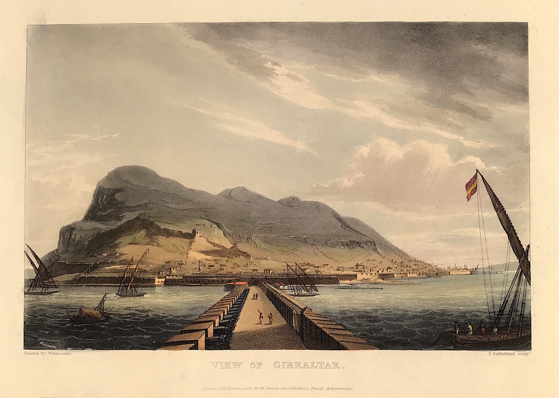
There are many examples of celestial maps and you may need to hunt a bit harder as there can be strong competition for these maps. If celestial maps tickle your fancy then do some research there are many variations and they come up in various online auctions so its worth searching the specialist auction houses. There is going to be something out there for you, within your price range, you just need to search . Happy Hunting! You can see more celestial maps by Alain Mallet HERE. Here's the View of Gibraltar an original aquatint print from James Jenkins The Naval Achievements of Great Britain, From the Year 1793 to 1817. These prints are exceptional in themselves with excellent hand colour. To give you even more of an insight into the event recorded I've shared a brief excerpt from the original written account published below the print. The naval campaigns, operations and battles of the Napoleonic Wars were events during the period between 1802 and 1814 that were undertaken by European powers in support of their land-based strategies. Above: View of Gibralter from The Martial achievements of Great Britain and Her Allies from 1799 to 1815 by J. Jenkins.
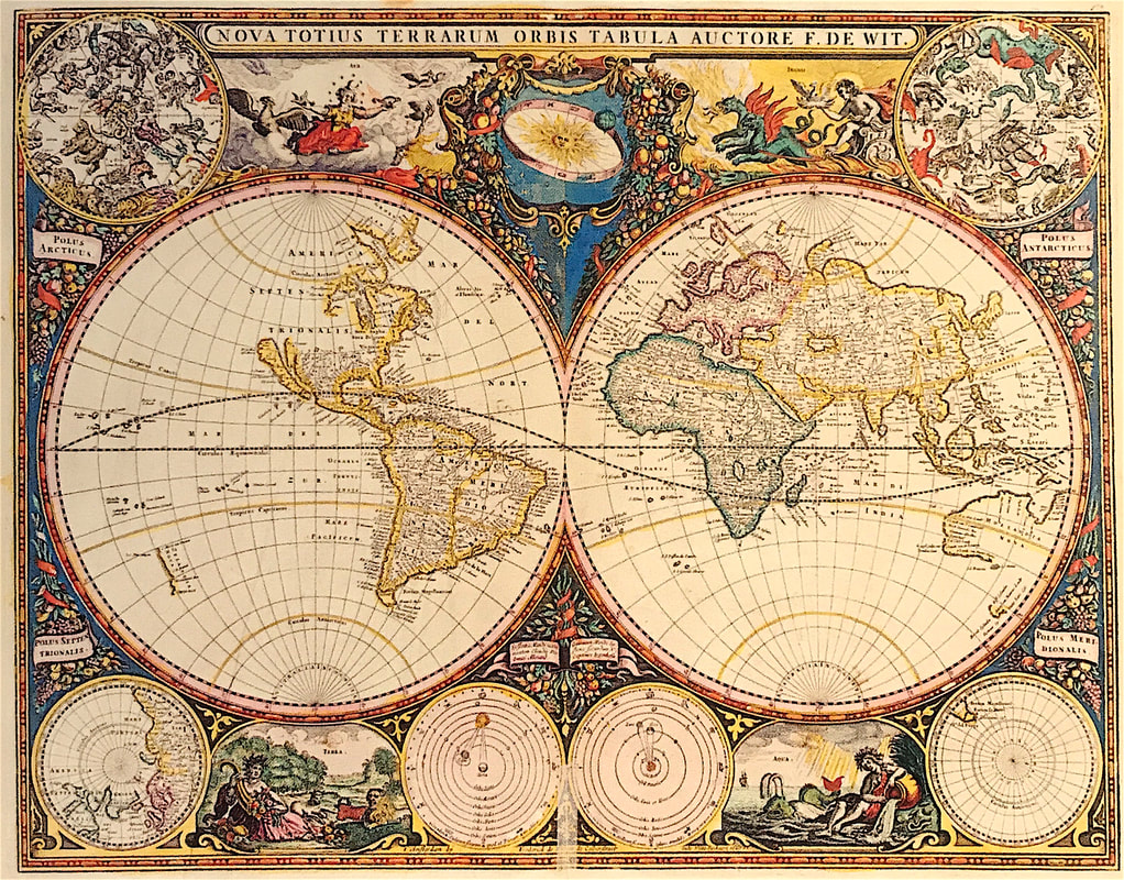
Excerpt from the written account as published: A CONCISE ACCOUNT OF GIBRALTAR: GIBRALTAR is a part of Andalusia, the most southern province of Spain, to which it is connected by a low isthmus of sand. The rock is seven miles in circumference, forming a promontory three miles in length, and presenting the most singular natural appearance. It was distinguished in the earliest annals of European nations. It does not, however, appear that any of the ancients inhabited it: their knowledge and practice of the military art were not indeed suited to improve the natural advantages of such a place; these seem to have been disregarded till the beginning of the eighth century, when the Saracens invaded Spain, and subjugated the country. It remained in their hands till the commencement of the fourteenth century, when it was taken by Ferdinand, King of Castile, in whose possession it continued till Abomalique, son of the Emperor of Fez, arrived to the succour of the Moorish King of Grenada, who laid siege to the fortress, and in five months starved it into a surrender. The Emperor of Morocco next made himself master of it; but the King of Grenada having appeared before it the next year, with a powerful fleet and army, and having reduced the garrison to the greatest extremity for want of provisions, obliged them to submit. It remained in the quiet possession of the Spaniards till 1704, when it was unexpectedly wrested from them (and we trust for ever) by an English squadron under the command of that gallant and enterprising officer, Sir G. Rooke, who had been sent into the Mediterranean with a strong fleet to assist the Archduke . . . How to Identify the Prints: The original prints from "The Naval Achievements of Great Britain. From the Year 1793 to 1817" are aquatint engravings on a medium weight wove paper. All the plates identify at bottom left Painted by T. Whitcombe and bottom right T. Sutherland (sculpt) who produced the aquatint engravings. Some plates were engraved by Jeakes and Bailey after Whitcombe. Each plate is accompanied by a text page describing the action, often with lists of ships captured or sunk, and excerpts from contemporary bulletins, dispatches, letters, and speeches. The first edition appeared in 1817. Early issues have watermarks of Whatman with the undated watermark IIS&S on some plates. The vignette title page was uncoloured in the first issue. The approx engraved image area of the plates are 7" x 10.25" (175mm x 260mm). Engraved plate mark area is approx 8.5 x 11.75 (215mm x 300mm). The folio sheet size is approx 11.5" x 14" (290mm x 355mm). You can see more prints from Jenkins The Naval Achievements of Great Britain, From the Year 1793 to 1817 HERE If you're interested in a specific print and you cannot see it on my website please feel free to message me . One size fits all! That may be true with many things in this life but you'll quickly realise that its not the case with antique maps. In fact its more a case of every size, shape, form, subject, appearance and kind of antique map is out there if you have a look around. This obviously makes the issue of what to collect somewhat daunting on one level, but on another level you could say you're spoilt for choice. Understanding why a map was made, the available technology of the time and the maps accuracy is important. How it fits in with the perceived geography, beliefs, social and cultural realities of a bygone era can also have a bearing on how we view such a map today. All these things can influence what maps we are personally attracted to. The where, why and how has its place, but at its core map collecting is a matter of the heart. So to keep this as simple as possible if you're new to map collecting, exactly what kinds of maps are on offer? Well, a list would do but I doubt it would mean much, so I'll spread it over more than one post. Above: (Nova Totius Terrarum Orbis Tabula Auctore F. De Wit.) Doncker, Hendrik from de Zee-Atlas ofte Water-Waereld, vertoonende alle de Zee-Kusten van het bekende deel des Aerd-Bodems. Amsterdam: Henrick Doncker, 1666.
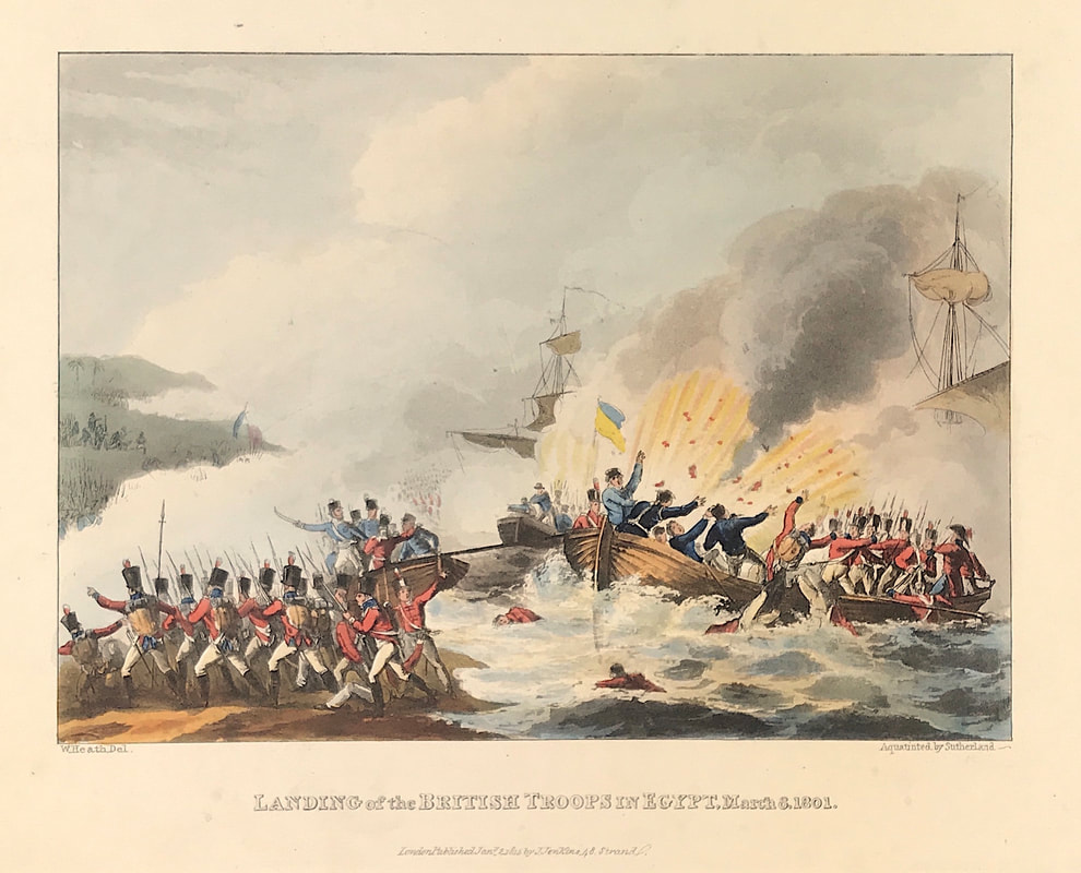
First and foremost Hemisphere Projections are very popular, attractive and collectable. These maps effectively convert half of the spherical world to a circle. obviously these don't come in all shapes, but they do come in all sizes, something for everyone almost. World Maps using a hemispheric projection are know as double-hemispheres. You can also get them based on the Western-Eastern Hemisphere or Northern-Southern (polar) Hemisphere with extensive variations. There are many affordable examples of single and double hemisphere maps to be found in the market obviously the example above is at the top end. If hemispheres are for you, then do some research there are many variations. There is going to be something out there for you, you just need to look . . . Happy Hunting! Image Credit: Sotheby's Wardington Library 2005 Collecting Antique Military Prints - Landing of the British Troops in Egypt March 8th 180111/5/2020 As promised another of the exceptional aquatint prints from Jenkins The Martial achievements of Great Britain and Her Allies from 1799 to 1815. Below the print is a short excerpt from the original written account as published with the print. The landing of the British expeditionary force under Sir Ralph Abercrombie was intended to defeat or drive out an estimated 21,000 remaining troops of Napoleon's ill-fated invasion of Egypt. The fleet commanded by Baron Keith included seven ships of the line, five frigates and a dozen armed corvettes. With the troop transports, it was delayed in the bay for several days by strong gales and heavy seas before disembarkation could proceed. Above: Landing of the British Troops in Egypt, March 8th, 1801 from Jenkins The Martial achievements of Great Britain and Her Allies from 1799 to 1815.
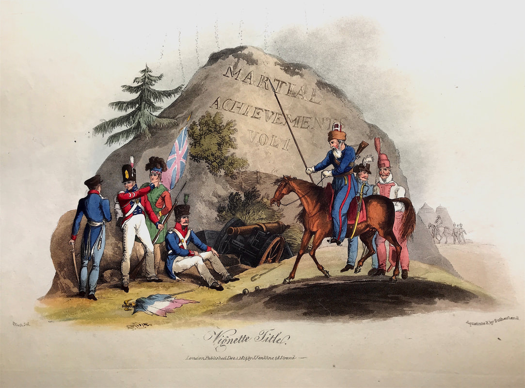
Excerpt from the written account as published: THE LANDING OF THE BRITISH TROOPS IN EGYPT. AFTER the attempt on Cadiz, it became absolutely necessary to employ more advantageously an army which might justly be regarded as the corps d'élite of England. On the 25th of October, 1800, orders from England arrived, to undertake an expedition against Egypt. Part of the fleet sailed on the 3d of November for Minorca; and the remainder, with Sir Ralph Abercrombie, proceeded direct for Malta, where it arrived on the 30th; and Lord Keith, with the division from Minorca, joined on the 14th of December. The British army amounted to 15,330 men, including 999 sick, 500 Maltese, and all kinds and descriptions of people attached to an army: its effective force in the field could not therefore be, at the highest computation, above 12,000; and, indeed, that number, within 200, was the return given in to the Commander in Chief. It must be allowed, even at the calculation of the supposed strength of the enemy, that to attack with such a force the possessors of a country strengthened by the advantages of strong fortified posts, a numerous cavalry, powerful artillery, and a perfect acquaintance with those few points where a debarcation was practicable, was an enterprize of the most audacious character. On the 1st of March a signal for landing was made by the leading frigate. This landing-place proved to be the coast near Arabs' Tower; and on the next morning the whole fleet anchored in Aboukir Bay, the men of war riding exactly where the Battle of the Nile was fought, for the Fou droyant chafed her cable against the wreck of l'Orient, whose anchor was afterwards fished up. It was here that the melancholy death of Major Makarras was announced, and the unfortunate capture of Major Fletcher, of the engineers. These circumstances took place while they were on a reconnoitring party, as they were proceeding to Aboukir Bay, in order to discover the proper point of landing. The wind continuing moderate, and the swell of the sea subsiding, on the morning of the 8th, at two o'clock, the first division of the army, consisting of the reserve under the orders of Major . . . How to Identify the Prints: The original prints from The Martial achievements of Great Britain and Her Allies from 1799 to 1815 are aquatint engravings on a medium weight wove paper. Plates also exist that were printed on India Paper. They should clearly identify bottom left W. Heath (delt) who did the drawings and bottom right T. Sutherland (sculpt) who produced most of the aquatint engravings with some by D. Havell, M. Dubourg and J. Hill. Each plate has the date of publication and the name of the publisher beneath the engraved title. The approx engraved area of the plates are 8.5" x 7.75" (215mm x 195mm) including the engraved title text. Engraved plate mark area is approx 8.5 x 11.75 (215mm x 300mm). The large sheet size is approx 11.5" x 14" (290mm x 355mm). You can see more prints from Jenkins The Martial achievements of Great Britain and Her Allies from 1799 to 1815 and Jenkins The Naval Achievements of Great Britain, From the Year 1793 to 1817 HERE. If you're interested in a specific print and you cannot see it on my website please feel free to message me. Interest in armed conflict with stories of campaigns and battles and the continuing assessment of leaders, tactics and their strategy remains ever popular with military history enthusiasts, historical reenactment groups and antique print collectors. In the coming weeks I'm going to share with you some of the exceptional aquatint prints from Jenkins The Martial achievements of Great Britain and Her Allies from 1799 to 1815 and Jenkins The Naval Achievements of Great Britain, From the Year 1793 to 1817. With each print I'll share a brief extract from the original written account published. This covers the Napoleonic Wars (May 1803 - November 1815). This series of major conflicts pitted the French Empire and its allies, led by Napoleon I, against a fluctuating array of European powers formed into various coalitions. It produced a brief period of French domination over most of continental Europe. Along with the French Revolutionary wars, the Napoleonic Wars constitute a 23-year period of recurrent conflict that concluded only with the Battle of Waterloo and Napoleon’s second abdication on June 22, 1815. The naval campaigns, operations and battles of the Napoleonic Wars were events during the period between 1802 and 1814 that were undertaken by European powers in support of their land-based strategies. Above: The Vignette Title from The Martial achievements of Great Britain and Her Allies from 1799 to 1815 by J. Jenkins.
Excerpt from the written account as published: REPRESENTS a Rendezvous of those Powers who were engaged in the grand struggle for the independence of nations. A British Soldier, in pointing to the MILITARY ACHIEVEMENTS OF GREAT BRITAIN AND HER ALLIES, alludes to the active part this country has taken in the deliverance of Europe. At the feet of the British Soldier preposes a French Warrior, tired of the repeated and decisive defeats he has at length met with under an illegitimate master. The broken Flag-Staff and the Imperial Eagle inform us, that the power of the once invincible Buonaparte is no more. On the left is a Don Cossac, who is coolly stopping his horse to gaze on his vanquished enemy: he is attended by an Austrian and a Swede, who are also contemplating those records, which will, in common with the other Powers of Europe, hand down their deeds to posterity. A Prussian, on the right, seems willing to accede to the share of glory which the British Soldier demands; conscious, that he also has saved his country from the despotism of a tyrannical usurper. How to Identify the Prints: The original prints from The Martial achievements of Great Britain and Her Allies from 1799 to 1815 are aquatint engravings on a medium weight wove paper. Plates also exist that were printed on India Paper. They should clearly identify bottom left W. Heath (delt) who did the drawings and bottom right T. Sutherland (sculpt) who produced most of the aquatint engravings with some by D. Havell, M. Dubourg and J. Hill. Each plate has the date of publication and the name of the publisher beneath the engraved title. The approx engraved area of the plates are 8.5" x 7.75" (215mm x 195mm) including the engraved title text. Engraved plate mark area is approx 8.5 x 11.75 (215mm x 300mm). The large sheet size is approx 11.5" x 14" (290mm x 355mm). You can see more prints from Jenkins The Martial achievements of Great Britain and Her Allies from 1799 to 1815 and Jenkins The Naval Achievements of Great Britain, From the Year 1793 to 1817 HERE If you're interested in a specific print and you cannot see it on my website please feel free to message me . |
LEARN ABOUT MAPS Where to Start? The Paper Earliest Maps Whats on the Paper? Rectum & Recto Marketing Devices Why Changing Faces? What is Ornamentation? Why all those lines? The Embellishment Story Illogical Prices Explained A Reference Library CLICK THE BOOK
Get the FREE Guide!
COLLECTING MAPS
Size Matters! Celestial Maps Strip Road Maps Sea Charts On the River of Life Projections The Sea Monsters Thematic Maps Town Plans Buy with Confidence. . .
More Top Tips for the Novice. Click the book to find out more . . .
COLLECTING PRINTS
Views of River Thames
Views of London Shipping & Craft Meet the Fairies Maritime Naval Military Battles Botanical Historic Churches Historic Views of Rome Archives
May 2024
|

