|
Another book recommendation for novice antique map collectors is The Mapping of Australia by Ronald Vere Tooley. This volume presents a brief historical account of the Mapping of Australia; to show its evolution from a theoretical conception to a precise fact; the slow emergence of its outline throughout the centuries; the first fixing of its exact limits on the maps of the world; followed by an alphabetical list of maps relating to Australia formerly in Mr Tooley's possession, and now reposing in the National Library in Canberra. The list of maps is not exhaustive but a considerable body of material has been assembled to illustrate one of the most varied and interesting subjects in the whole history of regional geography. The work, which is further enhanced by the inclusion of facsimiles of 239 maps of the period, will provide a reliable reference to future carto-bibliographical research for librarian, bookdealer and private collector." 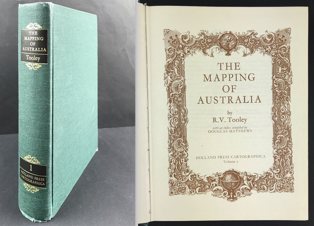 Above: The Mapping of Australia. Tooley, R.V. with an index compiled by Douglas Matthews. Publisher: Holland Press Cartographica and Richard B. Arkway. first edition (London, 1979)
As previously mentioned I recommend developing a reference library geared towards your specific subject of interest. The benefits are many and the knowledge you gain will help you with the decision making process when it comes to future investments for your map collection. These books are a great resource when it comes to understanding about maps and learning about your subject of interest. More info on "The Mapping of Australia" can be found HERE Happy Reference Book Hunting! James Jenkins: "The Martial Achievements of Great Britain and Her Allies from 1799 to 18153/28/2021 Just four of the exceptional aquatint prints available now in my March Sale. Included with each print is the original folio printed text pages account of the action as first published with the prints by James Jenkins. Beautiful aquatint prints and very collectable. I have prints available from the two works published by James Jenkins: "The Martial Achievements of Great Britain and Her Allies from 1799 to 1815." and "The Naval Achievements of Great Britain From the Year 1793 to 1817". 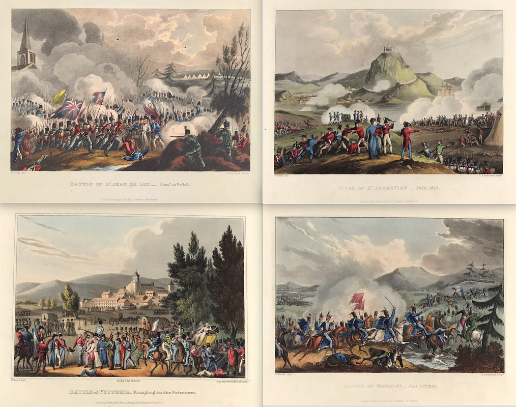 Above: Top Left: Battle of St Jean De Luz 1813. Top Right: Siege of St Sebastian 1813. Bottom Left: Battle of Vittoria, Bringing in the Prisoners Bottom Right: Battle of Morales 1813.
All aquatint engravings on a medium weight wove paper. Plates also exist that were printed on India Paper. They should clearly identify bottom left W. Heath (delt) who did the drawings and bottom right T. Sutherland (sculpt) who produced most of the aquatint engravings with some by D. Havell, M. Dubourg and J. Hill. Each plate has the date of publication and the name of the publisher beneath the engraved title. The approx engraved area of the plates are 8.5" x 7.75" (215mm x 195mm) including the engraved title text. Engraved plate mark area is approx 8.5 x 11.75 (215mm x 300mm). The large sheet size is approx 11.5" x 14" (290mm x 355mm). Here is the link to see more prints: "The Martial Achievements of Great Britain and Her Allies from 1799 to 1815." Just four of the exceptional aquatint prints available now in my March Sale. Included with each print is the original folio printed text pages account of the action as first published with the prints by James Jenkins. Beautiful aquatint prints and very collectable. I have prints available from the two works published by James Jenkins: "The Naval Achievements of Great Britain From the Year 1793 to 1817" and "The Martial Achievements of Great Britain and Her Allies from 1799 to 1815." 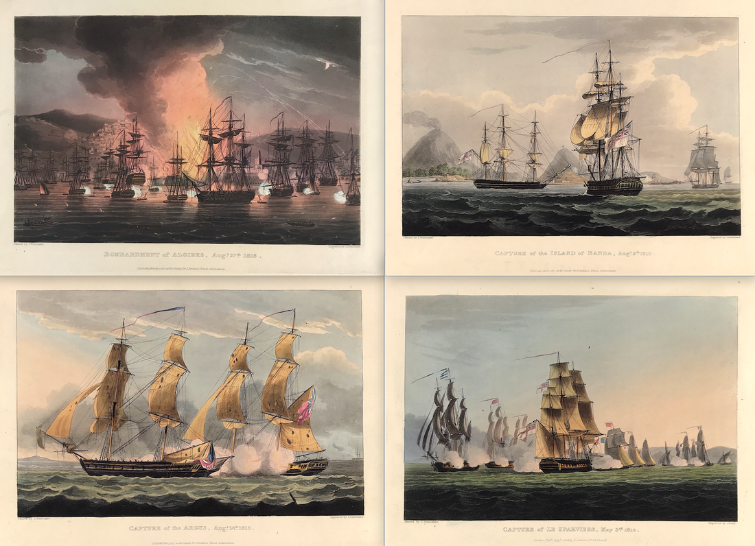 Above: Bombardment of Algiers, Aug 27th 1816. Capture of the Island of Banda, Aug 9th 1810. Capture of Argus, Aug 14th 1813. Capture of Le Sparviere, May 3rd 1810.
All original aquatint engraving on medium weight wove paper with wide margins. Good overall condition with exceptional original colour. The plate has the date of publication and the name of the publisher beneath the engraved title. The approx engraved image area of the plate is 7" x 10.25" (175mm x 260mm). Engraved plate mark area is approx 8.5 x 11.75 (215mm x 300mm). The folio sheet size is approx 11.5" x 14" (290mm x 355mm). "As a record of naval events spanning a period of over twenty years it has no precedent. At no time prior to 1817 had a publisher attempted such a complete volume of documentary naval prints. It is the quality of accuracy which makes Jenkins so valuable" Roger Quarm curator of pictures at the National Maritime Museum 1998. Please contact me directly if you have any questions about these original aquatint prints. More examples of these fine prints HERE If you were investing serious money you’d be a fool not to do your due diligence. Only then can you walk away perfectly happy and comfortable holding that investment if the market shuts down for the next ten years. Hence the Warren Buffett quote on investing. What does this have to do with buying rare maps and prints online?  I bet you’ve heard this said before “I forgot to check the small print”. Ever done that yourself over some really important transaction or deal? Most of us have made this mistake at sometime. Buying online has become so simple these days that it’s easy to forget to check on the details! When it comes to those scarce old maps or collectable prints these items often can have a high value. All the more reason to make sure you check the description and images provided and contact the seller to ask for additional information and images if need be. You should also check:
Its fair to say that when buying online you need to have your wits about you. There are many reliable and trustworthy online antique map and print dealers and sellers. Its simply good business practice to check the small print so you can buy with confidence.
Happy Buying! More help with "Buying Rare Maps and Prints Online" in this free ebook available on my START PAGE Another print from James Jenkins The Naval Achievements of Great Britain. These original prints are aquatint engravings on a medium weight wove paper and coloured by hand. The Action of 24 June 1795 was a minor naval engagement fought in the Western Basin of the Mediterranean Sea during the French Revolutionary Wars. This print depicts the confrontation between two British and two French naval ships. Minerve was a French 40-gun frigate launched in 1794. On 23 June 1795, she and the 36-gun Artémise engaged the frigates HMS Dido and Lowestoffe. Minerve surrendered to the British, Artémise having fled, and was commissioned in the Royal Navy as HMS Minerve. 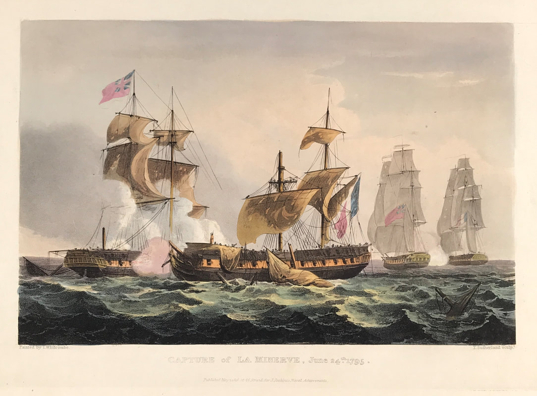 Above: Capture of La Minerve, June 24th 1795. Published May 1st 1816 at 48 Strand for J. Jenkins Naval Achievements. From The Naval achievements of Great Britain and Her Allies from 1793 to 1817 by J. Jenkins.
How to Identify the Prints: The original prints from "The Naval Achievements of Great Britain. From the Year 1793 to 1817" are aquatint engravings on a medium weight wove paper. All the plates identify at bottom left Painted by T. Whitcombe and bottom right T. Sutherland (sculpt) who produced the aquatint engravings. Some plates were engraved by Jeakes and Bailey after Whitcombe. Each plate is accompanied by text pages describing the action, often with lists of ships captured or sunk, and excerpts from contemporary bulletins, dispatches, letters, and speeches. The first edition appeared in 1817. Early issues have watermarks of J. Whatman with the undated watermark IIS&S on some plates. The vignette title page was uncoloured in the first issue. The approx engraved image area of the plates are 7" x 10.25" (175mm x 260mm). Engraved plate mark area is approx 8.5 x 11.75 (215mm x 300mm). The folio sheet size is approx 11.5" x 14" (290mm x 355mm). You can see more prints from Jenkins The Naval Achievements of Great Britain, From the Year 1793 to 1817 HERE. If you're interested in a specific print and you cannot see it on my website please feel free to message me Here's another book recommendation for the novice antique map collector especially if you're interest is the British Isles. County Atlases of the British Isles is designed as an aid to the study of the evolution of the English county atlas by establishing the genetic relationship between atlases, by tracing the history and successive users of map-plates, and by providing descriptions in such detail as to enable loose sheets, single maps, to be assigned to the atlas in which they were originally issued. A section of particular value is that on the history of the English map trade during the Tudor and Stuart periods. This original contribution to the subject is made from systematic examination of original documents such as map-sellers catalogues and wills. Important too are the three separate, comprehensive indexes: of persons, subjects, and titles. 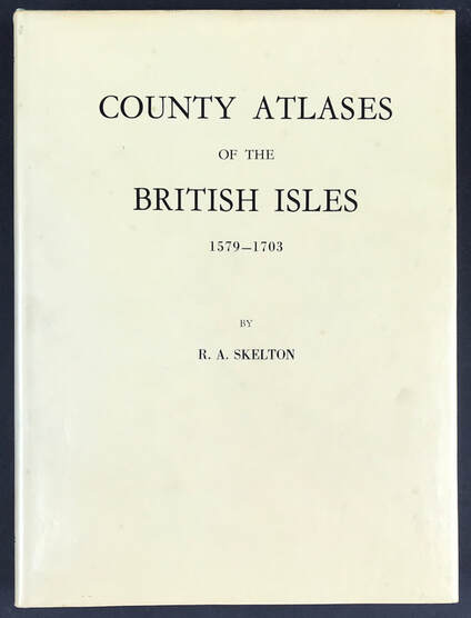 Above: Collecting Antique Maps - County Atlases of the British Isles 1579-1703. Skelton R.A. Sometime Superintendent of the Map Room in the British Museum and Honoray Secretary of the Hakluyt Society. Publisher: Carta Press 1970.
Collectors of county maps and atlases will find Skelton's authoritative book an indispensable reference work of permanent value. Developing a reference library geared towards your subject of interest is well worth doing. If that interest is the 'British Isles' then this is a super reference work that will set you right especially if you want to invest in maps of Books like this one are a great resource when it comes to understanding about maps and learning about your subject of interest. The benefits are many and the knowledge you gain will help you with the decision making process when it comes to future investments for your map collection. I have a copy of "County Atlases of the British Isles 1579-1703" available on my website HERE Happy Reference Book Hunting! Another print from Jenkins The Martial Achievements of Great Britain and Her Allies from 1799 to 1815. Below the print is a short excerpt from the original written account as published with the print. The Battle of Barrosa also known as the Battle of Chiclana or Battle of Cerro del Puerco was part of an unsuccessful manoeuvre by an Anglo-Iberian force to break the French siege of Cádiz during the Peninsular War. This was British officer, Lieutenant General Thomas Graham’s notable victory over the French during the march to Cadiz in the Peninsular War. 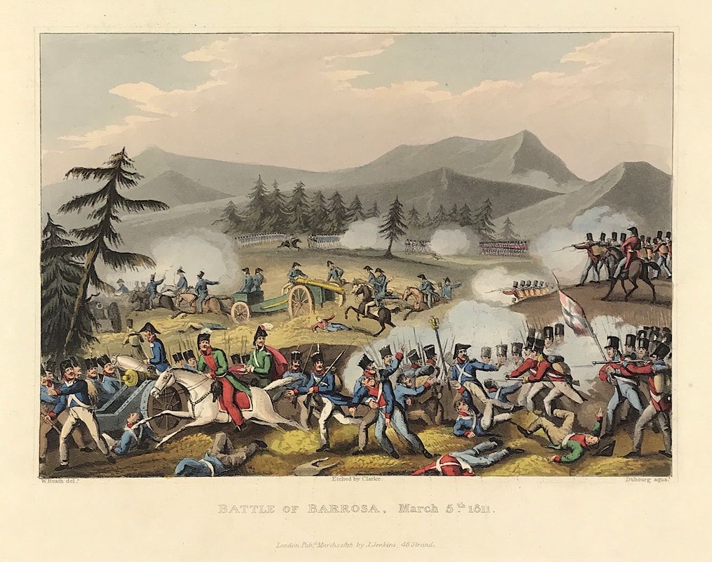 Above: Battle of Barrosa March 5th 1811. London Published June 1st 1815 by J. Jenkins, 48 Strand. From The Martial achievements of Great Britain and Her Allies from 1799 to 1815 by James Jenkins.
Excerpt from the written account as published: THE BATTLE OF BARROSA. THE annexed illustration shews the pinewood from which the enemy commenced a most determined and destructive fire on our troops. The centre of the print, or middle-ground, is occupied by the artillery of the enemy in full retreat; and the fore-ground represents the charges of the three companies of Guards and the 87th regiment on the enemy's troops commanded by General Laval. The following is an Extract from Lieutenant-General Graham's Letter to the Earl of Liverpool, dated Isla de Leon, 6th and 10th March, 1811. My division being halted on the eastern slope of the Barrosa height, was marched, about twelve o'clock, through the wood towards the Bermesa, cavalry patrols having previously been sent towards Chiclana without meeting with the enemy. On the march I received notice, that the enemy had appeared in force on the plain, and was advancing towards the height of Barrosa. As I considered that position as the key of that of Santa Petri, I immediately countermarched, in order to support the troops left for its defence; and the alacrity with which this manoeuvre was executed, served as a favourable omen. It was, however, impossible, on such intricate and difficult ground, to preserve order in the columns, and there never was time to restore it entirely. But before we could get ourselves quite disentangled from the wood, the troops on the Barrosa bill węre seen returning from it, while the enemy's left wing was rapidly ascending. At the same time his right wing stood on the plain, on the edge of the wood, within cannon-shot. A retreat in the face of such an enemy, already within reach of the easy communication by the sea-beach, must have involved the whole army in all the danger of being attacked during the unavoidable confusion of the different corps arriving on the narrow ridge of Bermesa nearly at the same time. Trusting to the known heroism of British troops, regardless of the numbers and position of their enemy, an immediate attack was determined on. Major Duncan soon opened a powerful battery of ten guns in the centre. Brigadier-General Dilkes with the brigade of Guards, Lieutenant-Colonel Browne's (of the 28th) flank battalion, Lieutenant-Colonel Norcott's two companies of the 2d rifle corps, and Major Acheson with a part of the 67th foot (separated from the regiment in the wood), formed on the right; Colonel Wheatly's brigade, with three companies of the Coldstream Guards under Lieutenant-Colonel Jackson (separated likewise from his battalion in the wood), and Lieutenant-Colonel Barnard's flank battalion, formed on the left . . . How to Identify the Prints: The original prints from The Martial achievements of Great Britain and Her Allies from 1799 to 1815 are aquatint engravings on a medium weight wove paper. Plates also exist that were printed on India Paper. They should clearly identify bottom left W. Heath (delt) who did the drawings and bottom right T. Sutherland (sculpt) who produced most of the aquatint engravings with some by D. Havell, M. Dubourg and J. Hill. Each plate has the date of publication and the name of the publisher beneath the engraved title. The approx engraved area of the plates are 8.5" x 7.75" (215mm x 195mm) including the engraved title text. Engraved plate mark area is approx 8.5 x 11.75 (215mm x 300mm). The large sheet size is approx 11.5" x 14" (290mm x 355mm). You can see more prints from Jenkins The Martial achievements of Great Britain and Her Allies from 1799 to 1815 HERE. If you're interested in a specific print and you cannot see it on my website please feel free to message me. It’s unlikely you’re totally new to buying online, who doesn’t use Amazon? But would you be confident about buying a rare map or print and parting with several hundred dollars online? The great thing about the online world is you can find many highly respected map and print dealers just a click away. Plus you can buy without even getting off your sofa! You just need to know what you’re doing and be confident about it. If you’re considering buying via an online auction website or platforms like amazon, Etsy or good old ebay it’s sensible to check out the seller first. Likewise with platforms like Facebook and Instagram taking some time to get to know who you're dealing with is time well spent. All before you consider spending any money and buying. 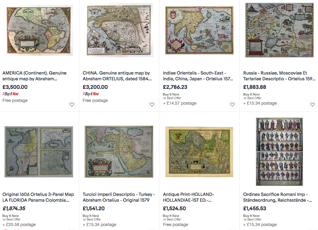 Above: A selection of Abraham Ortelius Maps for sale on a popular online platform. How confident would you be about buying?
Most online platforms provide some kind of buyers review feedback or ratings process for trading partners. Sellers know their reputation depends on it. Doing business with reliable people makes life a whole lot easier. This is all the more important when considering buying antique maps that are potentially rare and of value. Before you even get into examining the item itself you really should take a close look at the seller. If it’s not an individual it may be an auction house website, same rules apply. Start with checking out their reputation and expertise. Get to know the kind of service the seller provides. Its important to know how the person or company operates their business and how they treat buyers. Get more top tips about "Buying Rare Maps and Prints Online" in this free ebook available on my START PAGE Early etchings and copper engraved coats of arms from the 18th century are still very collectable. How about these beauties. Ready to be mounted and framed they certainly look the part and would make a statement on that office wall. These Heraldic Achievement's from Baronageium Genealogicum by Joseph Edmondson c1764 are a favourite and when accurately hand coloured in water colour in accordance with the Heraldic codes are some of the best. 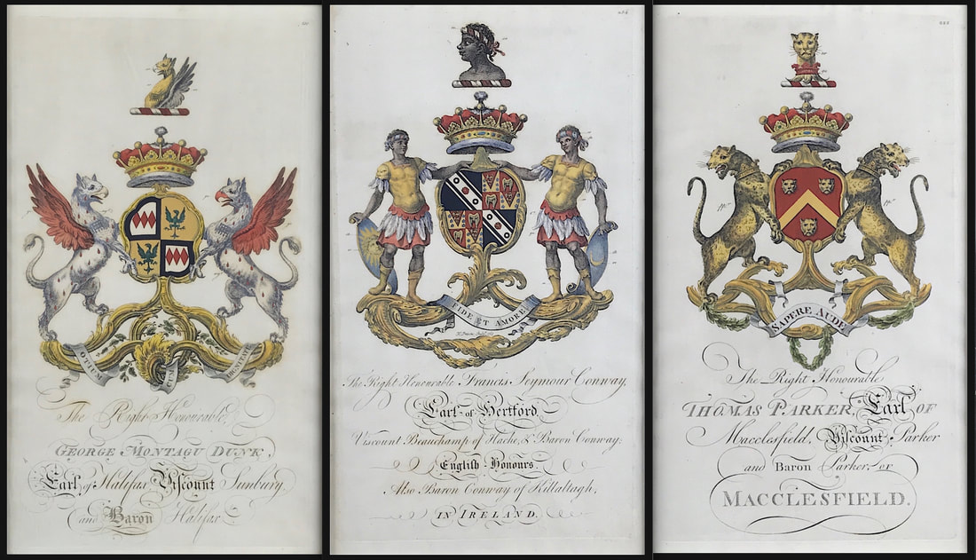 The original prints from Baronageium Genealogicum were copper plate engraved on hand laid paper. This kind of paper has a very distinct appearance and is identified by the visible lines seen in the paper when held up to a bright light. You can actually feel the lines and slight roughness when you touch this kind of paper. The original prints dimensions are width 10.75" x height 18”. If you find them coloured its good to check the colouring is correct in accordance with the Heraldic Codes. Most of this information is available online.
Happy Hunting! More Coats of Arms from Baronageium Genealogicum by Joseph Edmondson c1764 available HERE - I have a few available in my current "Mad as a March Hare" Sale! Collecting Antique Naval Prints - Lord Bridport's Action Off Port L'Orient, June 23rd 17953/18/2021 Another exceptional aquatint print from James Jenkins The Naval Achievements of Great Britain. These original prints are aquatint engravings on a medium weight wove paper and coloured by hand. All the plates are identified at the bottom left Painted by T. Whitcombe and bottom right T. Sutherland (sculpt) who produced the aquatint engravings. The Battle of Groix was a large naval engagement which took place near the island of Groix off the Biscay coast of Brittany on 23 June 1795 (5 messidor an III) during the French Revolutionary Wars. The battle was fought between elements of the British Channel Fleet and the French Atlantic Fleet, which were cruising in the region on separate missions. The British fleet, commanded by Admiral Lord Bridport, was covering an invasion convoy carrying a French Royalist army to invade Quiberon, while the French under Vice-admiral Villaret de Joyeuse had sailed a week earlier to rescue a French convoy from attack by a British squadron. 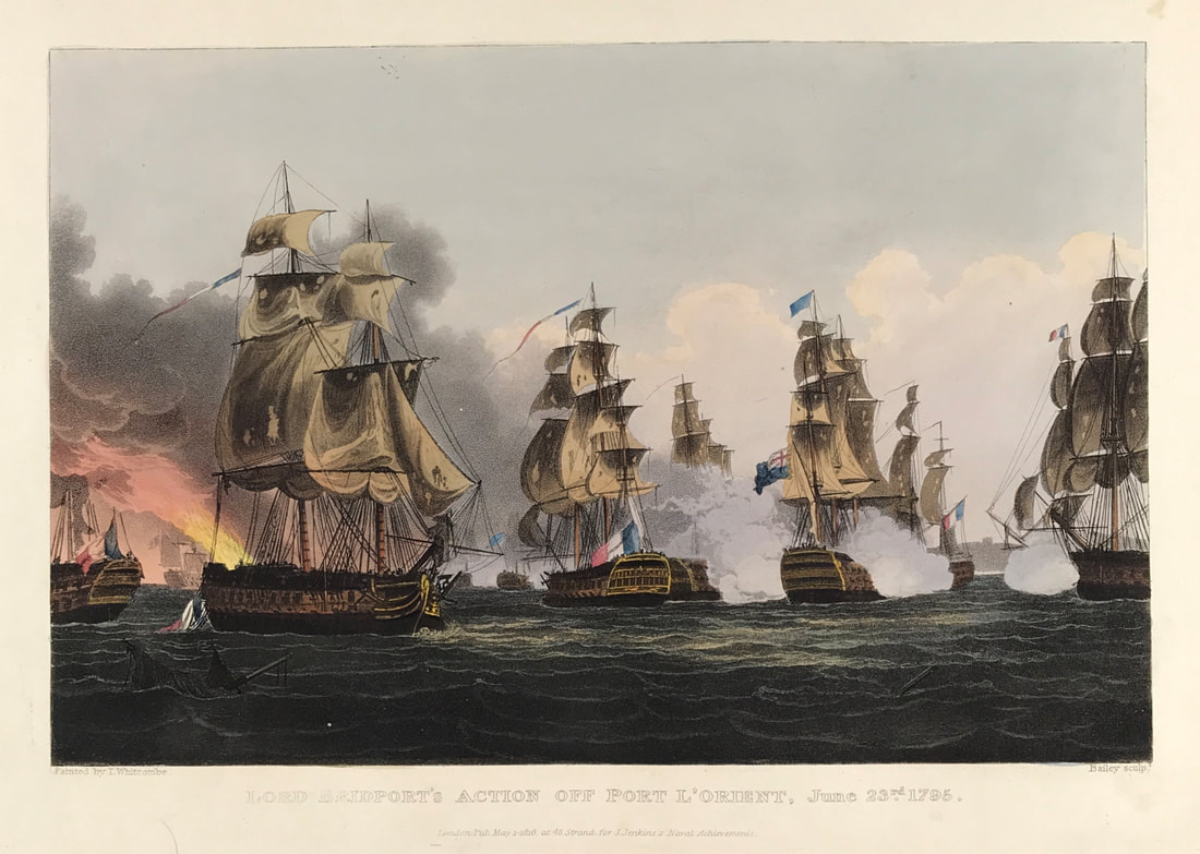 Above: Lord Bridport's Action Off Port L'Orient, June 23rd 1795. Published May 1st 1816 at 48 Strand for J. Jenkins Naval Achievements. From The Naval achievements of Great Britain and Her Allies from 1793 to 1817 by J. Jenkins.
Excerpt from the written account as published: LORD BRIDPORT's ACTION OFF L'ORIENT, JUNE 23, 1795. ON the 11th June, 1795, the signal was made for the fleet under Lord Bridport, then lying at Spithead, to prepare for sailing; and on the following day they unmoored, and proceeded on their destination. On the 22d, at four o'clock in the morning, being in latitude 47° 4' N. and longitude 4° 16' W. Belle Isle bearing E. by N. 14 leagues, the frigates made the sigınal for a strange fleet, which was soon discovered to be French. They were then right ahead, but the wind shifting, brought them on the weather bow of the British fleet. At six o'clock the admiral made a signal for four of the best sailing ships to chase, and his lordship followed with the whole fleet: the enemy at this time crowded all sail, endeavouring to escape. The chase continued with very little wind till three o'clock the next morning, when a breeze springing up, brought them within sight of the Isle de Groais, which was discovered from the lee bow. About six o'clock the headmost ships were within gun-shot of the enemy, followed closely by the Queen Charlotte, Irresistible, Royal George, and London. The annexed view represents that time of the action when the Royal George (to the right) having obliged the Tigre (in the centre) to haul down her colours, is ranging alongside the next in succession; immediately after which, bringing himself within reach of the enemy's batteries, and L'Alexandre and Le Formidable (to the left) having surrendered, the admiral threw out the signal to leave off chase. . . . How to Identify the Prints: The original prints from "The Naval Achievements of Great Britain. From the Year 1793 to 1817" are aquatint engravings on a medium weight wove paper. All the plates identify at bottom left Painted by T. Whitcombe and bottom right T. Sutherland (sculpt) who produced the aquatint engravings. Some plates were engraved by Jeakes and Bailey after Whitcombe. Each plate is accompanied by text pages describing the action, often with lists of ships captured or sunk, and excerpts from contemporary bulletins, dispatches, letters, and speeches. The first edition appeared in 1817. Early issues have watermarks of J. Whatman with the undated watermark IIS&S on some plates. The vignette title page was uncoloured in the first issue. The approx engraved image area of the plates are 7" x 10.25" (175mm x 260mm). Engraved plate mark area is approx 8.5 x 11.75 (215mm x 300mm). The folio sheet size is approx 11.5" x 14" (290mm x 355mm). You can see more prints from Jenkins The Naval Achievements of Great Britain, From the Year 1793 to 1817 HERE. If you're interested in a specific print and you cannot see it on my website please feel free to message me Another book recommendation for the novice antique map collector. London is a place close to my heart having family roots there, also lived, worked and played in and around London for most of my life. Maps and plans of London illustrate the stages in its growth, and the causes and consequences of this growth from the sixteenth century onwards. But would you know what to buy when it comes to old maps of London? Students and amateurs of cartography and of London's history and topography have long been handicapped by the total lack of any comprehensive descriptive key to the wealth of printed maps that have survived from the sixteenth century onwards. Here, for the first is a scholarly catalogue of maps of London, listed in chronological order of their first appearance. 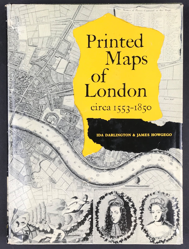 Above: Printed Maps of London circa 1553-1850. Darlington, Ida & James Howgego with Forward by R. A. Skelton. Published by George Philip & Son Limited 1964.
Each entry gives exact details of title, size, extent, scale, key, decorative features, etc., and present location, and is followed by a careful collation of later editions, with all information necessary for identification, and of derivatives, reproductions and facsimiles. As mentioned before I recommend developing a reference library geared towards your specific subject of interest. If that interest is 'London' then this is a super reference work that will set you right especially if you want to invest in printed maps of London. Books like this one are a great resource when it comes to understanding about maps and learning about your subject of interest. The benefits are many and the knowledge you gain will help you with the decision making process when it comes to future investments for your map collection. I have a copy of "Printed Maps of London circa 1553-1850" available on my website HERE Happy Reference Book Hunting! Another print from Jenkins The Martial Achievements of Great Britain and Her Allies from 1799 to 1815. Below the print is a short excerpt from the original written account as published with the print. The Battle of Buçaco or Bussaco, fought on 27 September 1810 during the Peninsular War in the Portuguese mountain range of Serra do Buçaco, resulted in the defeat of French forces by Lord Wellington's Anglo-Portuguese Army. Wellington's preparations for a defensive battle along the line of the Buçaco ridge had extended as far as the construction of a lateral communications road behind the crest. Although Wellington's forces were concentrated at the likely points of attack within the northern half of the 16km-long ridge, the communications road allowed troops to be moved quickly from one point to another. 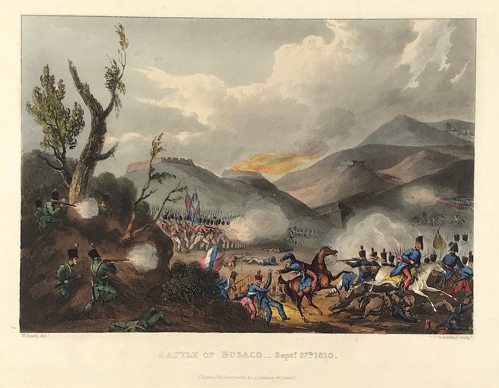 Above: Battle of Busaco, Sept 27th, 1810. London Published June 1st 1815 by J. Jenkins, 48 Strand. From The Martial achievements of Great Britain and Her Allies from 1799 to 1815 by James Jenkins.
Excerpt from the written account as published: THE BATTLE OF BUSACO, SEPTEMBER 27, 1810. THE Sierra de Busaço is a high ridge which extends from the Mondego in a northerly direction about eight miles, upon the highest point of which, about two miles from its termination, are the convent and garden of Busaço. The Sierra de Busaço is connected by a mountainous tract with the Sierra de Cara. The roads are all very difficult of access to an army, the approach to the top of the ridge being rugged and intersected. It was here the British army completely discomfited the forces of Massena. At six in the morning of the 27th of September, according to the Gazette Extraordinary of October 15th, the enemy made two desperate attacks upon our position, the one on the right, the other on the left of the highest point of the Sierra. The attack upon the right was made by two divisions of the 2d corps on that part of the Sierra occupied by the 3d division of infantry. One division of French infantry arrived at the top of the ridge, when it was attacked in the most gallant manner by the 88th-(see the Plate)-under the command of the Hon. Lieutenant-Colonel Wallace, the 45th under the Hon. Lieutenant-Colonel Meade, and the 5th Portuguese under Lieut.-Colonel Douglas, directed by Major-General Picton: these three corps advanced with the bayonet, and drove the enemy's division from the advantageous ground which it had obtained. The other division of the 2d corps attacked farther on the right, by the road leading to St. Antonio de Cantaro, also in front of Major-General Picton's division: this division of the enemy was repulsed, before it could reach the top of the ridge, by the 74th regt. under the Hon. Lieutenant-Colonel Freaeh, and the brigade of Portuguese infantry under Colonel Champelmond, directed by Colonel M'Kinnon. Major General Leith also moved to his left, to the support of Major-General Picton, and aided in the defeat of the enemy in this quarter with the 3d bat. of royals and the Ist and 2d batts. of the 38th. In these attacks Major-Generals Leith and Picton, Colonels M'Kinnon and Champelmond of the Portuguese service, the latter of whom was wounded; the Hon. Lieutenant-Colonels Wallace and Meade, Lieatenant-Colonel Sutton of the 9th Portuguese, Major Samith of the 454h (hiled), Lieut. Colonel Douglas and Major Birmingham of the 8th Portuguese legion, greatly distinguished themselves. Major-General Picton reports in handsome terms of the 0th and 21st Portuguese regts. commanded by Lieutenant-Colonels Sutton and De Arouje Bacellar, and of the Portuguese artillery commanded by Lieutenant-Colonel Arenschild. Particular mention is also made of the conduct . . . How to Identify the Prints: The original prints from The Martial achievements of Great Britain and Her Allies from 1799 to 1815 are aquatint engravings on a medium weight wove paper. Plates also exist that were printed on India Paper. They should clearly identify bottom left W. Heath (delt) who did the drawings and bottom right T. Sutherland (sculpt) who produced most of the aquatint engravings with some by D. Havell, M. Dubourg and J. Hill. Each plate has the date of publication and the name of the publisher beneath the engraved title. The approx engraved area of the plates are 8.5" x 7.75" (215mm x 195mm) including the engraved title text. Engraved plate mark area is approx 8.5 x 11.75 (215mm x 300mm). The large sheet size is approx 11.5" x 14" (290mm x 355mm). You can see more prints from Jenkins The Martial achievements of Great Britain and Her Allies from 1799 to 1815 HERE. If you're interested in a specific print and you cannot see it on my website please feel free to message me. Collecting Antique Maps - The United States of North America by T. Bowen - More Tips for the Novice!3/15/2021 Last week I mentioned how the eighteenth century has much to offer the map collecting enthusiast. French cartographers played a significant role with the publishing of maps dominated by a small group of families. Germany saw a resurgence in map publishing with the firms of Homann, Seutter and Lotter. Look out here comes the British! Bringing up the rear as it were at the latter part of the century the British Empire took the reins of naval and commercial power with expansion of the East India Company and colonisation, the invention of the marine chronometer and the discoveries of Captain James Cook. The centre of mapmaking now became London. English cartographers of the period include Thomas Jefferys, William Faden, Herman Moll and Robert Sayer to name a few. 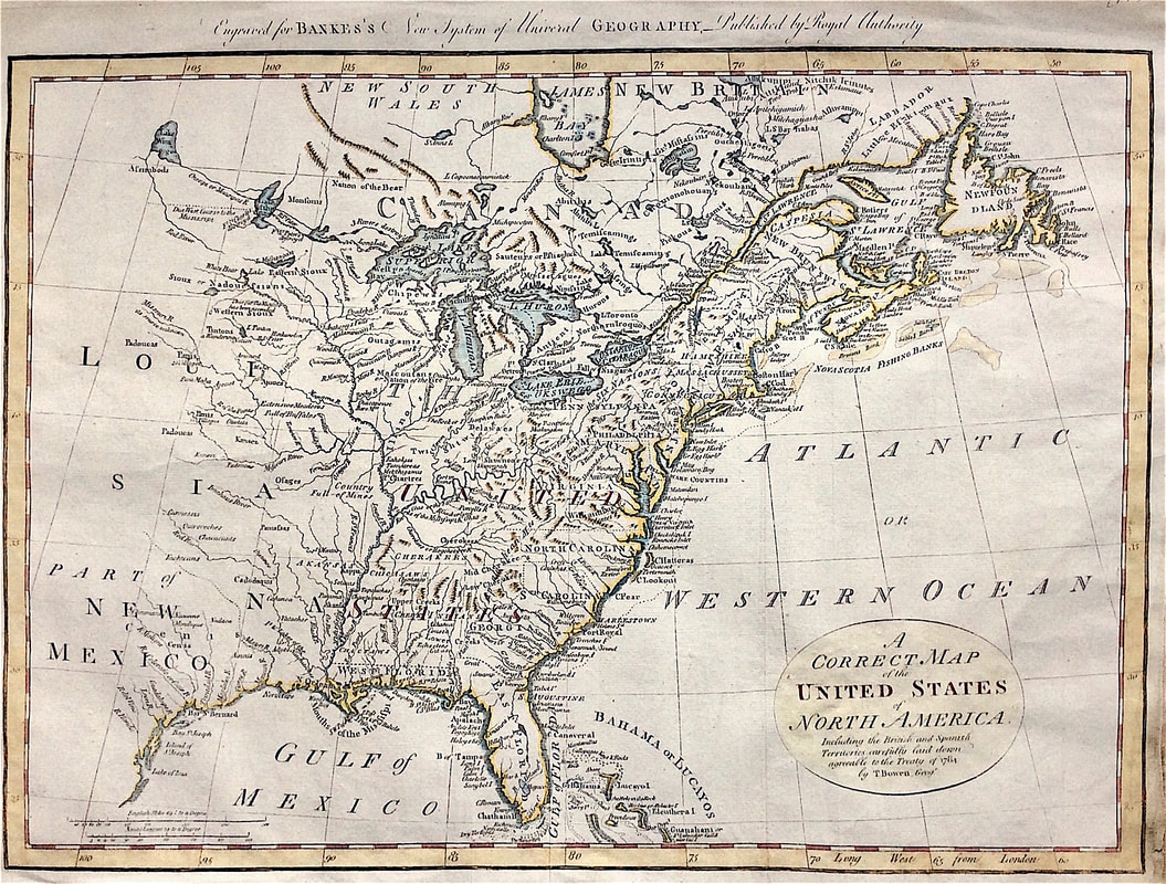 Above: Map of North East America c1784 showing the British and Spanish Territories by Thomas Bowen. Including the British and Spanish Territories, carefully laid down agreeable to the Treaty of 1784.
This map was published shortly after independence and prior to the admission of Kentucky, Tennessee or Vermont as states, although Vermont is named quite curiously appearing above "Hampshire." Both East and West Florida are shown. Many Indian tribes shown. Published: Engraved for Bankes's New system of universal geography, published by royal authority. This map is likely the 6th edition c1797 based on having a watermark for 1796. Thomas Bowen (1749-1790) was a Welsh engraver of maps and charts. He was the son of Emanuel Bowen (1720-17670) the map engraver to George II of England and Louis XV of France. Bowen is highly regarded for producing some of the largest, most detailed and accurate maps of his era. These highly attractive maps were also worked on by his son Thomas. In spite of his royal patronage and renown, Emanuel Bowen like many cartographers of his day, died in poverty. His son Thomas continued on the business however a similar outcome befell him and he died in Clerkenwell Workhouse in 1790. This map is currently up for sale at a reduced price as part of my "Mad as a March Hare" Sale. More information HERE If you're new to Antique Maps and thinking what next ? . . . . Back in January I published this free ebook to help to those new to the idea of antique maps and map collecting. If you missed this first time around here's another chance to grab the free download. It’s in pdf format so you can consume on the go! Perfect for your iPhone, tablet, iPad, laptop or desktop. This is for those who are new to collecting or even new to the idea of collecting maps. This will help you get to grips with what you really need to know first. Jumping in feet first can be fun but leaves you open to the potential of making what could be an expensive mistake. I’ve been there so I’m adequately qualified! 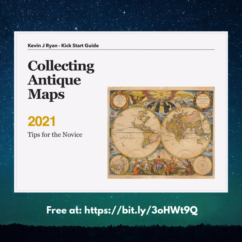 You can download your free copy today: bit.ly/3oHWt9Q Military History in the United Kingdom emerged during the eighteenth century with studies of the Napoleonic wars, especially the Peninsular and Waterloo campaigns. This interest in armed conflict remains today, with stories of campaigns and battles and the continuing assessment of leaders, tactics and their strategy. Nowadays its defined as a humanities discipline and also remains popular with antique print collectors with a passion for military history, records of armed conflict and rare prints depicting battle scenes. These small scale maps and plans produced for Alison's History of Europe, Atlas published in 1875 remain popular with original print collectors. The atlas was intended to illustrate the most important period of modern history and consists of Plans, Sieges and Battles pointing out every circumstance of locality, affecting the operations detailed, and maps of extensive portions of country, exhibiting at one view the whole range of a campaign, with relative positions and political boundaries of Empire and States. Below is just one example of these popular little maps. 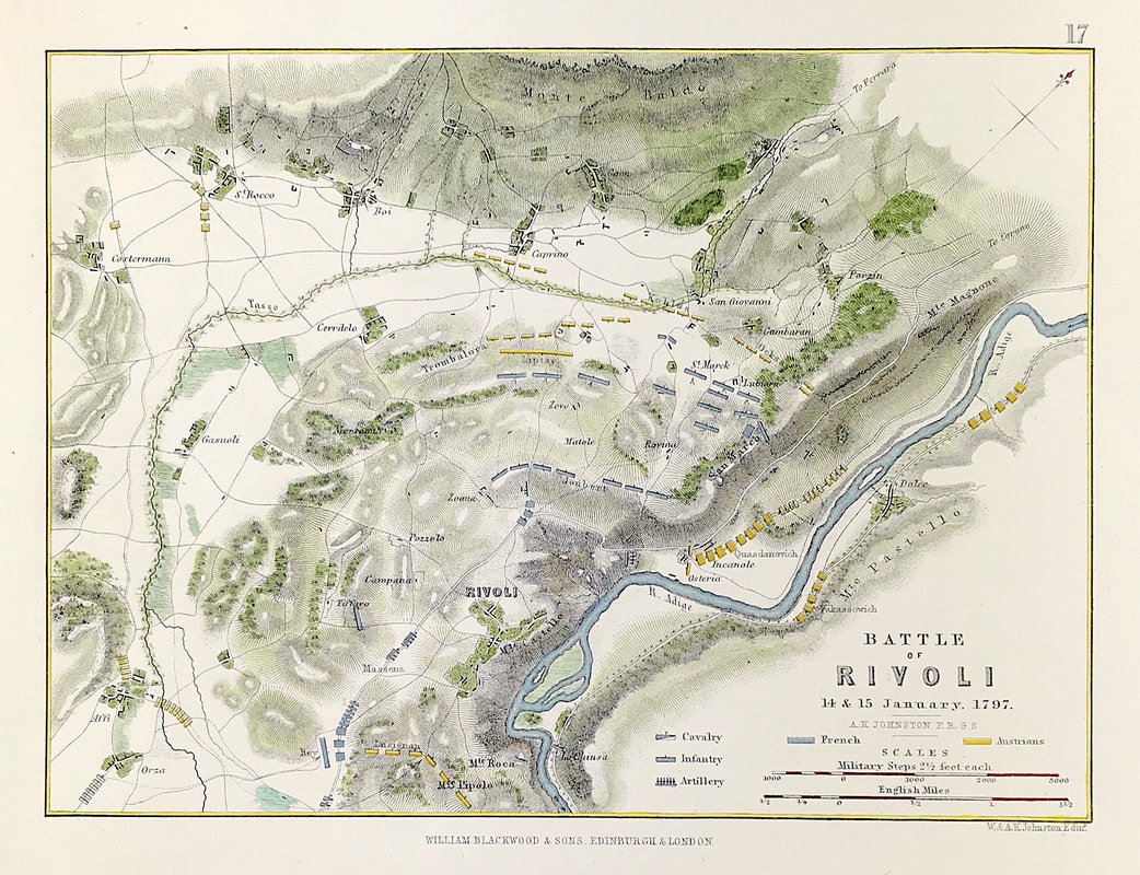 Above: Battle of Rivoli 14th & 15th January 1793. From the Atlas to Alison's History of Europe By Sir Archibald Alison by Alexander Keith Johnson, F.R.S.E F.R.G.S. F.G.S. Published by William Blackwood & Sons, Edinburgh and London c1875. Original map produced with mechanical outline colour. Addition later fine wash hand colour embellishments make this a unique edition of the map.
The Battle of Rivoli (14–15 January 1797) was a key victory in the French campaign in Italy against Austria. Napoleon Bonaparte's 23,000 Frenchmen defeated an attack of 28,000 Austrians under General of the Artillery Jozsef Alvinczi, ending Austria's fourth and final attempt to relieve the Siege of Mantua. Rivoli further demonstrated Napoleon's brilliance as a military commander and led to the French consolidation of northern Italy. A selection of these Plans, Sieges and Battle Maps are available HERE |
LEARN ABOUT MAPS Where to Start? The Paper Earliest Maps Whats on the Paper? Rectum & Recto Marketing Devices Why Changing Faces? What is Ornamentation? Why all those lines? The Embellishment Story Illogical Prices Explained A Reference Library CLICK THE BOOK
Get the FREE Guide!
COLLECTING MAPS
Size Matters! Celestial Maps Strip Road Maps Sea Charts On the River of Life Projections The Sea Monsters Thematic Maps Town Plans Buy with Confidence. . .

More Top Tips for the Novice. Click the book to find out more . . .
COLLECTING PRINTS
Views of River Thames
Views of London Shipping & Craft Meet the Fairies Maritime Naval Military Battles Botanical Historic Churches Historic Views of Rome Archives
May 2024
|