- Published on
Collecting Antique Maps - The United States of North America by T. Bowen - More Tips for the Novice!
Last week I mentioned how the eighteenth century has much to offer the map collecting enthusiast. French cartographers played a significant role with the publishing of maps dominated by a small group of families. Germany saw a resurgence in map publishing with the firms of Homann, Seutter and Lotter. Look out here comes the British!
Bringing up the rear as it were at the latter part of the century the British Empire took the reins of naval and commercial power with expansion of the East India Company and colonisation, the invention of the marine chronometer and the discoveries of Captain James Cook. The centre of mapmaking now became London. English cartographers of the period include Thomas Jefferys, William Faden, Herman Moll and Robert Sayer to name a few.
Bringing up the rear as it were at the latter part of the century the British Empire took the reins of naval and commercial power with expansion of the East India Company and colonisation, the invention of the marine chronometer and the discoveries of Captain James Cook. The centre of mapmaking now became London. English cartographers of the period include Thomas Jefferys, William Faden, Herman Moll and Robert Sayer to name a few.
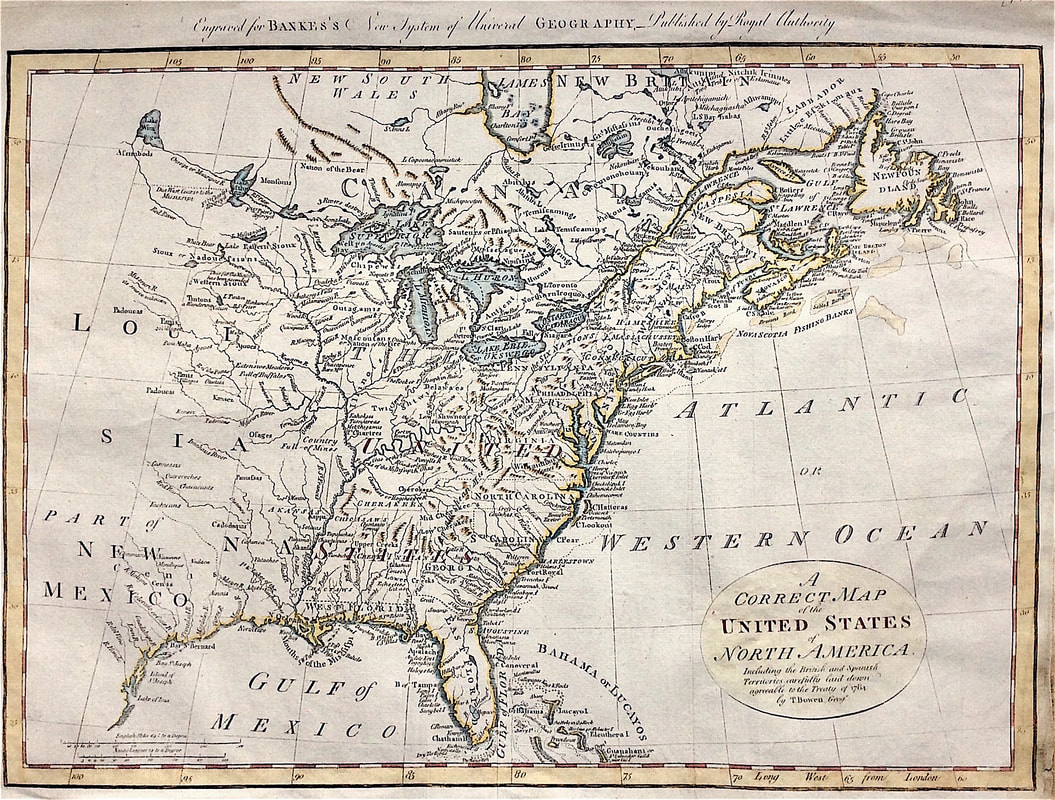
Above: Map of North East America c1784 showing the British and Spanish Territories by Thomas Bowen. Including the British and Spanish Territories, carefully laid down agreeable to the Treaty of 1784.
This map was published shortly after independence and prior to the admission of Kentucky, Tennessee or Vermont as states, although Vermont is named quite curiously appearing above "Hampshire." Both East and West Florida are shown. Many Indian tribes shown. Published: Engraved for Bankes's New system of universal geography, published by royal authority. This map is likely the 6th edition c1797 based on having a watermark for 1796.
Thomas Bowen (1749-1790) was a Welsh engraver of maps and charts. He was the son of Emanuel Bowen (1720-17670) the map engraver to George II of England and Louis XV of France. Bowen is highly regarded for producing some of the largest, most detailed and accurate maps of his era. These highly attractive maps were also worked on by his son Thomas. In spite of his royal patronage and renown, Emanuel Bowen like many cartographers of his day, died in poverty. His son Thomas continued on the business however a similar outcome befell him and he died in Clerkenwell Workhouse in 1790.
This map is currently up for sale at a reduced price as part of my "Mad as a March Hare" Sale. More information HERE
0 Comments