- Published on
Still on the subject of elements that make up a maps ornamentation that you should be aware of brings us to the matter of whats with all those lines? On your travels you will see maps similar to the example below. These fall into the category of sea or navigational charts. These maps showing large areas of the ocean and a particular coast line are very attractive and popular with collectors.
Direction on old maps is indicated by means of a compass or wind rose, simple or elaborate in design, traditionally with north indicated by the use of of a fleur de lis and east by a small cross. So whats with all those lines? These are known as rhumb lines. In navigation, a rhumb line or loxodrome is an arc crossing all meridians of longitude at the same angle, that is, a path with constant bearing as measured relative to true or magnetic north.
Direction on old maps is indicated by means of a compass or wind rose, simple or elaborate in design, traditionally with north indicated by the use of of a fleur de lis and east by a small cross. So whats with all those lines? These are known as rhumb lines. In navigation, a rhumb line or loxodrome is an arc crossing all meridians of longitude at the same angle, that is, a path with constant bearing as measured relative to true or magnetic north.
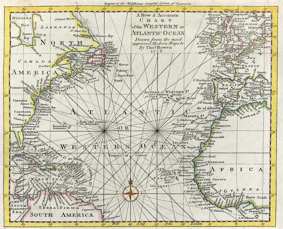
Above: Original Map of Chart of the Western or Atlantic Ocean by Thomas Bowen 1788. A New & Accurate Chart of the Western or Atlantic Ocean Drawn from Surveys and most approved Maps & Charts. Published: Middleton's Complete System of Geography 1788
In this example you can see the rhumb lines radiating from the compass rose. You can see the fleur de lisat the top of the rose indicating north. East is indicated by the small cross to the right. On old sea charts the rhumb lines represent the bearings sailors used to navigate long ocean voyages prior to the invention of the chronometer.
HOW TO IDENTIFY:
Well you won't have trouble identifying sea charts or navigational maps in future These are the ones with the rhumb lines all over them radiating out from the compass rose!
Happy Hunting!
Click the link to continue to the next article in the Collecting Antique Maps series: "Does your penchant for embellishment drive you?"
0 Comments

