|
It’s unlikely you’re totally new to buying online, who doesn’t use Amazon? But would you be confident about buying a rare map or print and parting with several hundred dollars online?
The great thing about the online world is you can find many highly respected map and print dealers just a click away. Plus you can buy without even getting off your sofa! You just need to know what you’re doing and be confident about it. It’s also possible to find ‘Little Gems’ as I call them being sold on various online platforms by people who sometimes simply don’t know what they’ve got! I’m not just talking about on sites like eBay here. You’d be surprised what you can find when you know where to look. One of the keys is knowing what to look for. If you’re lucky enough to find the elusive ‘little gem’ then the next step is all the more important for you. The information in this ebook will help you avoid some basic mistakes still made by the unwary on the verge of buying a rare map or collectable print online. This is a quick step by step guide to buying online with practical suggestions and 'real life' examples of what can be achieved. Get your copy today!
FREE DOWNLOAD
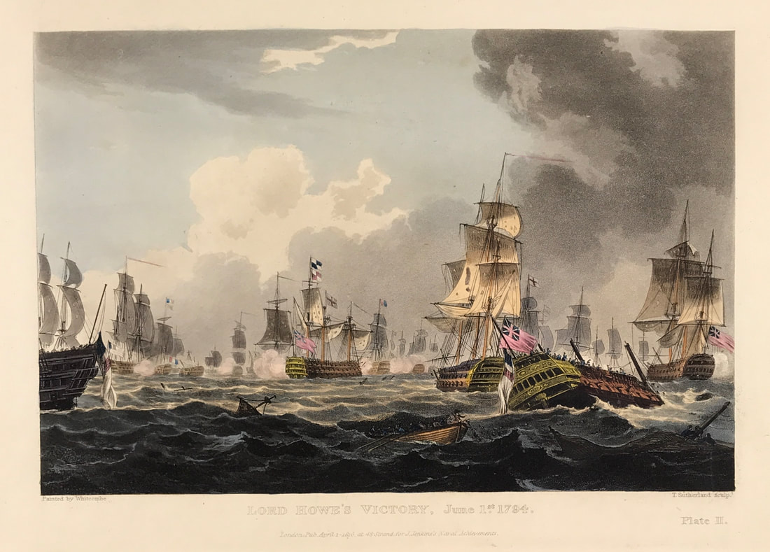
Back in December I shared with you Plate I from Lord Howes Victory for James Jenkins The Naval Achievements of Great Britain. Below is Plate II and below the print is the brief excerpt from the original written account as published with the aquatint plate. The French fleet of twenty-five sail of the line and fifteen frigates had sailed out of Brest in order to bring in homeward bound merchant ships. The fleet was discovered by the British on 28 May and battle was given on the 29th. The action was interrupted by fog and battle was not re-engaged until 1 June when the British fleet prevailed and captured seven vessels. Known as 'The Glorious First of June', this action was also known as the 'Third Battle of Ushant'. The British were commanded by Admiral Richard Howe, 1st Earl Howe (1726-99), and the French were commanded by Admiral Louis-Thomas Villaret de Joyeuse (1747-1812). The British defeat of the French was only a tactical victory, the objective of capturing a French grain convoy was not achieved. Above: Plate II: Lord Howe's Victory, June 1st 1794. Published Apr 1st 1816 at 48 Strand for J. Jenkins Navel Achievements. From The Naval achievements of Great Britain and Her Allies from 1793 to 1817 by J. Jenkins.
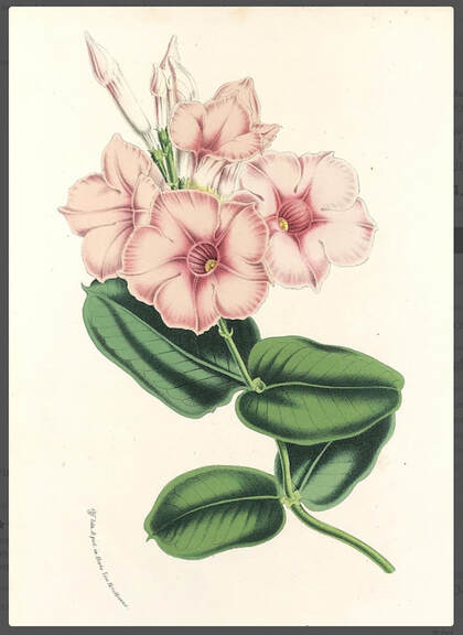
Excerpt from the written account as published: PL A T E II From the 29th May till the afternoon of the 31st, the fog continued with little intermission. About half-past one on the latter day, the enemy was discovered in a line about seven miles to leeward. Lord Howe immediately formed his line, but not being able to close with the enemy that day, he hauled his wind on the larboard tack; and the French admiral, following the example, brought the van of the British squadron abreast of the French centre: in this situation they remained the whole night. At five a. m. his lordship made the signal to bear up; at seven the two fleets were within three miles of each other. Lord Howe, after making the signal that he intended to pass through the enemy's line and engage to leeward, and that each ship was to steer for and engage the ship immediately opposite in the French line, bore away for the Montagne. The annexed view represents the Vengeur sinking, which, after having en gaged the Brunswick from the commencement of the action, was obliged to hoist the British jack as a token of submission, and implored assistance; but the boats of the Brunswick being shot away, she could afford them no aid. The Brunswick having lost her mizen-mast in the action, and drifted to leeward of the French retreating ships, was obliged to put away large to the northward from them; not seeing her chased by the enemy in that predicament, I flatter myself that she may arrive in safety at Ply mouth. All the other twenty-four ships of his Majesty's fleet re-assembled later in the day; and I am preparing to return with them, as soon as the captured ships of the enemy are secured, to Spithead. The material injury to his Majesty's ships is, I understand, confined principally to their masts and yards, which I conclude will be speedily replaced. I have not yet been able to collect regular accounts of the killed and wounded in the different ships. Captain Montague is the only officer of his rank who fell in the action. . . . How to Identify the Prints: The original prints from "The Naval Achievements of Great Britain. From the Year 1793 to 1817" are aquatint engravings on a medium weight wove paper. All the plates identify at bottom left Painted by T. Whitcombe and bottom right T. Sutherland (sculpt) who produced the aquatint engravings. Some plates were engraved by Jeakes and Bailey after Whitcombe. Each plate is accompanied by text pages describing the action, often with lists of ships captured or sunk, and excerpts from contemporary bulletins, dispatches, letters, and speeches. The first edition appeared in 1817. Early issues have watermarks of J. Whatman with the undated watermark IIS&S on some plates. The vignette title page was uncoloured in the first issue. The approx engraved image area of the plates are 7" x 10.25" (175mm x 260mm). Engraved plate mark area is approx 8.5 x 11.75 (215mm x 300mm). The folio sheet size is approx 11.5" x 14" (290mm x 355mm). You can see more prints from Jenkins The Naval Achievements of Great Britain, From the Year 1793 to 1817 HERE. If you're interested in a specific print and you cannot see it on my website please feel free to message me. As I've mentioned before having beautiful prints of flowers in your home is like bringing the outside indoors. If you're looking to brighten up your decor or simply love collecting botanical prints then the work of Louis Benoît Van Houtte should be on your list. Van Houtte (1810-1876) was a Belgian horticulturist who worked at the Jardin Botanique de Brussels between 1836 and 1838 and is best known for his famous series of botanicals, Flore des Serres et des Jardins de l’Europe. He was the proprietor of the largest nursery of its time on the continent. At the height of European orchid mania in 1845 he despatched plant collectors to the Americas to search for orchids and other exotic plants. Above: Flowering plant Dipladdenia Nobilis c1849 original chromolithograph from Louis van Houtte’s, Flore des Serres et des Jardins de l’Europe (Flowers of the Greenhouses and Gardens of Europe).
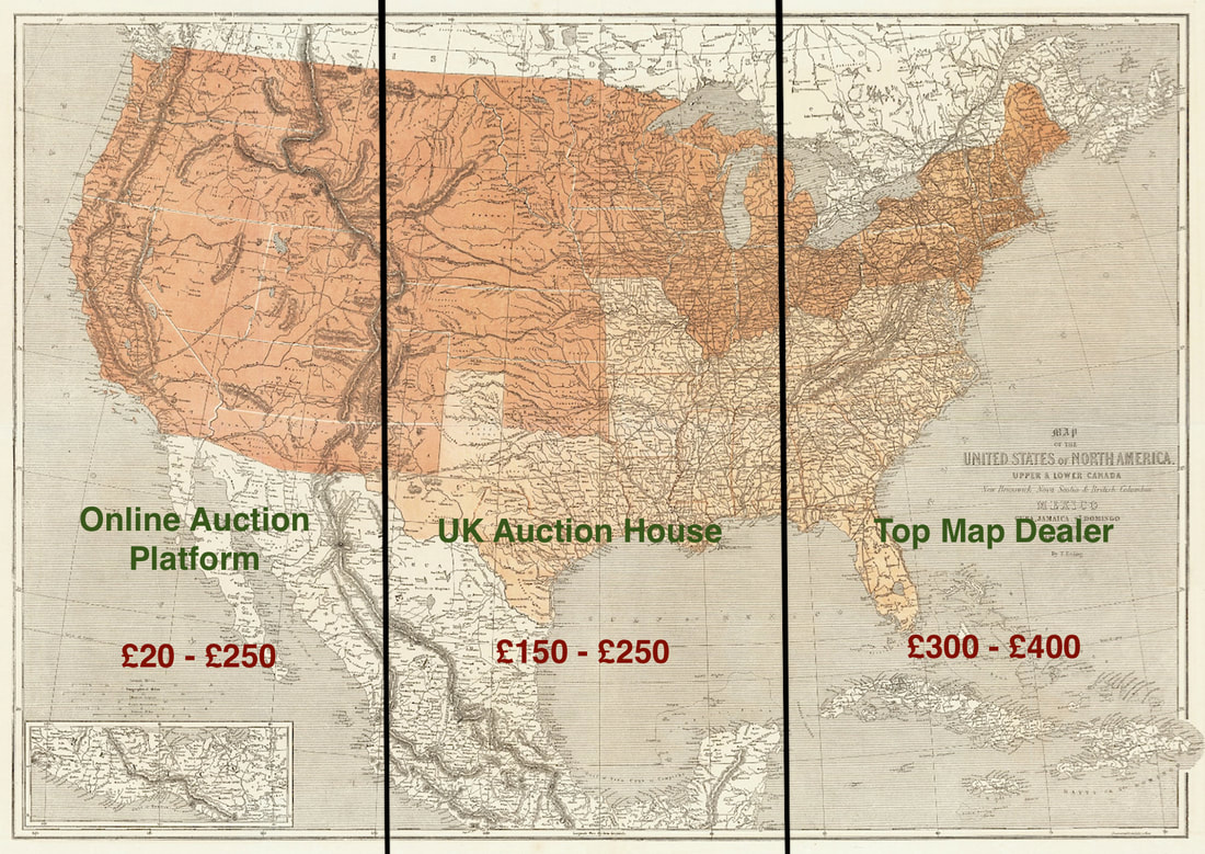
Van Houtte founded a number of high quality botanical periodicals to advertise the plants he sold. Many of the beautiful prints were created by his own printing office in the middle of the gardens, the Horto van Houtteano. His illustrations of plants are especially notable for the craftsmanship of the Belgian lithographers Severeyns, Stroobant and De Pannemaker, who had mastered the art of colour printing from stone. Happy Hunting! You can see more botanicals by Louise Van Houtte and Jean Jules Linden HERE. A regular question asked on Facebook groups like "Antique Map Collectors" is what's it worth? People stick up a picture of some map they've picked up at some estate sale or something thats been tucked away in the attic for years in the hope it may just be worth money. Most times these are no more than reproduction maps, not even antique and of little value. Occasionally the map is antique but commonplace and therefore only worth a few pounds. The truth is there are no fixed price’s for maps. You’ll have to take some time and do some research to get an understanding of how the map market works. Some maps that are more popular with a wide appeal do have a more stable price range but this is not the case with most maps. Above: America Civil War Map by Theodre Ettling c1861. Depending where you interact with the market affects the price you'll pay. The illogical reality in this example shows the variation in what you could pay. Within the antique map market there are segments that within themselves create differing sub markets. Prices will differ within these sub markets for the same map. Think of it like this, the overall market is made up of a mix of buyers and sellers including dealers, auction houses, serious collectors, casual collectors, institutions, even interior decor buyers and various others that of themselves create there own transient markets. The buyers and sellers take into consideration factors that will impact the price of the map being sold. These factors will include factors like: Geographical area popular or unpopular. Popular maps with wide appeal will usually demand a higher price. An early state or first edition of a map by a mapmaker of significance will usually demand a higher price than a later edition of the same map. But there’s lots of other factors that affect price. No two maps are exactly the same! Add to this issues like condition good or not so good, its visual appeal, has it got original colour, later colour, or is it uncoloured as first published. As an example, if this is a popular map the issue of colour alone may make for a higher value if its original, or it could even lower the value if the colour has been added later and executed poorly or incorrectly for the period!
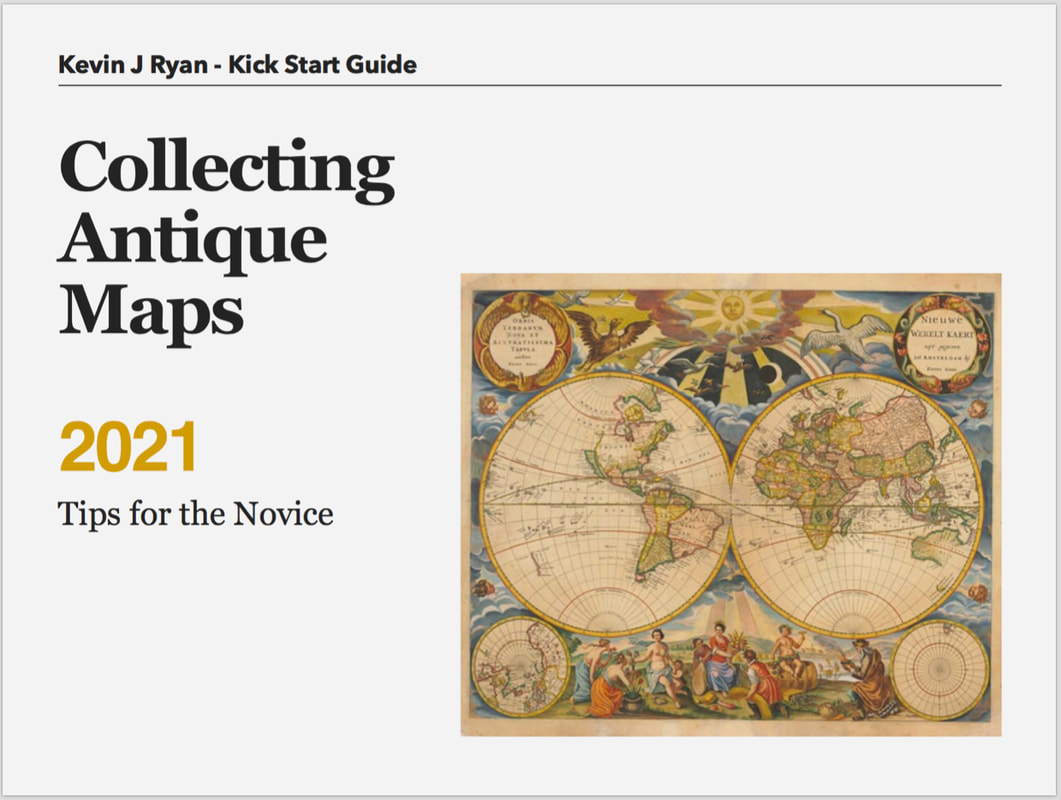
There are many experienced dealers with websites, do your research and you will be able to establish some guidelines on price’s for most antique maps for both retail and trade prices. Top Tip: Research, research, research. Knowledge gained along with experience comes highly recommended at this stage. As they say “If in doubt - don’t” well maybe don’t is no help so I recommend ask someone with more experience and if you can’t ask directly you can reach out to people online. Grab a copy my ebook "Collecting Antique Maps 2021 - It’s Free at https://bit.ly/3oHWt9Q Well this is my first post of 2021, what can I say about 2020! Best left unsaid I think. On a positive note here's wishing you all a better than good 2021 and yes Stay Safe! Those of you that follow my posts will know that since around last September I started weekly posts for the series "Collecting Antique Maps - Tips for the Novice". Well those that have missed out now have a chance to get this information as a free download pdf book to see you on your way for 2021. It’s in pdf format so you can consume on the go! Perfect for your iPhone, tablet, iPad, laptop or desktop. This is for those who are new to collecting antique maps or even new to the idea of collecting maps. How you got to this point doesn’t really matter. What you do next is what matters. This may be something you’ve been thinking about starting for sometime, its fast becoming you’re new passion, so where do you start?
This kick start guide will help you get to grips with what you really need to know first. Jumping in feet first can be fun but leaves you open to the potential of making what could be an expensive mistake. I’ve been there so I’m adequately qualified! If you’re thinking beyond an interesting hobby or personal collection and see this as your next ‘side hustle’ maybe even getting into buying and selling online as I do then you MUST read this guide before anything else - enjoy! Here's the link to DOWNLOAD your free copy today. All the best for 2021! |
LEARN ABOUT MAPS Where to Start? The Paper Earliest Maps Whats on the Paper? Rectum & Recto Marketing Devices Why Changing Faces? What is Ornamentation? Why all those lines? The Embellishment Story Illogical Prices Explained A Reference Library CLICK THE BOOK
Get the FREE Guide!
COLLECTING MAPS
Size Matters! Celestial Maps Strip Road Maps Sea Charts On the River of Life Projections The Sea Monsters Thematic Maps Town Plans Buy with Confidence. . .
More Top Tips for the Novice. Click the book to find out more . . .
COLLECTING PRINTS
Views of River Thames
Views of London Shipping & Craft Meet the Fairies Maritime Naval Military Battles Botanical Historic Churches Historic Views of Rome Archives
May 2024
|

