- Published on
As you've probably gathered by now especially if you've read the previous posts in this short series the discussion has been pretty much about the paper, more than the map. In part two we looked at identifying maps produced on wove paper and I hinted that next we would get down to looking at whats on the paper! Well what's on the paper in terms of helping you with identification is a lot, but before we jump into that boat and head upstream there's one other consideration.
If you're new to collecting maps its likely you may be interested in maps from anywhere between the 17th century and 20th century. This provides a wide range of possibilities where the majority tend to pitch their collecting tent. Before moving on I'm going to share with you one other area back downstream as it were. You may be interested in starting to collect maps pre 17th century?
The very earliest maps are referred to as Manuscript, drawn by hand. Most all early maps and navigational charts were manuscripts, often the work of explorers. This is the place of experts when it comes to authenticity so best advice I can give is, leave it to the experts or certainly get an experts advice if you want to delve into manuscript maps.
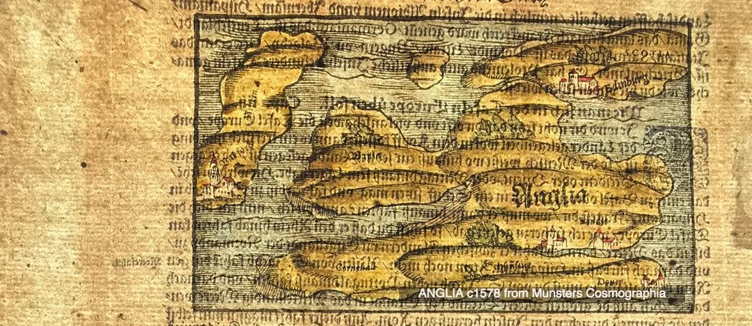
From mid 15th century to late 16th century the earliest printed maps were produced using the Relief printing process. In the map world, relief or woodcut/woodblock maps were common since printing first began. A map could be produced by pressing paper against a raised inked surface that had been carved out on wood. Having carved the image into the wood, ink was rolled onto the raised image, then paper pressed onto the raised area transferring the image to the paper.
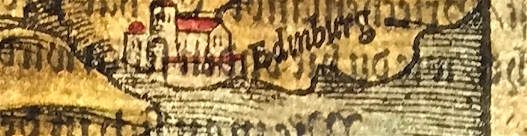
When you look at the examples here, again produced by having a bright light behind the paper you can see in the enlarged image above the typical lines of this kind of printing. The lines are simple, heavy and have blunt ends. The text in woodcut was achieved by inserting movable type as it was easier to make changes. Observe that the paper is laid paper, in keeping with how paper was being produced at the time. Remember the laid lines and chain lines we looked at in Part One? Have fun!
Click the link to continue to Part 4 in the Series Collecting Antique Maps
Click the link to continue to Part 4 in the Series Collecting Antique Maps
You can find this map over on my Etsy shop site: ANGLIA c1578 from Munsters Cosmographia
0 Comments

