|
Interest in armed conflict, campaigns, battles and the continuing assessment of leaders, tactics and their strategy remains ever popular with military history enthusiasts, historical reenactment groups and antique print collectors. In a discussion of colour plate books on Wellington and Waterloo, Prideaux distinguishes this volume and Jenkins’s 1817 companion volume, Naval Achievements of Great Britain and Her Allies, as “worthy of their theme; nor could one desire a finer record of heroic deeds” (pp. 223, 224). 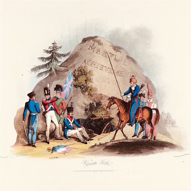 Above: The Vignette Title from The Martial achievements of Great Britain and Her Allies from 1799 to 1815 by J. Jenkins. Excerpt from the written account as published: REPRESENTS a Rendezvous of those Powers who were engaged in the grand struggle for the independence of nations. A British Soldier, in pointing to the MILITARY ACHIEVEMENTS OF GREAT BRITAIN AND HER ALLIES, alludes to the active part this country has taken in the deliverance of Europe. At the feet of the British Soldier preposes a French Warrior, tired of the repeated and decisive defeats he has at length met with under an illegitimate master. The broken Flag-Staff and the Imperial Eagle inform us, that the power of the once invincible Bonaparte is no more. On the left is a Don Cossac, who is coolly stopping his horse to gaze on his vanquished enemy: he is attended by an Austrian and a Swede, who are also contemplating those records, which will, in common with the other Powers of Europe, hand down their deeds to posterity. A Prussian, on the right, seems willing to accede to the share of glory which the British Soldier demands; conscious, that he also has saved his country from the despotism of a tyrannical usurper. See more prints from Martial Achievements
More Tips for the Novice Map Collector . . . There's lots of advantages to collecting small. Yes I do mean literally 'small' not just a smaller budget. For one thing you don't have a problem with storage space. You can amount frame and provide wall space easily with a collection of smaller maps, Health Warning! It's also less of a shock for your partner when they return home from shopping only to discover that large map now taking pride of place on your office wall or even the lounge wall! Only to be asked "How much did you pay for that thing?". 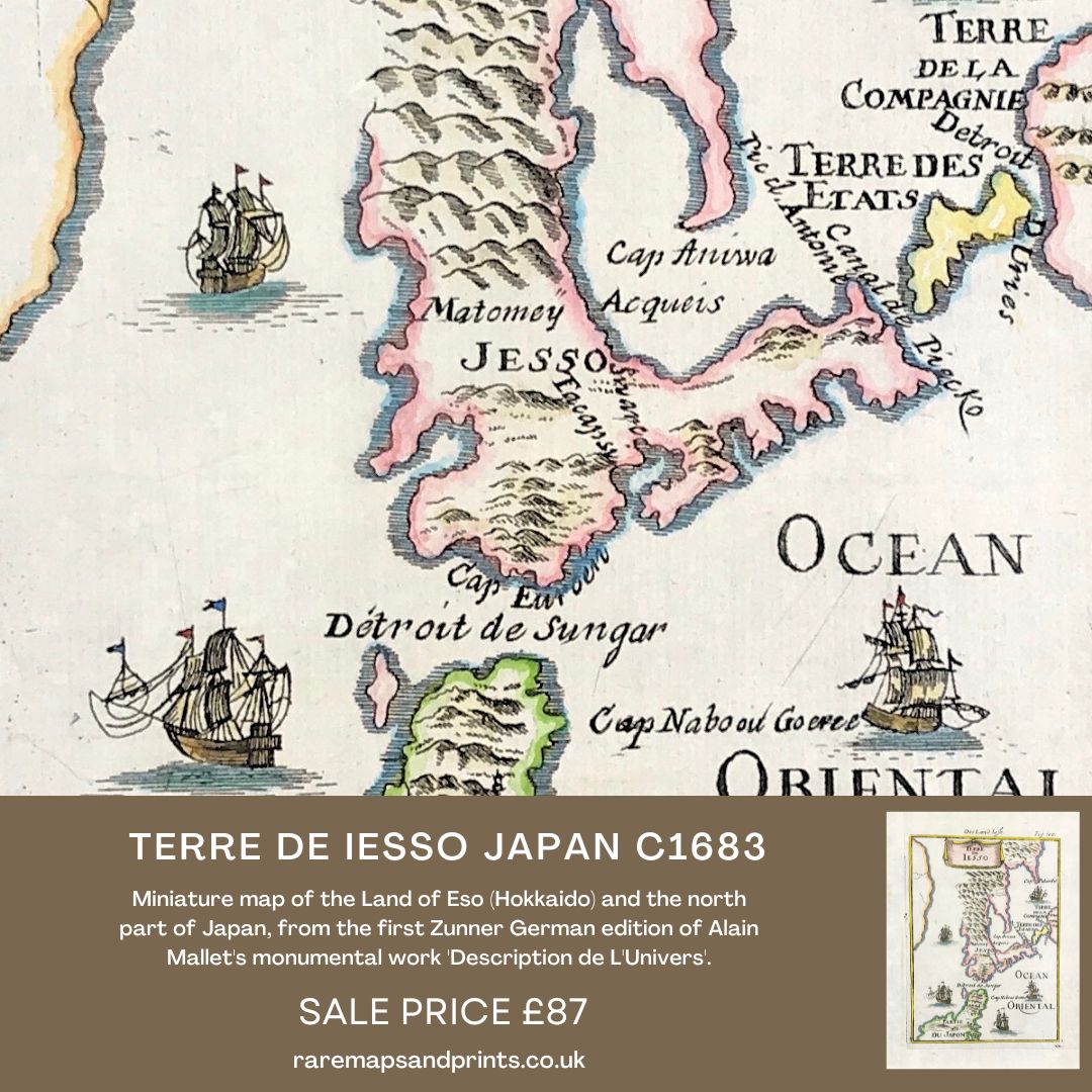 Above: Terre De Iesso (Hokkaido) Japan by Alain Manesson Mallet c1683. This from Volume 1 of the French text edition published by Johann David Zunner 1684. The plates engraved for Zunner are close copies of the originals and still have French titles and names. A few are signed by there engravers: J.P. Aubrey, Johann J. Vogel and W.C. Daucher. Info Link: Japan by Mallet
More Tips for the Novice Map Collector . . . There's lots of advantages to collecting small. For one thing you don't have a problem with storage space. You can also mount frame and provide wall space easily with a collection of smaller maps, before you decide to go big! . . . Below is a super example of a lovely small map over 300 years old by John Seller of Bedfordshire c1695 Engraved area approx: 5" x 6" ( 125mm x 150mm) to plate mark. External mount size: 10.25" X 11" (260mm x 280mm). All good things come in small sizes! 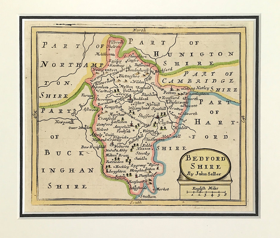 Above: Antique Map of Bedfordshire c1695 which appeared in John Seller's Anglia Contracta (London: J. Seller, 1694/1695). John Seller (fl. 1660-1697). More info: Bedfordshire 1695.
Another exceptional view of the picturesque scenery of Scotland and the Scottish Highlands. The Town of Montrose. From the "Views in Scotland" series. The plates are signed I.Clark but it is generally accepted that these views are the work of the Scottish artist John Heaviside Clark, 1771-1836. He was a prolific artist, aquatinter and engraver, sometimes known as Waterloo Clark due to the sketches he made on the field directly after the Battle of Waterloo. He was also skilled in aquatinting and certainly none of this series has a named engraver. . . 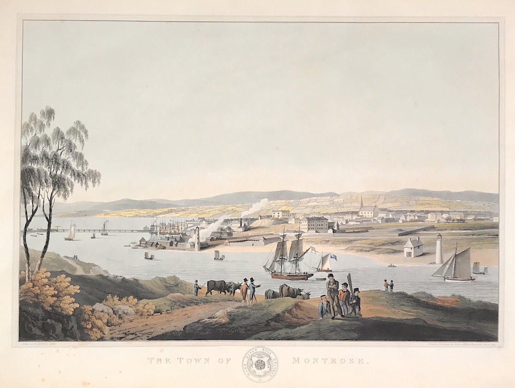 Above: The Town of Montrose. Drawn on the Spot by I. Clark. Hand-coloured etching and aquatint. Published by Smith & Elder, Fenchurch Street, London 1c824. Plate approx 475 x 629mm (18¾ x 24¾") External displayed mount approx size: 525mm x 700mm (20.75 x 27.75). More info for "The Town of Montrose".
"India Orientalis cum Adjacentibus Insulis Nova Delineatione ob oculos posita . ." Rare Map of Southeast Asia, Indian Ocean and Australia. Published: Augsberg c1730. India, Myanmar, India, Thailand. Bangladesh, Cambodia, Philippines, Indonesia, Australia, India Orientalis. Matthaus Seutter. A scarce map of the East Indies and part of Australia, from the Atlas Novus. Excellent condition, copperplate engraved on hand laid paper with fine hand colour. Blank to verso and fold as issued. Approx engraved area: 480mm x 560mm (19" x 22") . . . 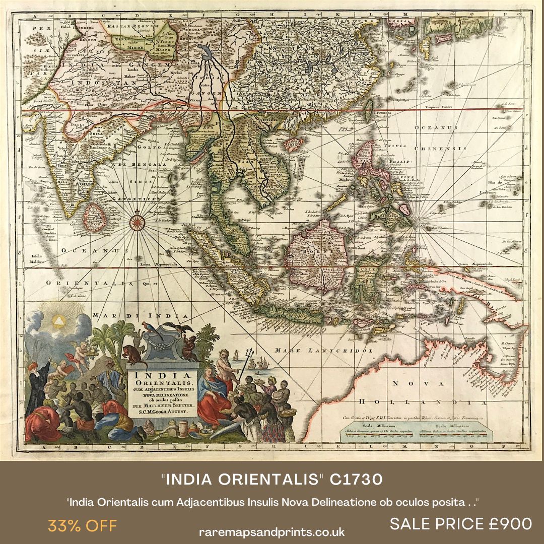 The detail on the map throughout Southeast Asia is excellent and the print style typically strong. The cartouche is one of the more ornate Seutter cartouches, with elaborate scenes from sea, land, jungle and mythology. More info: "India Orientalis"
Another print from James Jenkins The Naval Achievements of Great Britain. These original prints are aquatint engravings on a medium weight wove paper and coloured by hand. This Plate II depicts the British naval victory over Denmark in the Napoleonic Wars. The armed-neutrality treaty of 1794 between Denmark and Sweden, to which Russia and Prussia adhered in 1800, was considered a hostile act by England. Conversely, while at war with France during the Napoleonic Wars, Britain’s naval operations against French trade also hurt neutral nations’ shipping. Such hostility brought Britain into conflict with Denmark in 1801 . . . 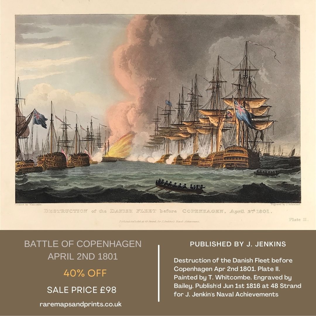 Above: Destruction of the Danish Fleet before Copenhagen Apr 2nd 1801. Plate II. Painted by T. Whitcombe. Engraved by T. Sutherland. Publish'd Oct 1st 1816 at 48 Strand for J. Jenkin's Naval Achievements.
How to Identify the Prints: The original prints from "The Naval Achievements of Great Britain. From the Year 1793 to 1817" are aquatint engravings on a medium weight wove paper. All the plates identify at bottom left Painted by T. Whitcombe and bottom right T. Sutherland (sculpt) who produced the aquatint engravings. Some plates were engraved by Jeakes and Bailey after Whitcombe. Each plate is accompanied by text pages describing the action, often with lists of ships captured or sunk, and excerpts from contemporary bulletins, dispatches, letters, and speeches. The first edition appeared in 1817. Early issues have watermarks of J. Whatman with the undated watermark IIS&S on some plates. The vignette title page was uncoloured in the first issue. The approx engraved image area of the plates are 7" x 10.25" (175mm x 260mm). Engraved plate mark area is approx 8.5 x 11.75 (215mm x 300mm). The folio sheet size is approx 11.5" x 14" (290mm x 355mm). You can see more prints from Jenkins The Naval Achievements of Great Britain, From the Year 1793 to 1817 HERE. If you're interested in a specific print and you cannot see it on my website please feel free to message me . . . The range of thematic maps is just about unlimited and generally cover physical, political, economic and social aspects connected with a specific geographical area. If geography and especially mountain ranges and forests are of interest to you then the map below by Heinrich Scherer is for you. Scherer’s world atlas, the Atlas Novus, first published in Munich between 1702 and 1710 and reissued in a second edition between 1730 and 1737, forms a singularly unusual, almost revolutionary work in terms of the development of European mapmaking at the beginning of the 18th Century. The Atlas comprised seven separate volumes entitled Geographia Naturalis, Geographia Hierarchica, Geographia Politica, Tabellae Geographicae, Atlas Marianus, Critica Quadrapartita, and Geographia Artificialis. Most of the some 180 maps appear to have been prepared between 1699 and 1700 and were engraved by Leonard Hecknaeur, Joseph Montelegre or Matthus Wolfgang, with each volume introduced by fine allegorical frontispieces by the same engravers . . . 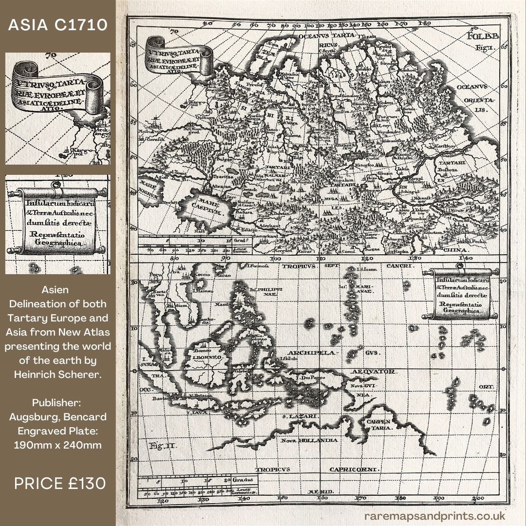 Above: Asien - Utriusque Tartariae, Europaeae et Asiatiae delinatio. Insularum Indicarum & Terre Australis. Kupferstich aus Scherer, Heinrich: Atlas Novus exhibens orbem terraqueum (Asien - Delineation of both Tartary, Europe and Asia. of the Indian Islands & Southern Land).Scherer takes thematic cartography one step further in the Geographia Politica and Geographia Naturalis. He produces maps that remove political boundaries, borders and place names, replacing them with the revolutionary concept for the period of showing the mountains and forests in physical relief with all of the major waterways and rivers systems clearly depicted. Details on Heinrich Scherer - Map of Asia
There's a handful of elements besides the Cartouche that make up a maps Ornamentation . With most 16th to 18th century maps you will want to be aware of these and they are shown in the boxes below. Maps were made to different scales so it would be logical for there to be a ratio that compared the measurement on the map to the actual distance. These scales are normally shown by means of multiple scale bars for the units of measurement to the mile. 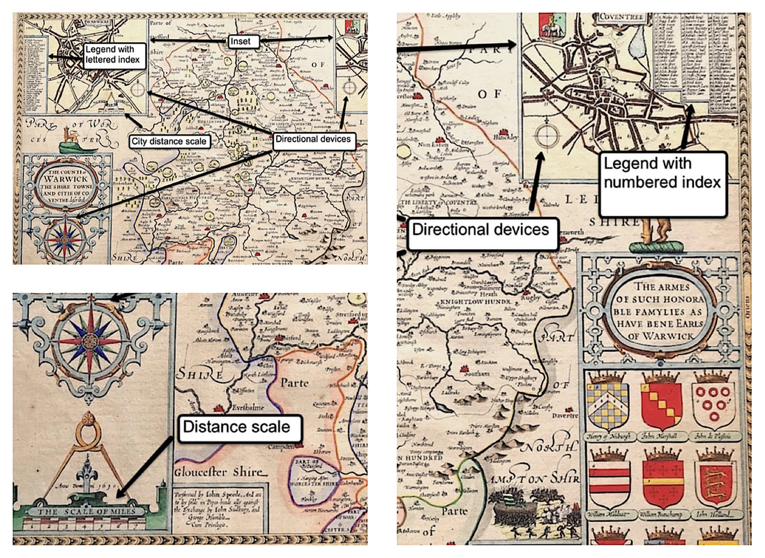 Another feature is whats known as the 'Legend'. This simple device contains the explanation for symbols used on the map such as towns, roads, canals, rivers, forts, bridges etc. Many old maps have different symbols for the likes of market towns, cathedral towns and fortifications, within somelegends there is a simple numbered or alphabetical index. Getting a basic understanding of a maps anatomy so you're able to identify the ornamental parts that make up a map is essential . . . Know your ORNAMENTATION
The design of cartouches varies according to cartographer and period style. The all important cartouche on a map is a keeper of secrets to some degree. When it comes to the novice map collector this is one area of a map to pay attention to. A cartouche map can contain the title, the printer's address, date of publication, the scale of the map and legends plus sometimes a dedication . . . 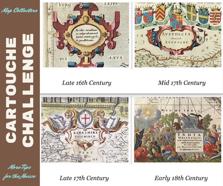 The design style of a cartouche should be in keeping with the period the map is claimed to be from. If you're looking to buy a sixteenth century map by Abraham Ortelius, could you instantly tell by the cartouche design on the map, if the cartouche at least is looking right for that period? The more experience you get at recognising cartouche styles the better . . . In the above examples you'll see the cartouche styles changing faces over time. These are just four well known mapmakers . . . . Can you name the mapmakers? Mapmakers Indentified.
Good Things Come in Small Sizes! This is certainly true when it comes to smaller maps. If you're new to collecting antique maps there are some big advantages to collecting small. There's no problem with wanting to display your collection. If you have limited space at home this is not an issue. These small maps are easy to handle, store and affordable to mount and frame . . . 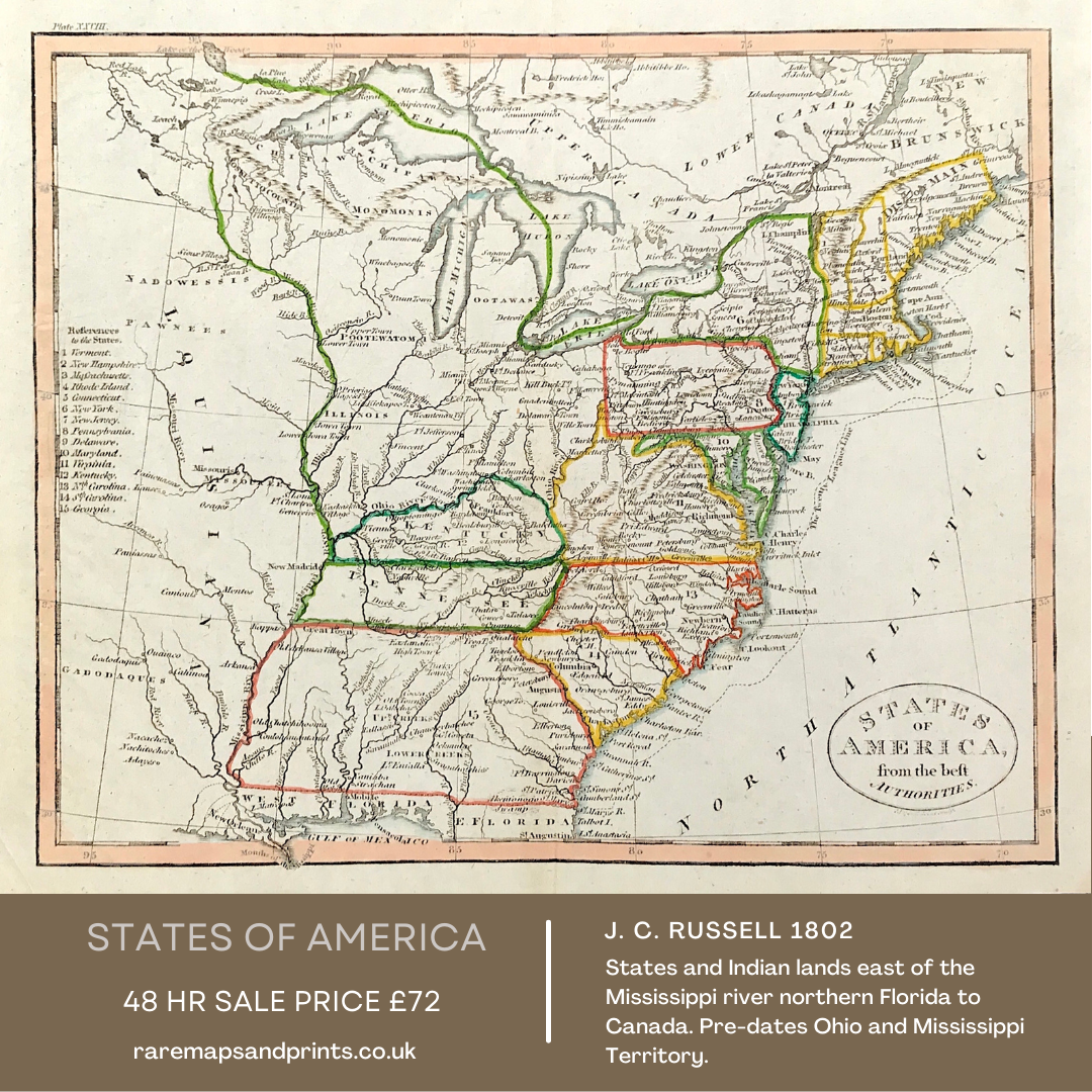 The above fascinating map details the states and Indian lands east of the Mississippi River from northern Florida to Canada. The map pre-dates Ohio and Mississippi Territory. Louisiana is shown, but the map would seem to predate Louisiana Territory. This nicely falls into the 'smaller' map category with an approx engraved area of 9" x 7.5" (230mm x 190mm) More info: STATES OF AMERICA
Early on mapmakers quickly realised marketing was everything! Once the issue of scale had been addressed this was obviously going to result in some empty space appearing on the map in production. So like any good marketing push they set about filling such space with a variety of devices including cartouches, vignettes or insets . . . 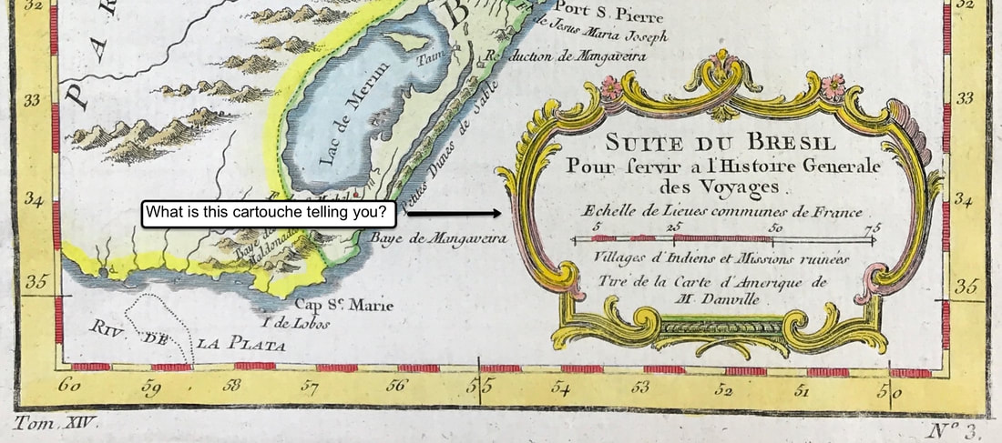 Above: c1758 Jacques Nicolas Bellin. Continuation of Brazil drawn from Mr. Danville's America Map. Such devices, collectively grouped are referred to as ornamentation. Wise use of the available space on a map was used to capture attention and convey the message - There's nothing new under the Sun! So what would a map cartouche contain? . . . Find out more. click the link CARTOUCHE IN CARTOGRAPHY.
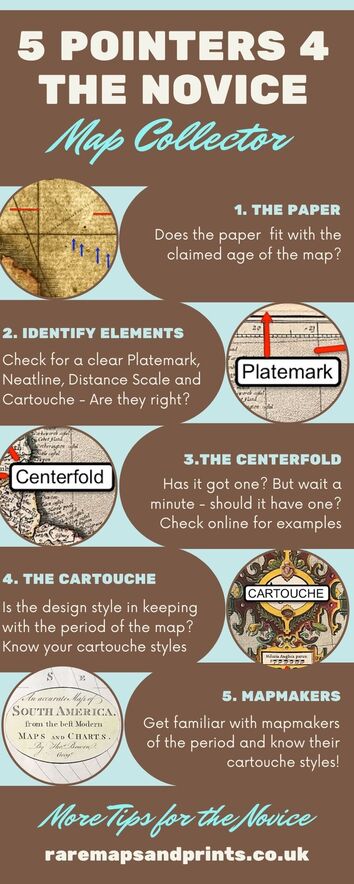
Most antique maps were originally bound into books and atlases. A centerfold down the middle made this possible and the map was folded ready to be inserted and bound. So when you look at a map as in the example here the front of the map is often referred to as the 'recto' from the latin (Leaf), the front side of a leaf. The reverse or back of the page is known as the 'verso'. Thats it in map trade talk 'recto' the front side of the sheet with the image on it and the back is called the 'verso'. Often the verso will have text printed on it but this is not always the case. 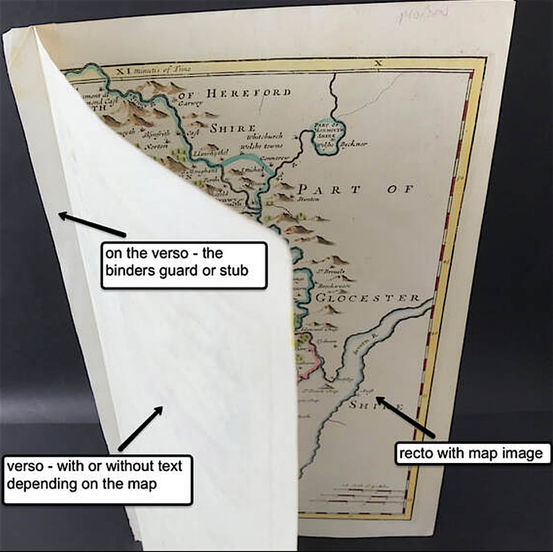 All the points discussed in the previous several posts can help you evaluate the antique map you're considering. As mentioned you want to look at whats on the paper, but even more importantly the paper itself. What does the paper itself tell you? Is it laid paper or wove? This will help clarify does the paper fit with the claimed age of the map. Download the free pdf Kick Start Guide COLLECTING ANTIQUE MAPS - More Tips for the Novice. This is for those who are new to collecting or even new to the idea of collecting maps. This will help you get to grips with what you really need to know first.
|
LEARN ABOUT MAPS Where to Start? The Paper Earliest Maps Whats on the Paper? Rectum & Recto Marketing Devices Why Changing Faces? What is Ornamentation? Why all those lines? The Embellishment Story Illogical Prices Explained A Reference Library CLICK THE BOOK
Get the FREE Guide!
COLLECTING MAPS
Size Matters! Celestial Maps Strip Road Maps Sea Charts On the River of Life Projections The Sea Monsters Thematic Maps Town Plans Buy with Confidence. . .
More Top Tips for the Novice. Click the book to find out more . . .
COLLECTING PRINTS
Views of River Thames
Views of London Shipping & Craft Meet the Fairies Maritime Naval Military Battles Botanical Historic Churches Historic Views of Rome Archives
May 2024
|