- Published on
If you follow this blog, you'll be pleased to hear we're coming to the end of 'kinds of maps' that are available to collect by the newbie antique map enthusiast. Back in early November I started posting about the different kinds of maps available to collectors. Several post later as I suggested at the beginning to quote myself "One size fits all! That may be true with many things in this life but you'll quickly realise that its not the case with antique maps. In fact its more a case of every size, shape, form, subject, appearance and kind of antique map is out there if you look around."
In reality I've just scratched the surface with these blog posts but hopefully its given you some solid suggestions as to what you can consider as a theme for collecting. Before concluding one not to be left out of any basic list is the 'Town Plan'. Any view straight down on a city or town showing its streets, parks, blocks of buildings etc is called a town plan or birds-eye plan. Again popular with collectors as its something most of us are familiar with with from modern mapping. Now of course if you're lost in a city somewhere in the world you're going to pull up the available town plan likely via Google maps on your mobile device.
In reality I've just scratched the surface with these blog posts but hopefully its given you some solid suggestions as to what you can consider as a theme for collecting. Before concluding one not to be left out of any basic list is the 'Town Plan'. Any view straight down on a city or town showing its streets, parks, blocks of buildings etc is called a town plan or birds-eye plan. Again popular with collectors as its something most of us are familiar with with from modern mapping. Now of course if you're lost in a city somewhere in the world you're going to pull up the available town plan likely via Google maps on your mobile device.
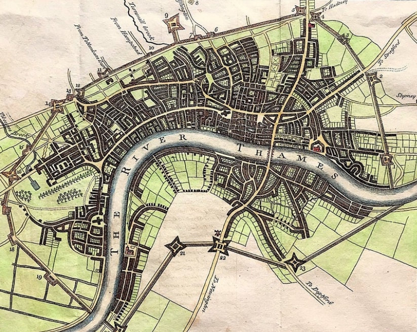
Above: The City And Environs Of London, As Fortified ....1642 & 1643 Published for Walter Harrison's History of London 1775. The map shows and a numbered key describes the fortifications put in place (and perhaps made of wood) to defend London from the Royalist forces in the Civil War. With no such attack forthcoming, they were demolished in 1647.
There were many town plans published in the nineteenth century and those published by the Society for the Diffusion of Useful Knowledge (SDUK) are among the most popular. Older plans like the on above of London are also popular but like with most things scarce they require a bit more searching to find.
Happy Hunting!
You can see more details about the town plan City of London and its Environs HERE. In my Etsy Shop section Views of London.
0 Comments

