- Published on
Here's the View of Gibraltar an original aquatint print from James Jenkins The Naval Achievements of Great Britain, From the Year 1793 to 1817. These prints are exceptional in themselves with excellent hand colour. To give you even more of an insight into the event recorded I've shared a brief excerpt from the original written account published below the print.
The naval campaigns, operations and battles of the Napoleonic Wars were events during the period between 1802 and 1814 that were undertaken by European powers in support of their land-based strategies.
The naval campaigns, operations and battles of the Napoleonic Wars were events during the period between 1802 and 1814 that were undertaken by European powers in support of their land-based strategies.
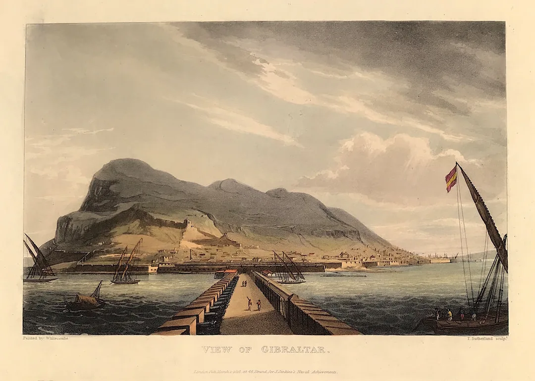
Above: View of Gibralter from The Martial achievements of Great Britain and Her Allies from 1799 to 1815 by J. Jenkins.
Excerpt from the written account as published:
A CONCISE ACCOUNT OF GIBRALTAR: GIBRALTAR is a part of Andalusia, the most southern province of Spain, to which it is connected by a low isthmus of sand. The rock is seven miles in circumference, forming a promontory three miles in length, and presenting the most singular natural appearance. It was distinguished in the earliest annals of European nations. It does not, however, appear that any of the ancients inhabited it: their knowledge and practice of the military art were not indeed suited to improve the natural advantages of such a place; these seem to have been disregarded till the beginning of the eighth century, when the Saracens invaded Spain, and subjugated the country. It remained in their hands till the commencement of the fourteenth century, when it was taken by Ferdinand, King of Castile, in whose possession it continued till Abomalique, son of the Emperor of Fez, arrived to the succour of the Moorish King of Grenada, who laid siege to the fortress, and in five months starved it into a surrender. The Emperor of Morocco next made himself master of it; but the King of Grenada having appeared before it the next year, with a powerful fleet and army, and having reduced the garrison to the greatest extremity for want of provisions, obliged them to submit.
It remained in the quiet possession of the Spaniards till 1704, when it was unexpectedly wrested from them (and we trust for ever) by an English squadron under the command of that gallant and enterprising officer, Sir G. Rooke, who had been sent into the Mediterranean with a strong fleet to assist the Archduke . . .
How to Identify the Prints:
The original prints from "The Naval Achievements of Great Britain. From the Year 1793 to 1817" are aquatint engravings on a medium weight wove paper. All the plates identify at bottom left Painted by T. Whitcombe and bottom right T. Sutherland (sculpt) who produced the aquatint engravings. Some plates were engraved by Jeakes and Bailey after Whitcombe. Each plate is accompanied by a text page describing the action, often with lists of ships captured or sunk, and excerpts from contemporary bulletins, dispatches, letters, and speeches. The first edition appeared in 1817. Early issues have watermarks of Whatman with the undated watermark IIS&S on some plates. The vignette title page was uncoloured in the first issue. The approx engraved image area of the plates are 7" x 10.25" (175mm x 260mm). Engraved plate mark area is approx 8.5 x 11.75 (215mm x 300mm). The folio sheet size is approx 11.5" x 14" (290mm x 355mm).
You can see more prints from Jenkins The Naval Achievements of Great Britain, From the Year 1793 to 1817 HERE If you're interested in a specific print and you cannot see it on my website please feel free to message me .
0 Comments

