|
Should there be a crease down the middle? Well yes and no, it depends on the map. To be fair if a person has no knowledge or experience of antique maps its unlikely they would be able to answer that question. Most printed maps avaialble to collectors today are printed maps that were originally bound in books and atlases, hence a crease down the middle where the page was folded is very common, but not always the case. . . . 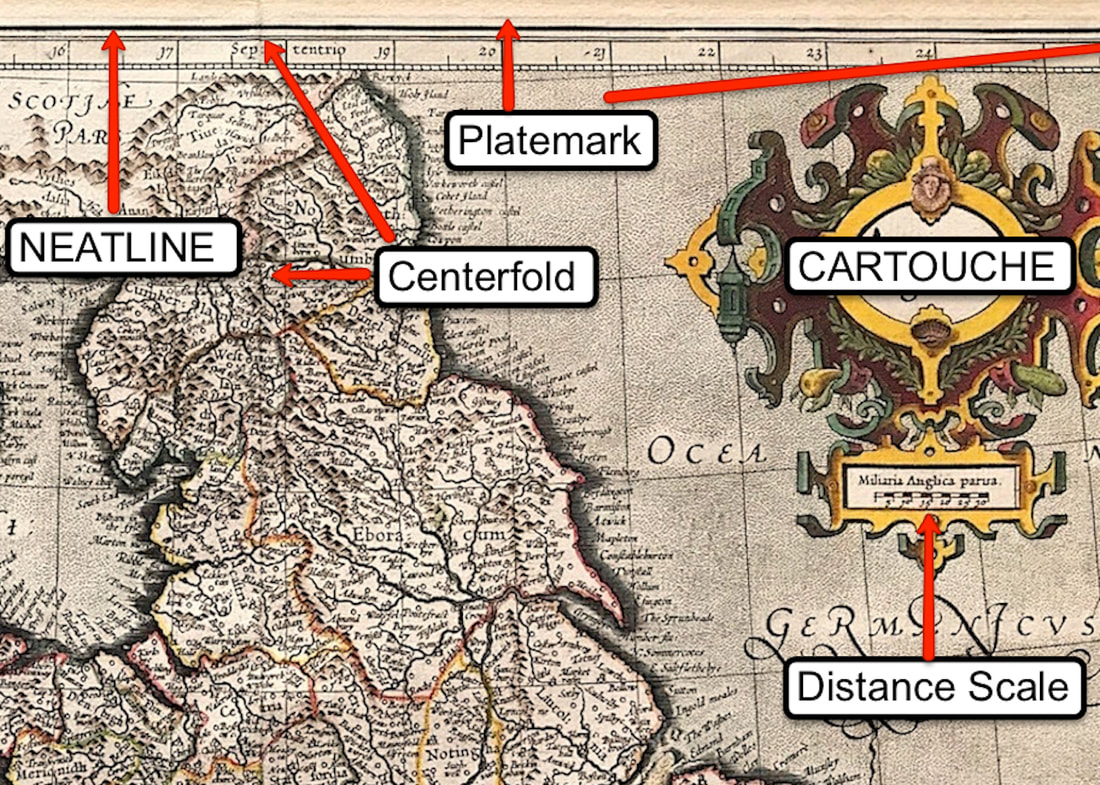 Above: Part of a Map of England & Wales 'Anglia Regnum' Duisberg 1595 by Mercator. Having got to grips with the paper itself, the next important step is to know what to be looking for on the paper itself. Identifying elements is what you're after. You can see the basic identifiers on a 16th century double page map here . . . Map Identifiers 16th Century
Who doesn't enjoy the picturesque scenery of Scotland and the Scottish Highlands. This view of the town of Inverness, in the Scottish Highlands, is from the "Views in Scotland" series published by Smith & Elder in 1824. It's generally accepted that these views are the work of the Scottish artist John Heaviside Clark who is thought to have been born in Scotland around 1771. He was a well-known engraver, landscape and seascape painter and miniaturist. He worked and lived in London between 1802 and 1832. He exhibited at the Royal Academy between 1812 and 1832 with a selection of maritime and landscape subjects. 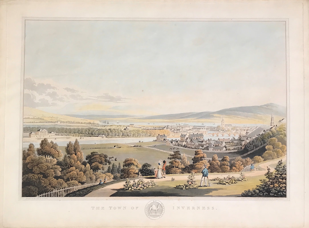 Above: The Town of Inverness. Drawn on the Spot by I. Clark. c1824 Hand-coloured etching and aquatint. Clark is most famous for his engravings of Scottish towns and cities, admired both for the highly accurate attention to detail and the clarity and softness of aesthetics. The accuracy of the view has historical importance as it documents the radical changes being made to the landscape, a result of industrialisation, population growth and migration. More info: Town of Inverness
More Tips for the Novice - Most newbie map collectors pitch their tent between 17th century and 19th century. This provides a wide range of possibilites for developing a collection however you may be interested in starting to collect pre 17th century maps! 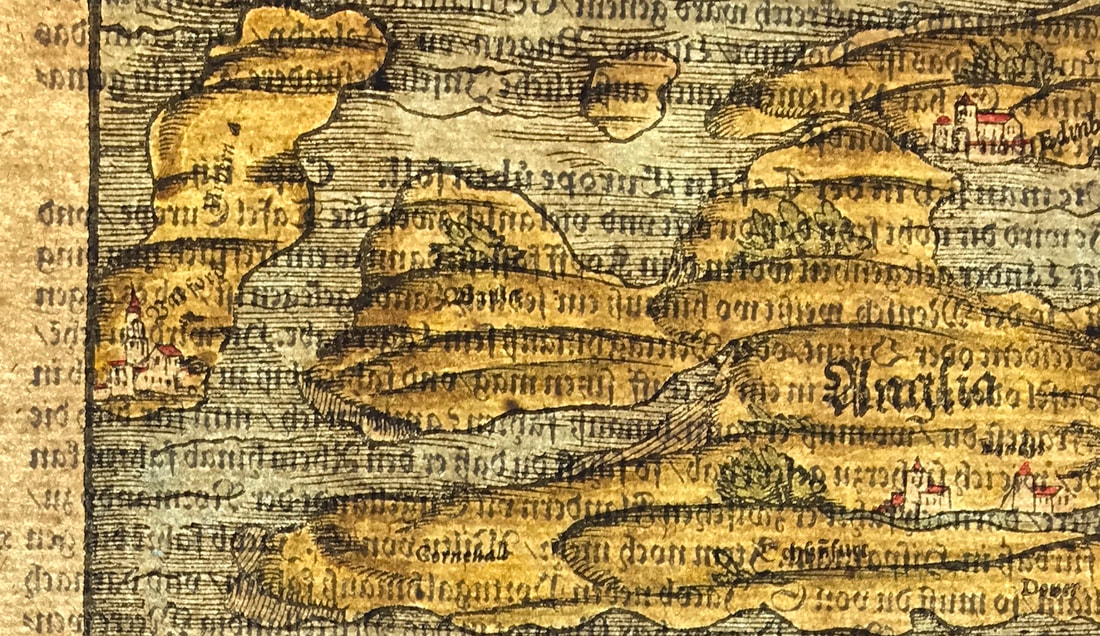 Above: Map of Anglia c1578 a relief woodcut Map from Munsters Cosmographia. The very earliest maps are referred to as Manuscript, drawn by hand. Most all early maps and navigational charts were manuscripts, often the work of explorers. From mid 15th century to late 16th century the earliest printed maps were produced using the Relief printing process . . . Where will you pitch your tent?
More Tips for the Novice - Just when you thought you had it all cracked with identifying the 'laid paper'! As we entered the first half of the 19th century a shift took place towards using paper produced on a new mold called 'wove'. This technique quickly spread throughout Europe and America and soon dominated the paper making industry . . . Now you're looking for a different set of clues because the process has changed . . . You don't want to end up being a Turkey! But can you identify Turkey Mill Paper? 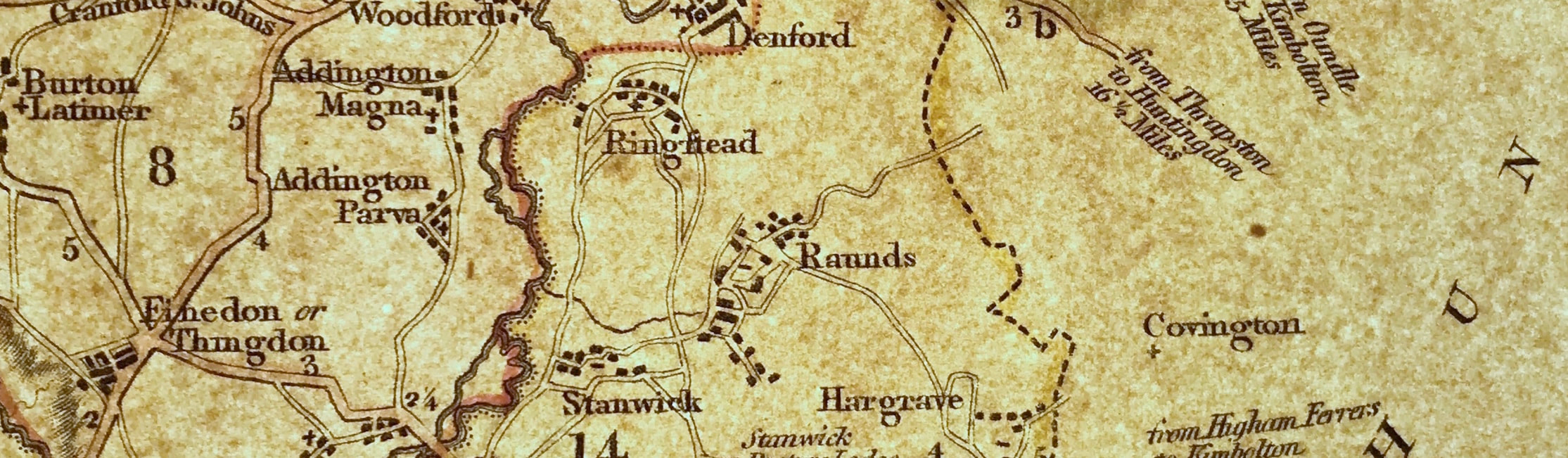 Above: c1802 Map Sheet produced on 'wove' paper the result is a smoother regular surface that with laid paper. No chain or laid lines. Top Tip: Go to auctions, see antique maps, touch them, feel the paper, examine it, hold it up to the light, then you will start to see there is another world of exploration under the surface of the image - The all important paper! Identify Turkey Mill
This is certainly true when it comes to so called miniature maps. If you're new to collecting antique maps there are some big advantages to collecting small. There's no problem with wanting to display your collection. If you have limited space at home is not an issue. These small maps are easy to handle, store and affordable to mount and frame. 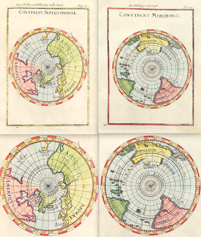 Above: A Pair of Hemisphere Maps - Continent Septentrional & Meridional by Alain Mallet c1683.
A favourite of mine is the work of Alain Manesson Mallet the French cartographer and engineer. He started his career as a soldier in the army of Louis XIV, became a Sergeant-Major in the artillery and an Inspector of Fortifications. He also served under the King of Portugal, before returning to France, and his appointment to the court of Louis XIV. His five volume work Description de l'univers was originally published in Paris in 1683 and contained almost 700 small engravings of maps, charts, plans and views. More info on this pair of Mallet's Hemisphere Maps Today we're plagued with online sites saturated with reproduction antique maps and prints. These reproductions are copies made by various modern methods. Price alone should indicate as to original or reproduction, but for those new to collecting its wise to do some basic research. This will be a great help in making the right call when it comes to buying. 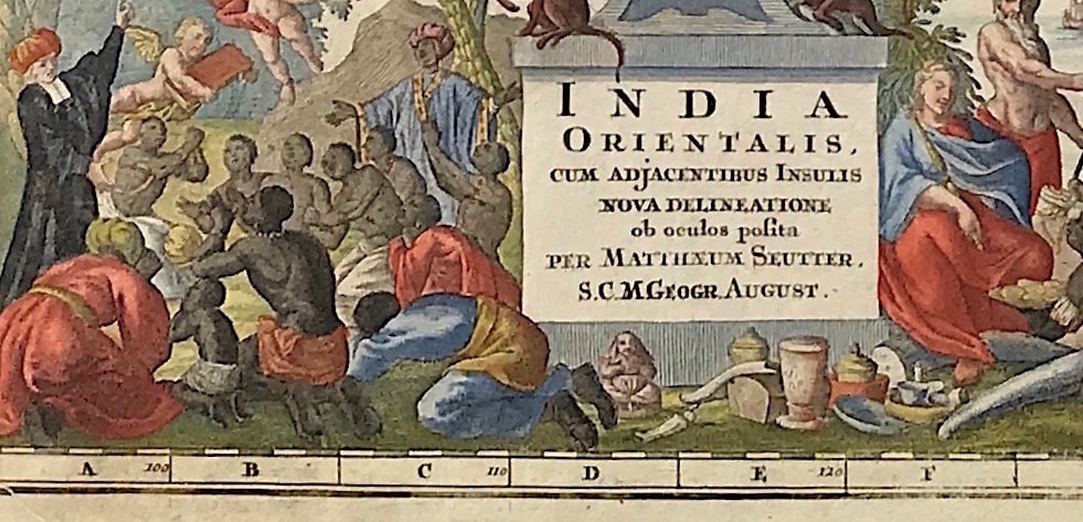 A simple place to start if you're interested in maps made between c1600 to late c1700 is to get familier with the intaglio print process used in making such maps. Get to grips with the basics HERE. (Above: From India Orientalis by Matthaus Seutter c1730 A scarce map of the East Indies and part of Australia, from the Atlas Novus.
A real help if you're new to antique map collecting is to get an understanding of what maps were printed on, yes, the paper! Getting an understanding of the history of paper making and how it relates to old maps is the real place to start.  You've likely heard the term 'laid paper' or seen it used by a map dealer in describing a map. All maps were printed on laid paper up until around the end of the 18th century. Your going to be ahead of the game if you know how to identify laid paper. I'll show you how . . . IDENTIFYING LAID PAPER
More Tips for the Novice . . . If you're new to collecting antique maps one of the first things that confuses the novice is the term 'original map'. This is compounded by the fact that many maps are attributed to differing people, sometimes the cartographer or the engraver, sometimes to the publisher. 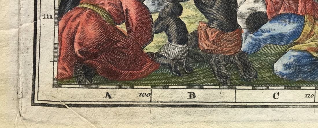 What can the image above tell you about the map? Above: From India Orientalis by Matthaus Seutter. A scarce map of the East Indies and part of Australia, from the Atlas Novus. Often map dealers will simply use the most famous name associated with the map. So what exactly is an original? Here's where to begin . . . THE BEGINNING!
|
LEARN ABOUT MAPS Where to Start? The Paper Earliest Maps Whats on the Paper? Rectum & Recto Marketing Devices Why Changing Faces? What is Ornamentation? Why all those lines? The Embellishment Story Illogical Prices Explained A Reference Library CLICK THE BOOK
Get the FREE Guide!
COLLECTING MAPS
Size Matters! Celestial Maps Strip Road Maps Sea Charts On the River of Life Projections The Sea Monsters Thematic Maps Town Plans Buy with Confidence. . .
More Top Tips for the Novice. Click the book to find out more . . .
COLLECTING PRINTS
Views of River Thames
Views of London Shipping & Craft Meet the Fairies Maritime Naval Military Battles Botanical Historic Churches Historic Views of Rome Archives
May 2024
|