- Published on
If you're new to map collecting then the subject of what kinds of maps to collect is a consideration. In the last few posts we've been focused on a selection of what 'kinds' are available to collectors. Hopefully this has at least given you some direction, or has made you aware of the possibilities. Perhaps for the more technically minded or those simply seeking something different from the run of the mill maps, map projections are a niche within the antique map market that may interest you.
As paper maps are flat and the earth is roughly spherical shaped the flat map obviously cannot represent the earths surface exactly. This is where the so called 'projection' comes in. Representations of the earths curved surface or forms of celestial spheres drawn on a flat surface are called projections.
As paper maps are flat and the earth is roughly spherical shaped the flat map obviously cannot represent the earths surface exactly. This is where the so called 'projection' comes in. Representations of the earths curved surface or forms of celestial spheres drawn on a flat surface are called projections.
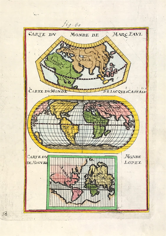
Above: World Maps by Allain Manesson Mallet c1684 Showing Map Projections of earlier maps 'Carte du Monde de Marc Paul; Carte du Monde de Jacques Castaldo; Carte du Monde de Miguel Lopez' by Marco Polo, Giacomo Gastaldi and Miguel Lopez.
There are many ways projections can be constructed. Depending on the purpose of the map the projection will cause distortion of at least one aspect of the real world - shape, area, distance or direction. Ptolemy described several ways to translate the spherical earth onto a flat plane which you can research online for an in depth explanation if you choose.
Happy Hunting!
0 Comments

